 Transparent World
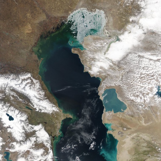
Transparent World in the Caspian Sea
28-11-2023 13:24
In order to detect film-type pollution on the sea surface, the most efficient are radar techniques, as they are of the all-weather category. Online public results you may find here.
)
25-09-2025 16:57
)
In the area covered by the morning imagery, the wind is predominantly from the south and southeast at 4-7 m/s. In the southern part of the Caspian Sea, there is a wind calm.
https://t.me/twworldkasp/434525-09-2025 16:52
)
Sentinel-1C satellite radar image acquired on 21.09.2025 02:58:57 UTC (05:58:57 Moscow time).
Location – within the Russian sector.
No anthropogenic slicks or natural oil seeps detected.
25-09-2025 16:51
)
Sentinel-1C satellite radar image acquired on 21.09.2025 02:58:32 UTC (05:58:32 Moscow time).
Location – within the Russian sector.
No anthropogenic slicks or natural oil seeps detected.
25-09-2025 16:50
)
Sentinel-1C satellite radar image acquired on 21.09.2025 02:58:07 UTC (05:58:07 Moscow time).
Location – within the borders of the Kazakhstani and Russian sectors.
No anthropogenic spots/slicks or natural oil seepages were detected.
22-09-2025 19:24
)
Wind over the area covered by today's images is predominantly:
- in the northern part - westerly up to 6 m/s;
- in the central and southern parts - northwesterly up to 6-7 m/s.
)
22-09-2025 19:24
)
Sentinel-1A satellite radar image acquired on 22.09.2025 14:30:04 UTC (17:30:04 Moscow time).
Location – within the Kazakhstani, Azerbaijani, and Turkmen sectors.
The following slicks were detected on the RLI:
1. Fragment of vessel discharge. Area 5.3 sq.km. In the Turkmen sector, coordinates 41°17'29.53" N, 51°43'39.78" E. Northern wind 5 m/s.
22-09-2025 19:24
)
Sentinel-1A satellite radar image acquired on 2025-09-22 14:30:04 UTC (17:30:04 Moscow time).
Location – within the Russian, Kazakhstani, and Azerbaijani sectors.
No anthropogenic or natural oil seeps detected.
)
)
22-09-2025 19:24
)
Sentinel-1A satellite radar image acquired on 22.09.2025 14:30:29 UTC (17:30:29 Moscow time).
Location – within the Russian and Kazakhstani sectors.
The following slicks were detected on the radar image:
1. Possible natural oil seeps. Total area 0.8 sq.km. In the Kazakhstani sector, coordinates 45°01'16.08" N, 49°44'45.46" E. West wind 3-5 m/s.
22-09-2025 19:23
)
Satellite Sentinel-1A radar image acquired on 22.09.2025 14:30:54 UTC (17:30:54 Moscow time).
Location – within the Russian and Kazakh sectors.
No anthropogenic slicks or natural oil seeps detected.
21-09-2025 07:53
)
On the water area covered by morning images, the wind is predominantly northwest and north, 9-10 m/s.
https://t.me/twworldkasp/433321-09-2025 07:29
)
Sentinel-1A satellite radar image acquired on 21.09.2025 02:42:35 UTC (05:42:35 Moscow time).
Location – within the boundaries of the Kazakhstani and Russian sectors.
No anthropogenic spots/slicks or natural oil seepages detected.
21-09-2025 07:14
)
Sentinel-1A satellite radar image acquired on 21.09.2025 02:43:54 UTC (05:43:54 Moscow time).
Location – within the borders of the Kazakhstani, Russian, Azerbaijani, and Turkmen sectors.
No anthropogenic spots/slicks or natural oil seepages were detected.
21-09-2025 07:08
)
Sentinel-1A satellite radar image acquired on 21.09.2025 02:43:54 UTC (05:43:54 Moscow time).
Location – within the borders of the Kazakhstani, Russian, Azerbaijani, and Turkmen sectors.
No anthropogenic stains/slicks or natural oil seeps detected.
)
21-09-2025 07:05
)
Sentinel-1A satellite radar image acquired on 21.09.2025 02:43:04 UTC (05:43:04 Moscow time).
Location – within the Kazakh sector.
No anthropogenic stains/slicks or natural oil seeps detected.
20-09-2025 18:46
)
On the water area covered by evening shots, the wind is predominantly:
- in the northern part - northerly 7 m/s;
- in the central part - northwesterly up to 15 m/s;
- in the southern part near the coast - a zone of wind calm.
20-09-2025 18:39
)
Sentinel-1A satellite radar image acquired on 20.09.2025 14:46:48 UTC (17:46:48 Moscow time). Location – within the Russian sector. No anthropogenic slicks or natural oil seeps detected.
https://t.me/twworldkasp/432620-09-2025 18:35
)
Sentinel-1A satellite radar image acquired on 20.09.2025 14:46:23 UTC (17:46:23 Moscow time). Location – within the Russian sector. No anthropogenic spots/slicks or natural oil seeps detected.
https://t.me/twworldkasp/432520-09-2025 18:30
)
Sentinel-1C satellite radar image acquired on 20.09.2025 02:49:54 UTC (05:49:54 Moscow time).
Location – within the Russian and Kazakh sectors.
No anthropogenic stains/slicks or natural oil seeps detected.
20-09-2025 18:29
)
Sentinel-1A satellite radar image acquired on 20.09.2025 14:45:58 UTC (17:45:58 Moscow time).
Location – within the Russian and Azerbaijani sectors.
No anthropogenic slicks or natural oil seeps detected.
19-09-2025 07:32
)
On the water area covered by morning images, the wind is predominantly easterly at 7-11 m/s.
https://t.me/twworldkasp/4322)
19-09-2025 07:27
)
Sentinel-1A satellite radar image acquired on 09/19/2025 03:00:07 UTC (05:03:07 Moscow time).
Location – within the Russian sector.
The following oil slicks were detected on the radar image:
1. Pollution from a coastal object. Area 0.24 sq.km. In the Russian sector, coordinates 43°00'16.55" N, 47°47'91.82" E, Makhachkala, source presumably a ship repair plant. West wind 2 m/s.
2. Pollution from a coastal object. Area 0.15 sq.km. In the Russian sector, coordinates 43°00'54.63" N, 47°47'26.56" E, Makhachkala, source presumably the Oil Port. West wind 2 m/s.
19-09-2025 07:12
)
Sentinel-1A satellite radar image acquired on 09/19/2025 02:59:13 UTC (02:59:13 Moscow time).
Location – within the Russian and Kazakh sectors.
No anthropogenic slicks or natural oil seeps detected.
19-09-2025 07:05
)
Sentinel-1A satellite radar image acquired on 09/19/2025 02:59:42 UTC (02:59:42 Moscow time).
Location – within the Russian sector.
No anthropogenic slicks or natural oil seeps detected.
15-09-2025 19:33
)
On the water area covered by evening images, the wind is predominantly:
- in the northern part - north-easterly and easterly up to 5-6 m/s;
- in the central part, in the Kazakh sector - north-easterly; in the Russian sector - south-easterly 4-5 m/s;
- in the southern part, on the border of the Kazakh and Azerbaijani sectors - a zone of wind calm.
15-09-2025 19:33
)
Sentinel-1A satellite radar image acquired on 2025-09-15 14:37:48 UTC (17:37:48 Moscow time).
Location – within the Russian, Kazakhstani, and Azerbaijani sectors.
No anthropogenic slicks or natural oil seeps detected.
)
)
15-09-2025 19:33
)
Sentinel-1A satellite radar image acquired on 15.09.2025 14:38:13 UTC (17:38:13 MSK).
Location – within the Russian and Kazakh sectors.
The following slicks were detected on the RLI:
1. Group ship discharge. Total area 15.7 sq km. In the Russian sector, coordinates 43°12'15.87" N, 48°09'24.20" E. Sea wind ESE 4 m/s.
2. Probable ship discharge. Area 0.6 sq km. In the Russian sector, coordinates 43°34'23.74" N, 47°59'53.34" E. Sea wind ESE 4 m/s.
)
)
)
)
15-09-2025 19:33
)
Sentinel-1A satellite radar image acquired on 2025-09-15 14:38:38 UTC (17:38:38 Moscow time).
Location – within the Russian and Kazakh sectors.
No anthropogenic slicks or natural oil seeps detected.
15-09-2025 19:33
)
Sentinel-1A satellite radar image acquired on 2025-09-15 14:39:03 UTC (17:39:03 Moscow time).
Location – within the Russian and Kazakh sectors.
No anthropogenic slicks or natural oil seepages detected.
15-09-2025 06:42
)
On the Northern Caspian Sea area covered by morning images, the wind is northerly and northeasterly up to 7 m/s.
In the central part of the Caspian Sea, predominantly:
- off the Kazakhstani coast - northerly 4-6 m/s;
- off the Russian coast - easterly 3-5 m/s.
In the Derbent area - a zone of wind calm.
)
)
15-09-2025 06:42
)
Sentinel-1C satellite radar image acquired on 09/15/2025 02:42:05 UTC (05:42:05 Moscow time). Location – within the Kazakh sector. No anthropogenic or natural oil seeps detected.
https://t.me/twworldkasp/4303)
15-09-2025 06:42
)
Sentinel-1C satellite radar image acquired on 09/15/2025 02:41:40 UTC (05:41:40 Moscow time).
Location – within the Russian and Kazakh sectors.
No anthropogenic slicks or natural oil seeps detected.
14-09-2025 06:49
)
Over the water area covered by evening images, the wind is predominantly northeast at 8-9 m/s, northwest 6-8 m/s along the coast from Makhachkala to Baku.
https://t.me/twworldkasp/4300)
14-09-2025 06:43
)
Sentinel-1A satellite radar image acquired on 14.09.2025 02:51:41 UTC (05:51:41 Moscow time).
Location – within the Russian and Kazakhstani sectors.
The following oil slicks were detected on the RLI:
1. Pollution from a coastal object. Area 0.11 sq.km. In the Russian sector, coordinates 43°00'02.64" N, 47°47'61.33" E, Makhachkala, source presumably a shipyard. Northwest wind 5 m/s.
14-09-2025 06:27
)
Sentinel-1A satellite radar image acquired on 2025-09-14 02:50:47 UTC (05:50:47 Moscow time).
Location – within the Russian and Kazakh sectors.
No anthropogenic spots/slicks or natural oil seeps detected.
14-09-2025 06:25
)
Sentinel-1A satellite radar image acquired on 2025-09-14 02:52:06 UTC (05:52:06 Moscow time).
Location – within the Russian, Azerbaijani, and Kazakhstani sectors.
No anthropogenic spots/slicks or natural oil seeps detected.
)
14-09-2025 06:23
)
Sentinel-1A satellite radar image acquired on 14.09.2025 02:51:16 UTC (05:51:16 Moscow time).
Location – within the Russian and Kazakh sectors.
No anthropogenic slicks or natural oil seeps detected.
10-09-2025 18:37
)
Wind over the area covered by evening images is predominantly:
- In the northern part - northeast up to 10 m/s;
- In the central part - northeast up to 13 m/s;
- In the southern part, along the Kuryk-Derbent line - northeast 2-4 m/s; closer to Garabogaz - north up to 6 m/s.
)
)
10-09-2025 18:37
)
Sentinel-1A satellite radar image acquired on 10.09.2025 14:30:28 UTC (17:30:28 Moscow time).
Location – within the Russian and Kazakh sectors.
No anthropogenic stains/slicks or natural oil seeps detected.
10-09-2025 18:37
)
Sentinel-1A satellite radar image acquired on 2025-09-10 14:30:03 UTC (17:30:03 Moscow time).
Location – within the Russian and Kazakh sectors.
No anthropogenic slicks or natural oil seeps detected.
10-09-2025 18:36
)
Sentinel-1A satellite radar image acquired on 10.09.2025 14:30:53 UTC (17:30:53 Moscow time).
Location – within the Russian and Kazakh sectors.
No anthropogenic stains/slicks or natural oil seeps detected.
10-09-2025 09:15
)
According to August 2025 monitoring results, 16 pollution incidents covering a total area of 12.5 km² were recorded in the Russian sector of the Caspian Sea.
Main areas:
Makhachkala agglomeration — recurring patches near the port, oil storage facilities, and urban wastewater outlets. Some pollution originated from the coast (sewage, industrial discharges).
Makhachkala outer roadstead — persistent patches in vessel anchorage areas. Linear pollution, typical of ballast and bilge water discharges, is frequently observed here.
Shipping lanes along the coast — separate large patches, most likely formed during vessel traffic on the Astrakhan – Makhachkala – Baku route.
10-09-2025 09:05
)
In August 2025, satellite monitoring by the "Transparent Caspian World" project recorded a large oil spill covering 82.4 km².
The spill was detected at the border of the Kazakh and Azerbaijani sectors of the sea. The scale and extent of the spill make it the largest incident of the month and one of the most significant in recent years.
Satellite images showed the spill had an elongated shape, typical of ship discharges or releases from offshore facilities. Precise source identification requires a comprehensive analysis: AIS data on shipping activity, hydrometeorological conditions, and coastal observation data. Image: Ship spill at the border of the Kazakh and Azerbaijani sectors, on Sentinel-1A/1C SAR imagery 16.08.2025. © ESA
09-09-2025 07:05
)
Wind over the area covered by today's images:
- In the northern part: northeast 6 m/s;
- In the central part: east 4-5 m/s;
- In the southern part: north 4 m/s.
Wind calm area near the coast in the Aktau region.
09-09-2025 06:57
)
Sentinel-1A satellite radar image acquired on 09.09.2025 02:43:54 UTC (05:43:54 Moscow time).
Location – within the Kazakhstani, Russian, Azerbaijani, and Turkmen sectors.
No anthropogenic spots/slicks or natural oil seeps detected.
09-09-2025 06:53
)
Sentinel-1A satellite radar image acquired 09.09.2025 02:42:35 UTC (05:42:35 Moscow time).
Location – within the borders of the Kazakhstani and Russian sectors.
No anthropogenic stains/slicks or natural oil seeps detected.
09-09-2025 06:22
)
Sentinel-1A satellite radar image acquired on 09.09.2025 02:43:29 UTC (05:43:29 Moscow time).
Location – within the borders of the Kazakhstani and Russian sectors.
No anthropogenic spots/slicks or natural oil seepages detected.
09-09-2025 06:18
)
Sentinel-1A satellite radar image acquired 09.09.2025 02:43:04 UTC (05:43:04 Moscow time).
Location – within the Kazakh sector.
No anthropogenic stains/slicks or natural oil seeps detected.
08-09-2025 19:53
)
On the water area covered by today's images, the wind is predominantly from the east:
- 7-8 m/s in the northern part;
- 4-5 m/s in the central and southern parts.
A windless area is observed off the coast near Derbent.
08-09-2025 19:52
)
Sentinel-1A satellite radar image acquired on 08.09.2025 14:45:58 UTC (17:45:58 Moscow time).
Location – within the Russian and Azerbaijani sectors.
No anthropogenic slicks or natural oil seeps detected.
)
)
08-09-2025 19:52
)
Sentinel-1A satellite radar image acquired on 08.09.2025 14:46:23 UTC (17:46:23 Moscow time).
Location – within the Russian sector.
The following slicks were detected on the radar image:
1. Wastewater pollution. Area 0.7 sq.km. In the Russian sector (Makhachkala), coordinates 42°58'28.82" N, 47°32'22.70" E. South-easterly wind 4 m/s.
2. Pollution from a stream mouth. Area 1.4 sq.km. In the Russian sector (Makhachkala), coordinates 42°57'55.66" N, 47°33'45.32" E. South-easterly wind 4 m/s.
3. Wastewater pollution. Area 0.7 sq.km. In the Russian sector (Izberbash), coordinates 42°33'39.68" N, 47°54'15.73" E. South wind 2 m/s.
)
08-09-2025 19:52
)
Sentinel-1A satellite radar image acquired on 08.09.2025 14:46:48 UTC (17:46:48 Moscow time).
Location – within the Russian sector.
No anthropogenic stains/slicks or natural oil seeps detected.
07-09-2025 08:34
)
On the water area covered by morning images, the wind is predominantly northeast at 2-4 m/s. In the northern part of the Caspian Sea, the wind is westerly at 7 m/s.
https://t.me/twworldkasp/427307-09-2025 08:28
)
Sentinel-1A satellite radar image acquired on 07.09.2025 02:59:13 UTC (05:59:13 Moscow time).
Location – within the Russian and Kazakh sectors.
No anthropogenic stains/slicks or natural oil seeps detected.
07-09-2025 08:18
5. Pollution from a stream mouth. Total area: 1.03 sq km. In the Russian sector (Makhachkala). Coordinates 42°96'73.70" N, 47°56'73.84" E. Northeast wind at sea, 3 m/s.
)
07-09-2025 08:17
)
Sentinel-1A satellite radar image acquired 07.09.2025 03:00:07 UTC (05:00:00 Moscow time).
Location – within the Russian sector.
The following slicks were identified on the RLI:
1. Pollution from a coastal object, probably an oil harbor. Area 1.14 sq.km. In the Russian sector (Makhachkala), coordinates 43°01'04.51" N, 47°47'25.14" E. Northeast wind 3 m/s.
2. Pollution from a coastal object, probably an oil depot. Area 0.22 sq.km. In the Russian sector (Makhachkala), coordinates 43°02'55.71" N, 47°46'84.10" E. Northeast wind 3 m/s.
3. Pollution in the area of the seaport. Area 1.47 sq.km. In the Russian sector (Makhachkala), coordinates 43°00'33.69" N, 47°49'66.41" E. Northeast wind 3 m/s.
)
07-09-2025 06:49
)
Sentinel-1A satellite radar image acquired 07.09.2025 02:59:42 UTC (05:59:42 Moscow time).
Location – within the Russian sector.
The following slicks were identified on the radar image:
1. Possible ship discharge. Area 2.27 sq.km. In the Russian sector. Coordinates 43°53'85.78" N, 48°15'16.48" E. North wind at 3 m/s.
03-09-2025 19:46
)
On the water area covered by evening images, a meeting zone (calm) of two air masses is observed, stretching almost meridionally from Derbent to the north. West of this "strip" the wind is westerly and north-westerly up to 5 m/s.
East of this "strip" is a zone of winds blowing from Central Asia, mainly: easterly in the southern part; changing direction to SE and southerly up to 6 m/s when moving north.
03-09-2025 19:46
)
Sentinel-1A satellite radar image acquired on 03.09.2025 14:37:48 UTC (17:37:48 Moscow time).
Location – within the Russian, Kazakh, and Azerbaijani sectors.
No anthropogenic slicks or natural oil seeps detected.
)
)
03-09-2025 19:46
)
Sentinel-1A satellite radar image acquired 03.09.2025 14:38:13 UTC (17:38:13 Moscow time).
Location – within the Russian and Kazakh sectors.
The following oil slicks were identified on the RLI:
1. Pollution from a creek mouth. Total area 0.2 sq.km. In the Russian sector (Izberbash). Coordinates 42°33'04.57" N, 47°54'19.12" E. North wind 2 m/s.
2. Possible ship discharge. Area 0.3 sq.km. In the Kazakh sector. Coordinates 43°51'03.59" N, 49°52'18.25" E. South wind 5 m/s.
)
)
03-09-2025 19:46
)
Sentinel-1A satellite radar image acquired on 03.09.2025 14:38:38 UTC (17:38:38 Moscow time).
Location – within the Russian and Kazakh sectors.
No anthropogenic slicks or natural oil seeps detected.
03-09-2025 19:46
)
Sentinel-1A satellite radar image acquired on 03.09.2025 14:39:03 UTC (17:39:03 Moscow time).
Location – within the Russian and Kazakhstani sectors.
No anthropogenic slicks or natural oil seeps detected.
03-09-2025 10:23
)
Over the water area covered by morning images, the wind is predominantly southeast at 8-9 m/s.
https://t.me/twworldkasp/4257)
03-09-2025 10:23
)
Sentinel-1C satellite radar image acquired 03.09.2025 02:42:04 UTC (05:42:04 Moscow time).
Location – within the Kazakh sector.
The following slicks were identified on the RLI:
1. Probable natural oil seeps. Total area 0.06 sq.km. In the Kazakh sector. Coordinates 45°33'40.55" N, 50°05'02.57" E. South-easterly wind 7-8 m/s.
)
03-09-2025 10:22
)
Sentinel-1C satellite radar image acquired 03.09.2025 02:41:39 UTC (05:41:39 Moscow time).
Location – within the Russian and Kazakh sectors.
No anthropogenic spots or natural oil seeps detected.
02-09-2025 06:52
)
Over the water area covered by morning imagery, the wind is predominantly north-easterly at 6-9 m/s. In the southern part, off the coast of Iran, there is a circular movement with a counter-clockwise change in direction at 4-6 m/s.
https://t.me/twworldkasp/425202-09-2025 06:41
)
Sentinel-1A satellite radar image acquired 02.09.2025 02:50:47 UTC (05:50:47 Moscow time).
Location – within the borders of the Russian and Kazakh sectors.
No anthropogenic spots/slicks or natural oil manifestations were detected.
02-09-2025 06:38
)
Sentinel-1A satellite radar image acquired 02.09.2025 02:51:16 UTC (05:51:16 Moscow time). Location – within the Russian and Kazakhstani sectors. No anthropogenic slicks or natural oil seeps detected.
https://t.me/twworldkasp/425002-09-2025 06:35
)
Sentinel-1C satellite radar image acquired 02.09.2025 02:51:41 UTC (05:51:41 Moscow time).
Location – within the Russian and Kazakh sectors.
No anthropogenic stains/slicks or natural oil seeps detected.
)