Transparent World in the Caspian Sea

28-11-2023 13:24
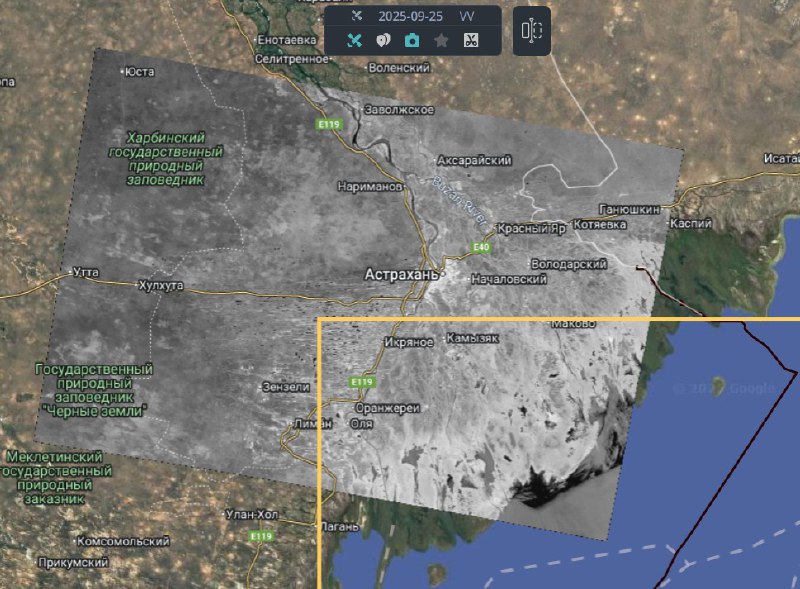
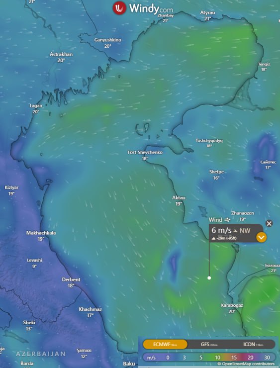
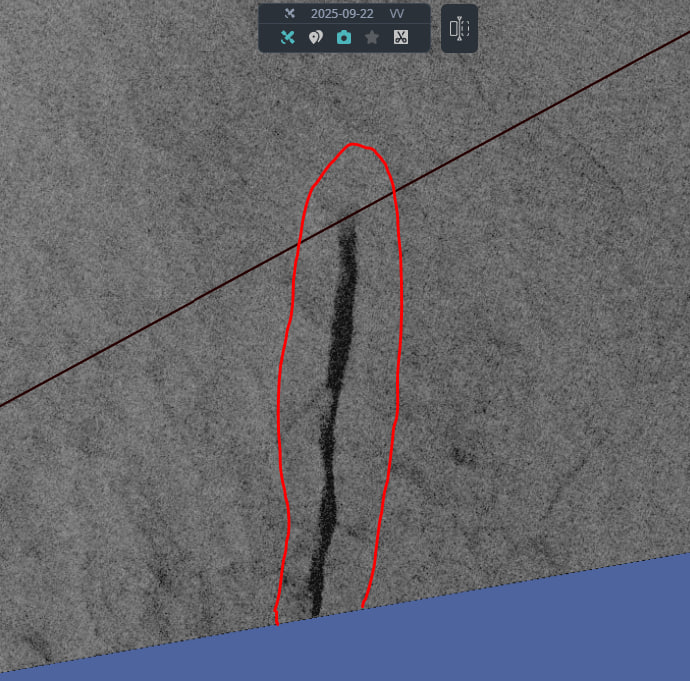
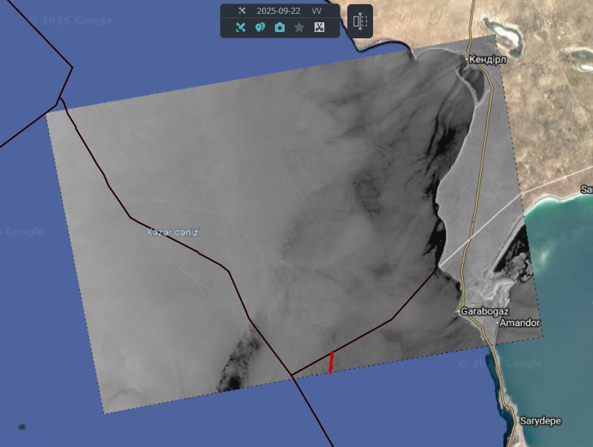
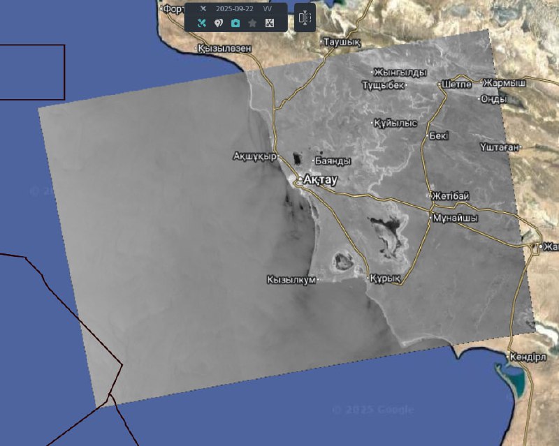
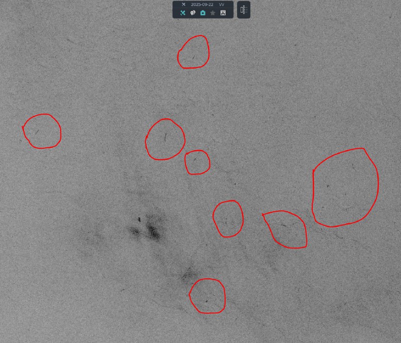
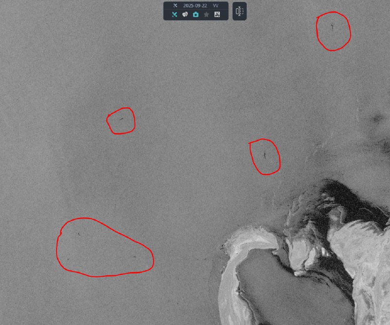
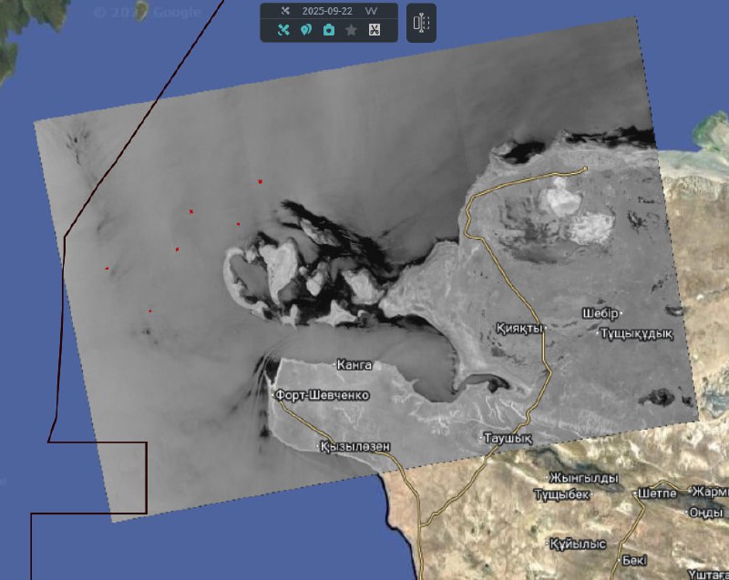
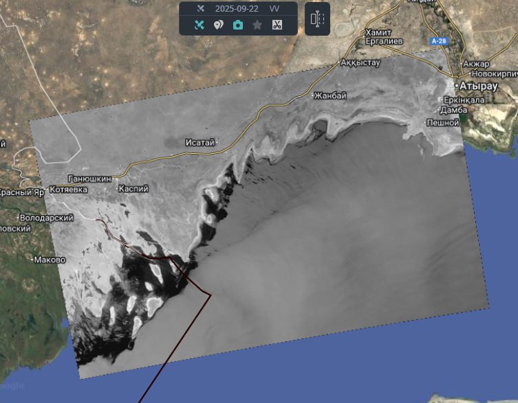
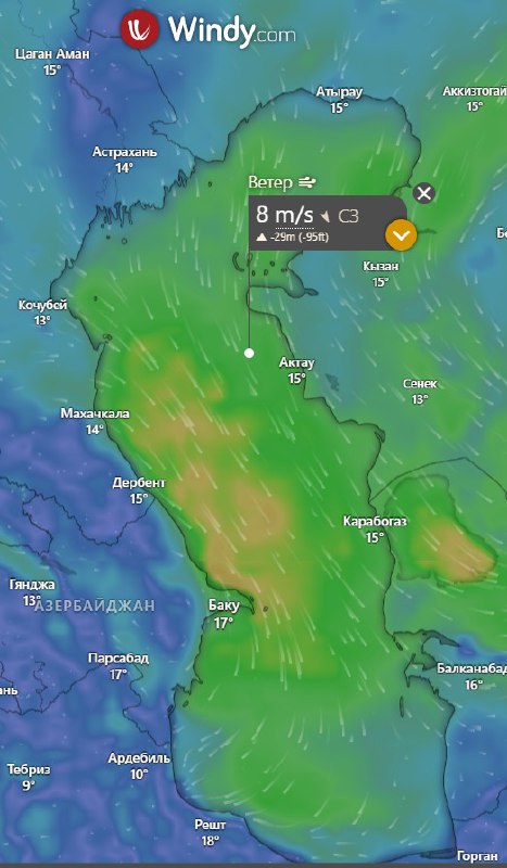
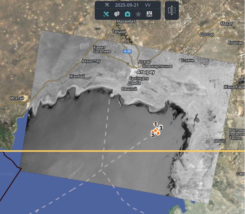
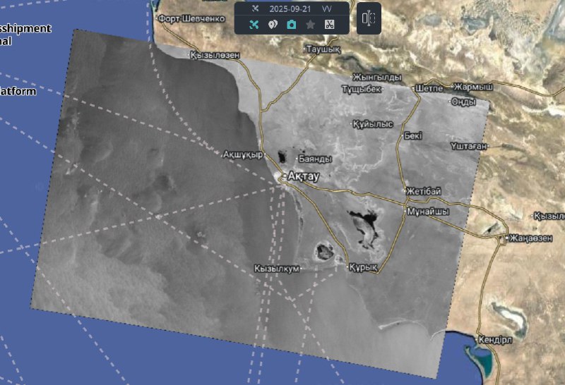
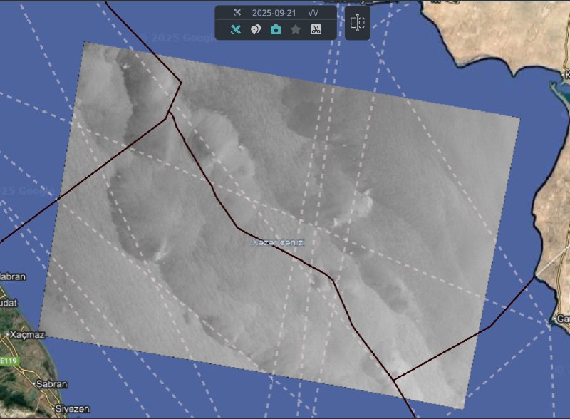
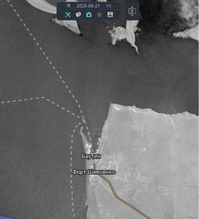
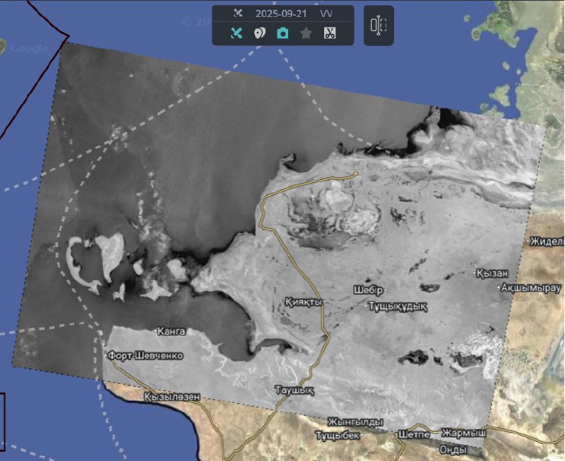
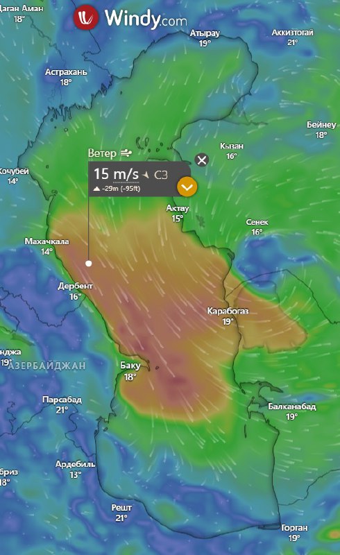
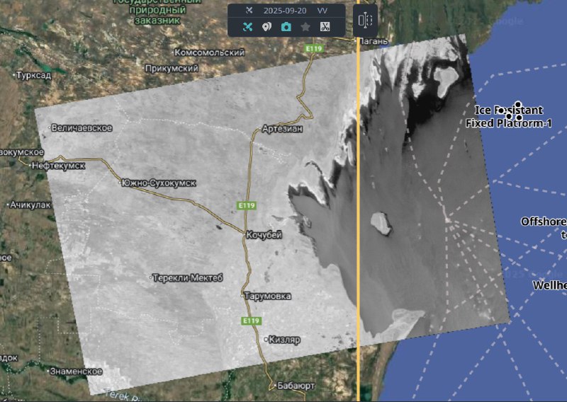
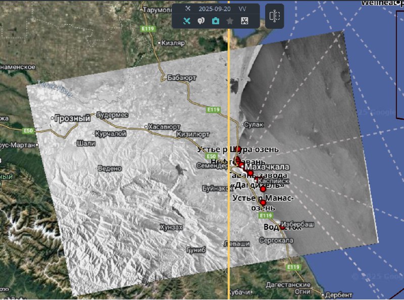
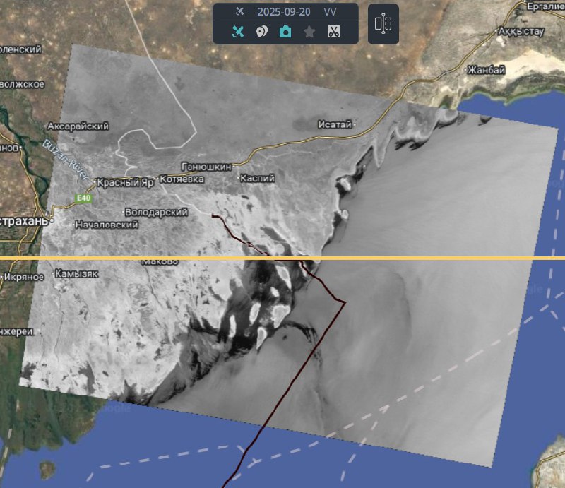
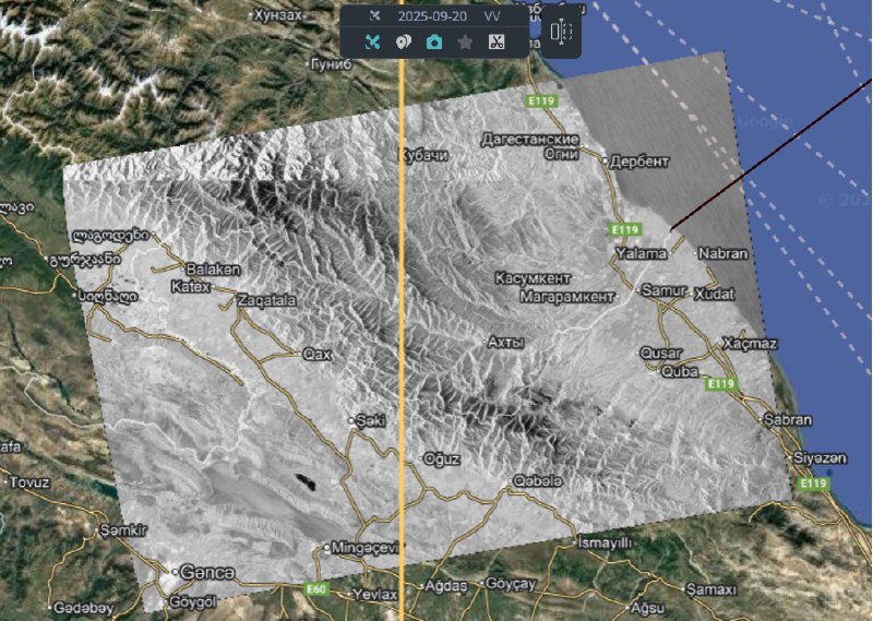
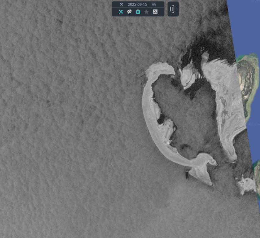
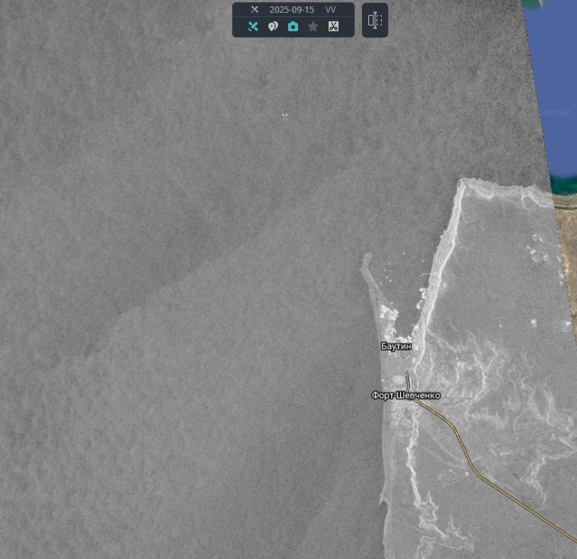
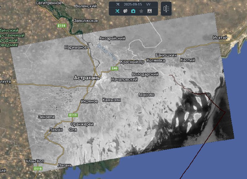
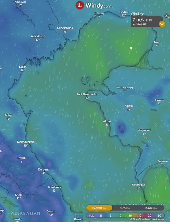
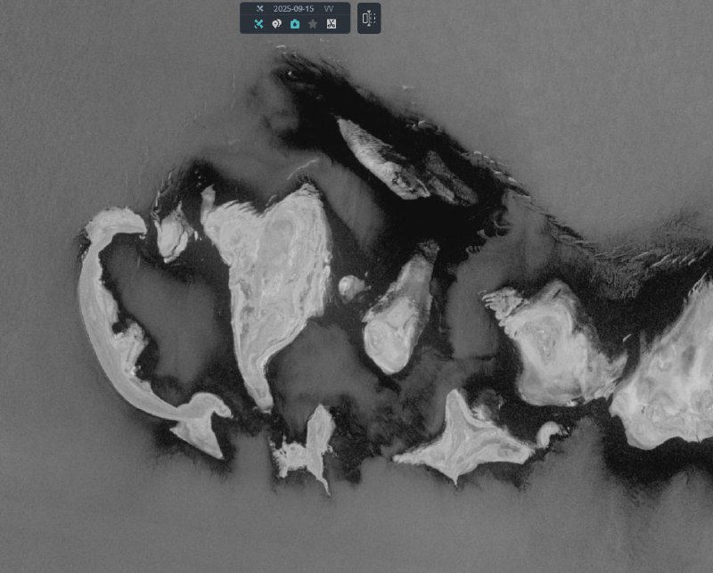
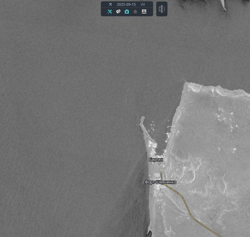
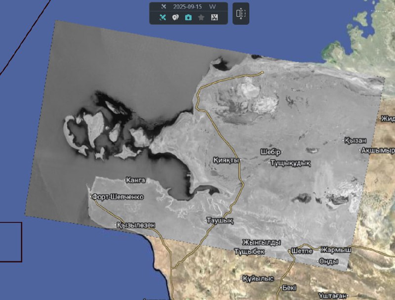
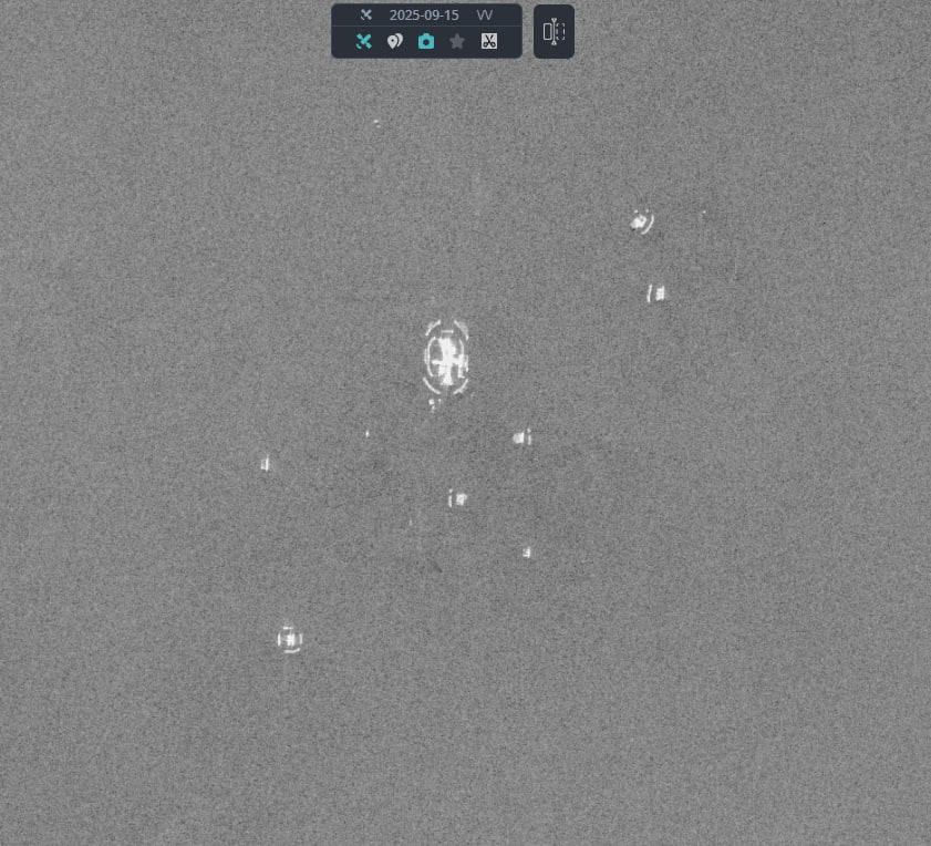
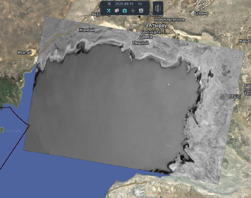
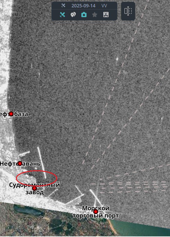
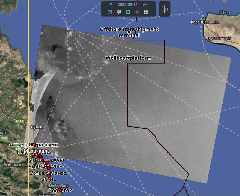
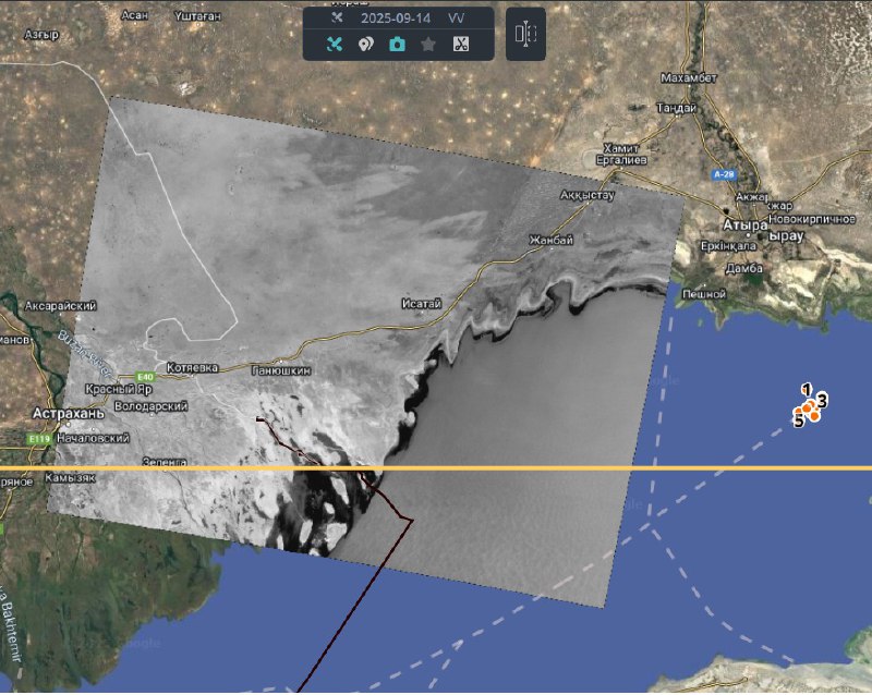
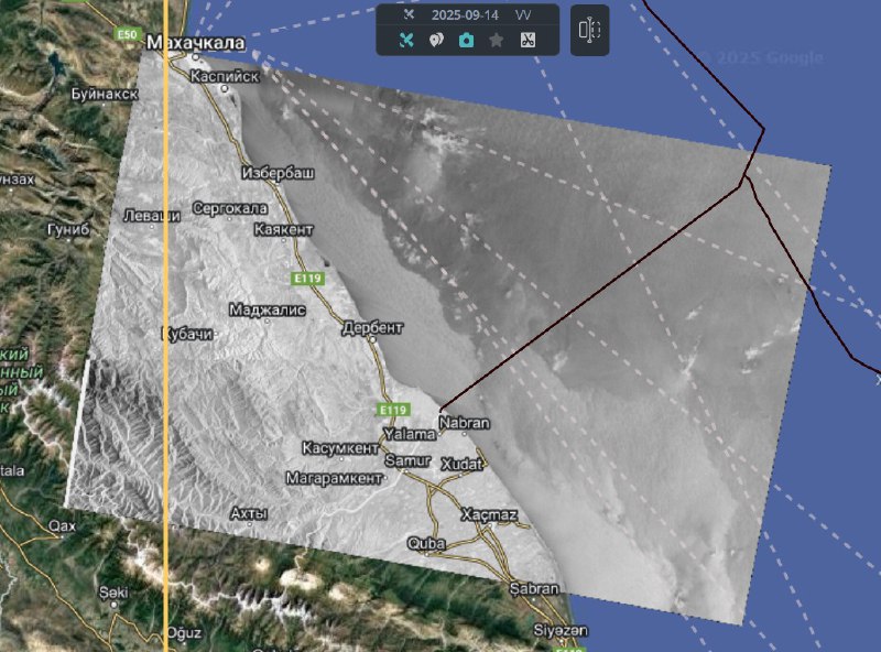
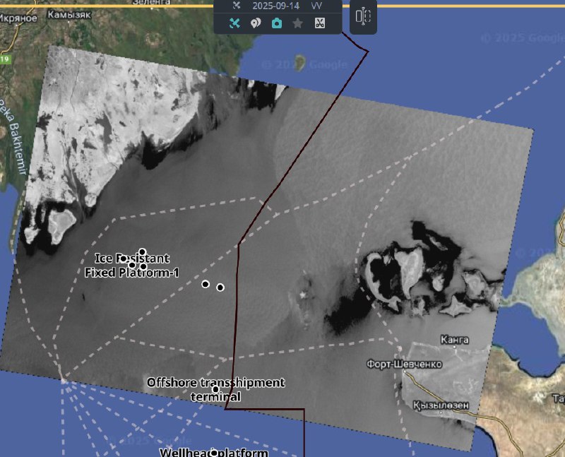
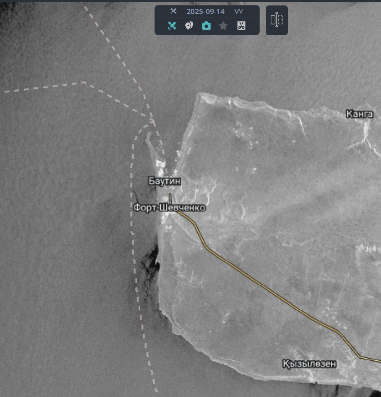
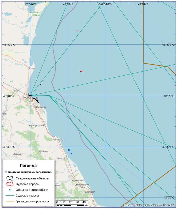
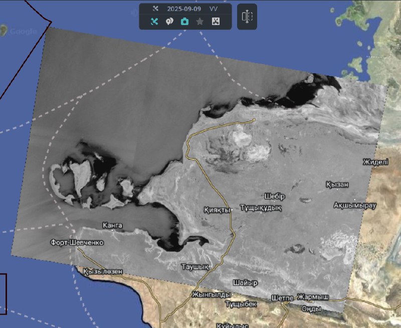
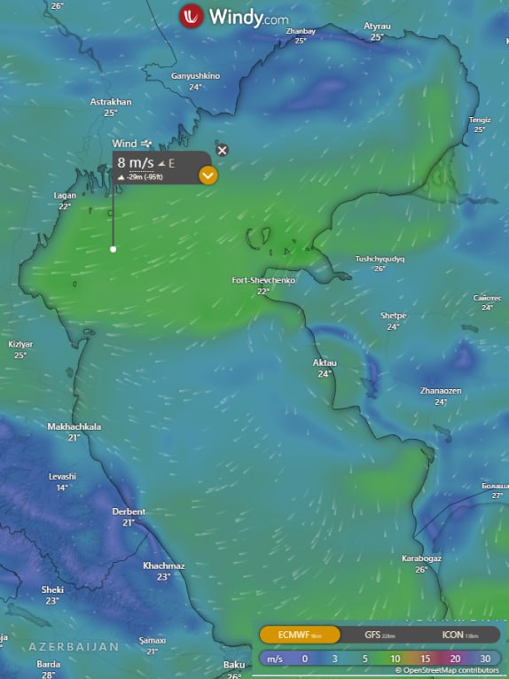
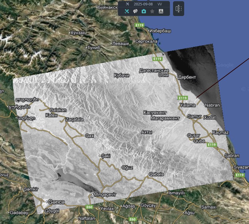
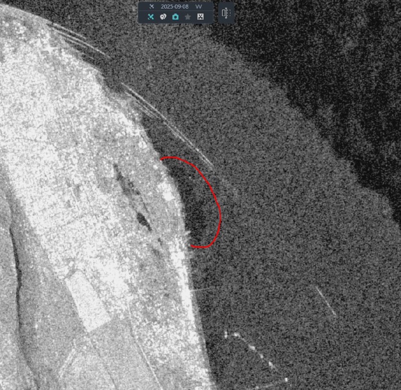
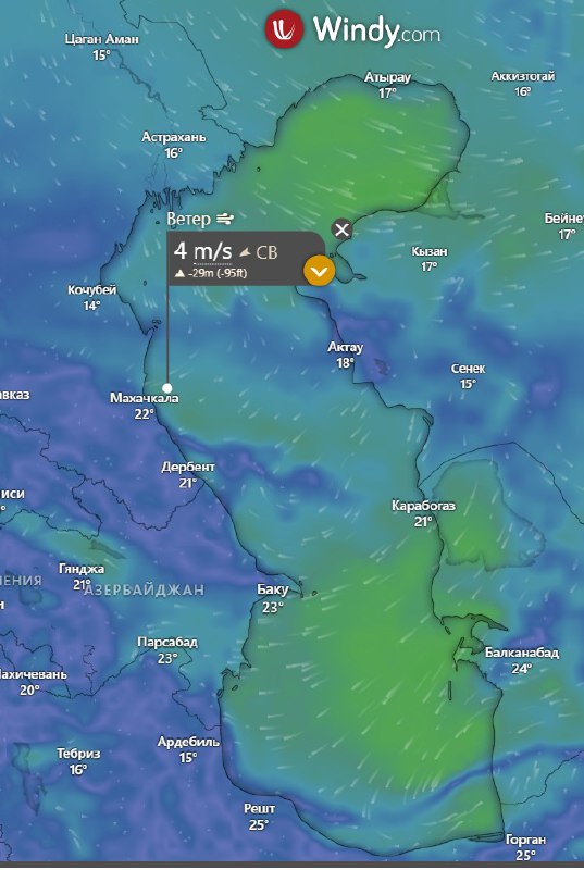
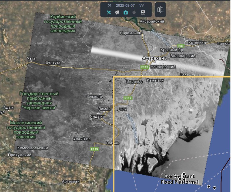
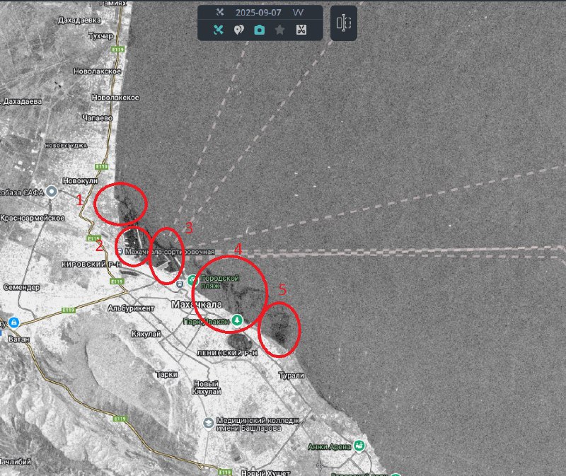
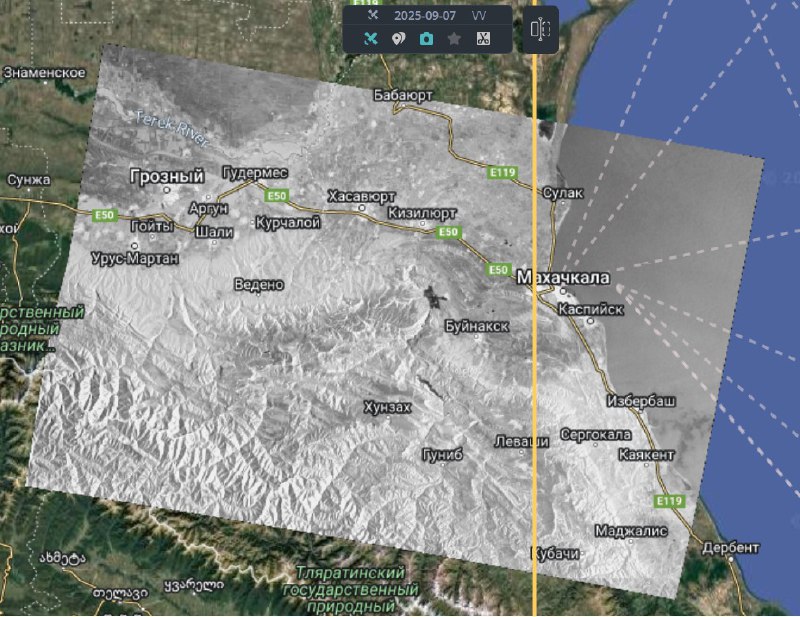
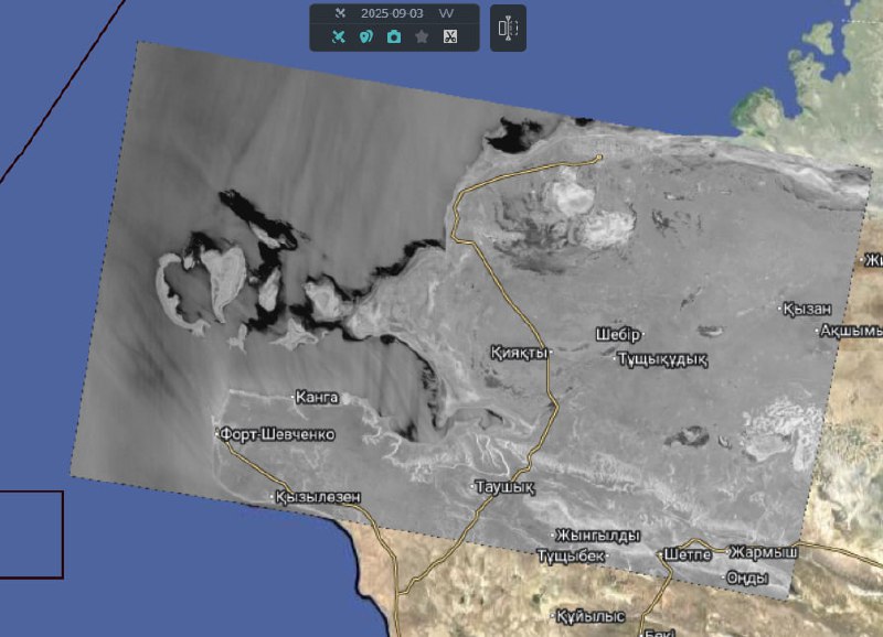
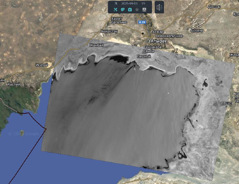
This is a project Transparent World at Caspian Sea for those interested in monitoring seal habitats from space. Environmental issues of the Caspian Sea are related to water pollution as a result of oil and gas production and transportation on the continental shelf.
In order to detect film-type pollution on the sea surface, the most efficient are radar techniques, as they are of the all-weather category. Online public results you may find here.

23-04-2024 06:31

No obvious anthropogenic spots were identified

Territorial waters of Kazakhstan

https://t.me/twworldkasp/2363
23-04-2024 06:28

No obvious anthropogenic spots were identified

Territorial waters of Russia, Kazakhstan, Azerbaijan and Turkmenistan

https://t.me/twworldkasp/2362
23-04-2024 06:22

No obvious anthropogenic spots were identified

Territorial waters of Kazakhstan

https://t.me/twworldkasp/2361
23-04-2024 06:19
23-04-2024 06:19

No obvious anthropogenic spots were identified

1 - port Bautin, Fort Shevchenko

Territorial waters of Kazakhstan

https://t.me/twworldkasp/2359
23-04-2024 06:12
Hired
23-04-2024 06:11
A new image has appeared from the Sentinel-1 satellite of the Northern Caspian Sea region.
Image ID: S1A_IW_GRDH_1SDV_20240423T024339
Delay: 02:37 (dataspace) + 00:50 (processing)
23-04-2024 06:09
Hired
23-04-2024 06:09
A new image has appeared from the Sentinel-1 satellite of the Northern Caspian Sea region.
Image ID: S1A_IW_GRDH_1SDV_20240423T024404
Delay: 02:38 (dataspace) + 00:46 (processing)
23-04-2024 06:07
Hired
23-04-2024 06:06
A new image has appeared from the Sentinel-1 satellite of the Northern Caspian Sea region.
Image ID: S1A_IW_GRDH_1SDV_20240423T024245
Delay: 02:45 (dataspace) + 00:38 (processing)
23-04-2024 06:04
Hired
23-04-2024 06:04
A new image has appeared from the Sentinel-1 satellite of the Northern Caspian Sea region.
Image ID: S1A_IW_GRDH_1SDV_20240423T024314
Delay: 02:38 (dataspace) + 00:42 (processing)
22-04-2024 18:40
22-04-2024 18:40
22-04-2024 18:40

No obvious anthropogenic spots were found
1 - Chechen Island
2 - Tyuleniy Island
Territorial waters of Russia

https://t.me/twworldkasp/2348
22-04-2024 18:30

No obvious anthropogenic spots were found
Territorial waters of Russia and Azerbaijan

https://t.me/twworldkasp/2347
22-04-2024 18:25
22-04-2024 18:25
22-04-2024 18:25

Difficult wind conditions make image analysis difficult
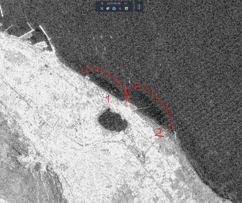
1 - faint spot in the port of Makhachkala, noted with low probability
2 - pollution confined to the wastewater discharge point in the southern part of Makhachkala. Area about 2.1 km2
Territorial waters of Russia

https://t.me/twworldkasp/2344
22-04-2024 18:03
Hired
22-04-2024 18:03
Hired
22-04-2024 18:03
A new image has appeared from the Sentinel-1 satellite of the Northern Caspian Sea region.
Image ID: S1A_IW_GRDH_1SDV_20240422T144658
Delay: 02:25 (dataspace) + 00:50 (processing)
22-04-2024 18:03
A new image has appeared from the Sentinel-1 satellite of the Northern Caspian Sea region.
Image ID: S1A_IW_GRDH_1SDV_20240422T144608
Delay: 02:29 (dataspace) + 00:47 (processing)
22-04-2024 17:59
Hired
22-04-2024 17:52
A new image has appeared from the Sentinel-1 satellite of the Northern Caspian Sea region.
Image ID: S1A_IW_GRDH_1SDV_20240422T144633
Delay: 02:25 (dataspace) + 00:40 (processing)
21-04-2024 07:43
21-04-2024 07:43

No obvious anthropogenic spots were identified

1 - o. Maly Zhemchuzhny

Territorial waters of Russia

https://t.me/twworldkasp/2336
21-04-2024 07:38
21-04-2024 07:38

No obvious anthropogenic spots were identified

1 - Makhachkala

Territorial waters of Russia

https://t.me/twworldkasp/2334
21-04-2024 07:37
Hired
21-04-2024 07:35
A new image has appeared from the Sentinel-1 satellite of the Northern Caspian Sea region.
Image ID: S1A_IW_GRDH_1SDV_20240421T025923
Delay: 03:46 (dataspace) + 00:49 (processing)
21-04-2024 07:33
21-04-2024 07:33
21-04-2024 07:33

No obvious anthropogenic spots were identified

1 - o. Chechen
2 - o. Seal

Territorial waters of Russia

https://t.me/twworldkasp/2329
21-04-2024 07:23
Hired
21-04-2024 07:21
A new image has appeared from the Sentinel-1 satellite of the Northern Caspian Sea region.
Image ID: S1A_IW_GRDH_1SDV_20240421T030017
Delay: 03:39 (dataspace) + 00:41 (processing)
21-04-2024 07:20
Hired
21-04-2024 07:20
A new image has appeared from the Sentinel-1 satellite of the Northern Caspian Sea region.
Image ID: S1A_IW_GRDH_1SDV_20240421T025952
Delay: 03:45 (dataspace) + 00:35 (processing)
17-04-2024 18:55

Bautin, Fort Shevchenko

https://t.me/twworldkasp/2324
17-04-2024 18:55
17-04-2024 18:55
17-04-2024 18:55
17-04-2024 18:55

No anthropogenic spots found
1- Chechen Island
2 - Tyuleniy Island
3 - Seal Islands
4 - Bautin, Fort Shevchenko
Territorial waters of Russia and Kazakhstan

https://t.me/twworldkasp/2320
17-04-2024 18:48

No obvious anthropogenic spots were found
Territorial waters of Russia and Kazakhstan

https://t.me/twworldkasp/2319
17-04-2024 18:47
Hired
17-04-2024 18:46
A new image has appeared from the Sentinel-1 satellite of the Northern Caspian Sea region.
Image ID: S1A_IW_GRDH_1SDV_20240417T143849
Delay: 03:06 (dataspace) + 01:01 (processing)
17-04-2024 18:44

No anthropogenic spots found
Territorial waters of Russia and Kazakhstan

https://t.me/twworldkasp/2316
17-04-2024 18:42
Hired
17-04-2024 18:42
A new image has appeared from the Sentinel-1 satellite of the Northern Caspian Sea region.
Image ID: S1A_IW_GRDH_1SDV_20240417T143914
Delay: 02:57 (dataspace) + 01:05 (processing)
17-04-2024 18:39
Hired
17-04-2024 18:38
A new image has appeared from the Sentinel-1 satellite of the Northern Caspian Sea region.
Image ID: S1A_IW_GRDH_1SDV_20240417T143824
Delay: 03:01 (dataspace) + 00:58 (processing)
17-04-2024 18:36
17-04-2024 18:36

Probable ship discharge, small area, about 0.05 km2, 2.5 km east of the mouth of the Samur River (Russian sector). The culprit ship is nearby.
Photo of the territorial waters of Russia, Kazakhstan and Azerbaijan

https://t.me/twworldkasp/2310
17-04-2024 18:24
Hired
17-04-2024 18:23
A new image has appeared from the Sentinel-1 satellite of the Northern Caspian Sea region.
Image ID: S1A_IW_GRDH_1SDV_20240417T143759
Delay: 03:01 (dataspace) + 00:44 (processing)
16-04-2024 06:59
16-04-2024 06:59
16-04-2024 06:59
16-04-2024 06:59
16-04-2024 06:59

2 ambiguous spots were found in the image

1 - a possible ship discharge has been identified with low probability, the area of ​​the stain is approximately 0.9 sq. km, the port of Makhachkala
2 - o. Chechen
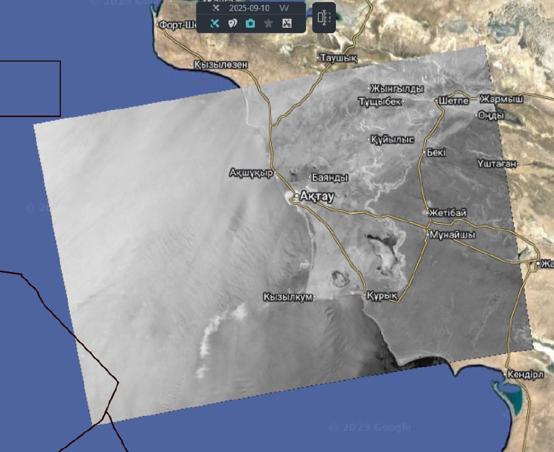
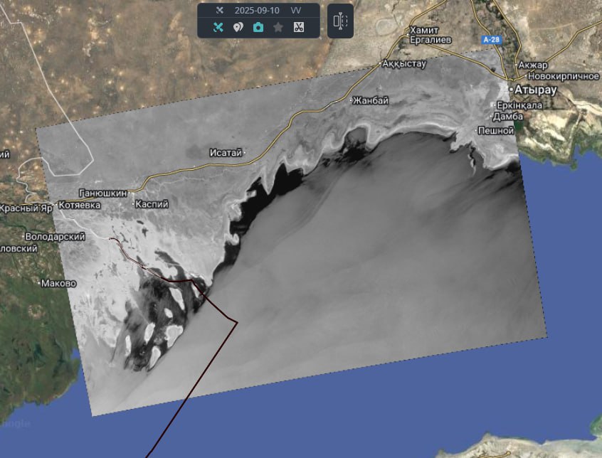
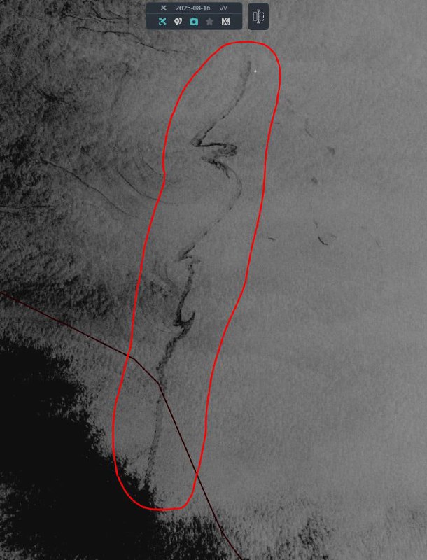
3.4 - a dubious slick with a length of approximately 48 km has been identified, the cause may be oils, noted with low probability. The spot is located approximately 83 km from the coast of Aktau

Territorial waters of Russia and Kazakhstan

https://t.me/twworldkasp/2303
16-04-2024 06:10

No anthropogenic spots were identified

Territorial waters of Kazakhstan and Russia

https://t.me/twworldkasp/2302
16-04-2024 06:08
16-04-2024 06:08
16-04-2024 06:08

No obvious anthropogenic spots were identified

1 - o. Maly Zhemchuzhny
2 - port Bautin, Fort Shevchenko

Territorial waters of Russia and Kazakhstan

https://t.me/twworldkasp/2299
16-04-2024 06:06
Hired
16-04-2024 06:05
Hired
16-04-2024 06:05
A new image has appeared from the Sentinel-1 satellite of the Northern Caspian Sea region.
Image ID: S1A_IW_GRDH_1SDV_20240416T025152
Delay: 02:16 (dataspace) + 00:57 (processing)
16-04-2024 06:05
A new image has appeared from the Sentinel-1 satellite of the Northern Caspian Sea region.
Image ID: S1A_IW_GRDH_1SDV_20240416T025057
Delay: 02:17 (dataspace) + 00:57 (processing)
16-04-2024 06:00
Hired
16-04-2024 06:00
A new image has appeared from the Sentinel-1 satellite of the Northern Caspian Sea region.
Image ID: S1A_IW_GRDH_1SDV_20240416T025127
Delay: 02:12 (dataspace) + 00:56 (processing)
16-04-2024 05:51

No obvious anthropogenic spots were identified
The picture shows difficult wind conditions

Territorial waters of Russia, Azerbaijan and Kazakhstan

https://t.me/twworldkasp/2292
16-04-2024 05:42
Hired
16-04-2024 05:42
A new image has appeared from the Sentinel-1 satellite of the Northern Caspian Sea region.
Image ID: S1A_IW_GRDH_1SDV_20240416T025217
Delay: 02:12 (dataspace) + 00:37 (processing)
14-04-2024 08:58

❗️Russian researchers have reported a significant oil spill at Kazakhstan's Kashagan oil field, while operator NCOC denies such an incident occurred.

https://t.me/twworldkasp/2289
12-04-2024 18:59

No anthropogenic spots were found. Territorial waters of Kazakhstan, Tajikistan, Azerbaijan.

https://t.me/twworldkasp/2288
12-04-2024 18:55
12-04-2024 18:55

No obvious anthropogenic spots were found. There is a difficult wind situation, which makes image analysis difficult. In some places griffins are visible (Fig. 2). Territorial waters of Kazakhstan and the Russian Federation

https://t.me/twworldkasp/2286
12-04-2024 18:40

No obvious anthropogenic spots were found. Photo on ter. waters of Kazakhstan.

https://t.me/twworldkasp/2285
12-04-2024 18:36
Hired
12-04-2024 18:36
A new image has appeared from the Sentinel-1 satellite of the Northern Caspian Sea region.
Image ID: S1A_IW_GRDH_1SDV_20240412T143037
Delay: 02:57 (dataspace) + 01:07 (processing)
12-04-2024 18:33
Hired
12-04-2024 18:33
A new image has appeared from the Sentinel-1 satellite of the Northern Caspian Sea region.
Image ID: S1A_IW_GRDH_1SDV_20240412T142947
Delay: 02:56 (dataspace) + 01:07 (processing)
12-04-2024 18:33
I took it
12-04-2024 18:32
A new image has appeared from the Sentinel-1 satellite of the Northern Caspian Sea region.
Image ID: S1A_IW_GRDH_1SDV_20240412T143012
Delay: 02:56 (dataspace) + 01:06 (processing)
12-04-2024 17:54

No obvious anthropogenic spots were found. Part of the image has complex wind conditions, which makes it difficult to analyze. Territorial waters of Kazakhstan and the Russian Federation

https://t.me/twworldkasp/2278
12-04-2024 17:41
Hired
12-04-2024 17:41
A new image has appeared from the Sentinel-1 satellite of the Northern Caspian Sea region.
Image ID: S1A_IW_GRDH_1SDV_20240412T143102
Delay: 02:18 (dataspace) + 00:51 (processing)
11-04-2024 10:46

No obvious anthropogenic spots were found. Territorial waters of Kazakhstan, Azerbaijan, Russian Federation, Turkmenistan.

https://t.me/twworldkasp/2275
11-04-2024 10:42
11-04-2024 10:42

No obvious anthropogenic spots were found. Difficult wind conditions make image analysis difficult. Territorial waters of Kazakhstan, Russian Federation

https://t.me/twworldkasp/2273
11-04-2024 10:41
11-04-2024 10:41

No obvious anthropogenic spots were found. Difficult wind conditions make image analysis difficult. Territorial waters of Kazakhstan, Russian Federation.

https://t.me/twworldkasp/2271
11-04-2024 10:37

No obvious anthropogenic spots were found. Difficult wind conditions make image analysis difficult. Territorial waters of Kazakhstan.

https://t.me/twworldkasp/2270
11-04-2024 10:27
Hired
11-04-2024 10:27
11-04-2024 10:27

No obvious anthropogenic spots were found. Difficult wind conditions make image analysis difficult. Territorial waters of Kazakhstan.

https://t.me/twworldkasp/2267
11-04-2024 10:27
A new image has appeared from the Sentinel-1 satellite of the Northern Caspian Sea region.
Image ID: S1A_IW_GRDH_1SDV_20240411T024338
Delay: 02:48 (dataspace) + 04:55 (processing)
11-04-2024 10:23
Hired
11-04-2024 10:21
A new image has appeared from the Sentinel-1 satellite of the Northern Caspian Sea region.
Image ID: S1A_IW_GRDH_1SDV_20240411T024403
Delay: 02:50 (dataspace) + 04:47 (processing)
11-04-2024 10:16
Hired
11-04-2024 10:16
Hired
11-04-2024 10:15
A new image has appeared from the Sentinel-1 satellite of the Northern Caspian Sea region.
Image ID: S1A_IW_GRDH_1SDV_20240411T024244
Delay: 02:48 (dataspace) + 04:44 (processing)
11-04-2024 10:09
A new image has appeared from the Sentinel-1 satellite of the Northern Caspian Sea region.
Image ID: S1A_IW_GRDH_1SDV_20240411T024313
Delay: 02:47 (dataspace) + 04:38 (processing)
10-04-2024 18:59

No obvious anthropogenic spots were found. Difficult wind conditions make image analysis difficult
Territorial waters of Russia and Azerbaijan

https://t.me/twworldkasp/2259
10-04-2024 18:56
10-04-2024 18:56

No obvious anthropogenic spots were found. Wind conditions make image analysis difficult
1 - Makhachkala
Territorial waters of Russia

https://t.me/twworldkasp/2257
10-04-2024 18:49
10-04-2024 18:49
10-04-2024 18:49

No anthropogenic spots found
1- Chechen Island
2 - Tyuleniy Island
Territorial waters of Russia

https://t.me/twworldkasp/2254
10-04-2024 18:43
Hired
10-04-2024 18:42
A new image has appeared from the Sentinel-1 satellite of the Northern Caspian Sea region.
Image ID: S1A_IW_GRDH_1SDV_20240410T144607
Delay: 02:58 (dataspace) + 00:57 (processing)
10-04-2024 18:38
Hired
10-04-2024 18:37
A new image has appeared from the Sentinel-1 satellite of the Northern Caspian Sea region.
Image ID: S1A_IW_GRDH_1SDV_20240410T144657
Delay: 02:55 (dataspace) + 00:55 (processing)
10-04-2024 18:36
Hired
10-04-2024 18:35
A new image has appeared from the Sentinel-1 satellite of the Northern Caspian Sea region.
Image ID: S1A_IW_GRDH_1SDV_20240410T144632
Delay: 03:00 (dataspace) + 00:48 (processing)
10-04-2024 14:15
10-04-2024 14:15
10-04-2024 14:15

No obvious anthropogenic spots were identified

1 - o. Chechen
2 - o. Seal


Territorial waters of Russia

https://t.me/twworldkasp/2245
10-04-2024 14:09
10-04-2024 14:09

No obvious anthropogenic spots were identified

1 - o. Maly Zhemchuzhny

Territorial waters of Russia

https://t.me/twworldkasp/2243
10-04-2024 14:04
10-04-2024 14:04

No obvious anthropogenic spots were identified

1 - Makhachkala, port

Territorial waters of Russia

https://t.me/twworldkasp/2241
10-04-2024 14:01
Hired
10-04-2024 14:00
A new image has appeared from the Sentinel-1 satellite of the Northern Caspian Sea region.
Image ID: S1A_IW_GRDH_1SDV_20240409T025952
Delay: 1d 10:16 (dataspace) + 00:44 (processing)
10-04-2024 13:59
Hired
10-04-2024 13:58
A new image has appeared from the Sentinel-1 satellite of the Northern Caspian Sea region.
Image ID: S1A_IW_GRDH_1SDV_20240409T025923
Delay: 1d 10:17 (dataspace) + 00:42 (processing)
10-04-2024 13:55
Hired
10-04-2024 13:54
A new image has appeared from the Sentinel-1 satellite of the Northern Caspian Sea region.
Image ID: S1A_IW_GRDH_1SDV_20240409T030017
Delay: 1d 10:15 (dataspace) + 00:39 (processing)
05-04-2024 19:37

No anthropogenic spots were identified

Territorial waters of Russia and Kazakhstan

https://t.me/twworldkasp/2234
05-04-2024 19:35
Hired
05-04-2024 19:35
A new image has appeared from the Sentinel-1 satellite of the Northern Caspian Sea region.
Image ID: S1A_IW_GRDH_1SDV_20240405T143914
Delay: 02:53 (dataspace) + 02:02 (processing)
05-04-2024 19:22
05-04-2024 19:22
05-04-2024 19:22
05-04-2024 19:22
05-04-2024 19:22

No obvious anthropogenic spots were identified. The image shows complex wind conditions, which makes it difficult to analyze

1 - o. Chechen
2 - o. Seal
3 - o. Maly Zhemchuzhny
4 - port Bautin, Fort Shevchenko

Territorial waters of Russia and Kazakhstan

https://t.me/twworldkasp/2227
05-04-2024 19:11
Hired
05-04-2024 19:11
A new image has appeared from the Sentinel-1 satellite of the Northern Caspian Sea region.
Image ID: S1A_IW_GRDH_1SDV_20240405T143849
Delay: 02:53 (dataspace) + 01:39 (processing)
05-04-2024 18:22

No obvious anthropogenic spots were identified. The image shows complex wind conditions, which makes it difficult to analyze

Territorial waters of Russia and Kazakhstan

https://t.me/twworldkasp/2224
05-04-2024 18:19
Hired
05-04-2024 18:19
A new image has appeared from the Sentinel-1 satellite of the Northern Caspian Sea region.
Image ID: S1A_IW_GRDH_1SDV_20240405T143824
Delay: 02:56 (dataspace) + 00:43 (processing)
05-04-2024 18:17

No obvious anthropogenic spots were identified. The image shows complex wind conditions, which makes it difficult to analyze

Territorial waters of Russia, Kazakhstan and Azerbaijan

https://t.me/twworldkasp/2221
05-04-2024 18:13
Hired
05-04-2024 18:12
A new image has appeared from the Sentinel-1 satellite of the Northern Caspian Sea region.
Image ID: S1A_IW_GRDH_1SDV_20240405T143759
Delay: 02:57 (dataspace) + 00:37 (processing)
05-04-2024 10:25
Azerbaijani tankers transported more than 960 thousand tons of oil across the Caspian Sea in the first quarter

CJSC Azerbaijan Caspian Shipping Company (ASCO) summed up the results of its activities in the first quarter of 2024.

Read more on KORABEL.RU

#shipping
All industry news on @korabel_news
04-04-2024 06:49

No anthropogenic spots were identified. Photo on ter. waters of the Russian Federation and Kazakhstan.

https://t.me/twworldkasp/2217
04-04-2024 06:44
04-04-2024 06:44
04-04-2024 06:44

No obvious anthropogenic spots have been identified; in some places there are minor manifestations of natural origin - griffins. Part of the image shows complex wind conditions (as near Maly Zhemchuzhny Island), which complicates the analysis. Photo on ter. waters of the Russian Federation and Kazakhstan.
1-o. Maly Zhemchuzhny
2-fort Shevchenko
3-habitat of seals

https://t.me/twworldkasp/2214
04-04-2024 06:26
The Ministry of Energy has not confirmed an oil spill in the Caspian Sea, but continues to check the information

Minister Satkaliev believes that this may be a “natural phenomenon”

Analysis of the image of space monitoring of the Caspian Sea shows an ambiguous picture, Energy Minister Almasadam Satkaliev said on the sidelines of the Majilis on Wednesday. But, according to him, the oil spill has not been previously confirmed.

“During the operation of the offshore complex at Kashagan, there was not a single oil spill during the entire period. Therefore, we are now verifying the information. An image from space monitoring is being analyzed, which shows an ambiguous picture. That is, it shows it as a natural phenomenon,” said Satkaliev.

He added that ecologists are working on site and taking water samples throughout the entire water area.

“At this stage, the oil spill has not been confirmed,” the minister said.

On Monday, Galina Chernova, director of the Globus Center for Environmental and Legal Initiative, reported that an oil spill had been discovered in the Caspian Sea in the area of ​​the Kashagan field. According to her, the spill was discovered using space monitoring. According to satellite images, it occurred on March 30 over an area of ​​about 7 square kilometers, the slick drifted to the north of the Caspian Sea.

The day before, the Department of Ecology for the Atyrau region reported that it would conduct a visual inspection and sampling at the site of Kashagan oil production after a report of its spill in the Caspian Sea. And if these facts are confirmed, an unscheduled inspection of NCOC will be carried out.

NCOC said that information about an alleged leak of oil, wastewater or other liquids at the Kashagan offshore complex on March 30 “has not been substantiated.”

https://vlast.kz/novosti/59562-v-minenergo-ne-podtverdili-razliv-nefti-na-kaspii-no-prodolzaut-proverat-informaciu.html?utm_source=yxnews&utm_medium=desktop&utm_referrer=https%3A%2F% 2Fdzen.ru%2Fnews%2Fsearch%3Ftext%3D
04-04-2024 06:22
04-04-2024 06:22
04-04-2024 06:22

A stain was found on the ter side. waters of Kazakhstan, identified as a ship spill with low probability. 1- spot 2

https://t.me/twworldkasp/2210
04-04-2024 06:03

No anthropogenic spots were identified. Photo on ter. waters of the Russian Federation, Azerbaijan, Kazakhstan.

https://t.me/twworldkasp/2209
04-04-2024 05:47
Hired
04-04-2024 05:47
Hired
04-04-2024 05:46
A new image has appeared from the Sentinel-1 satellite of the Northern Caspian Sea region.
Image ID: S1A_IW_GRDH_1SDV_20240404T025217
Delay: 02:07 (dataspace) + 00:46 (processing)
04-04-2024 05:45
A new image has appeared from the Sentinel-1 satellite of the Northern Caspian Sea region.
Image ID: S1A_IW_GRDH_1SDV_20240404T025058
Delay: 02:06 (dataspace) + 00:48 (processing)
04-04-2024 05:44
Hired
04-04-2024 05:43
Hired
04-04-2024 05:43
A new image has appeared from the Sentinel-1 satellite of the Northern Caspian Sea region.
Image ID: S1A_IW_GRDH_1SDV_20240404T025152
Delay: 02:07 (dataspace) + 00:44 (processing)
04-04-2024 05:43
A new image has appeared from the Sentinel-1 satellite of the Northern Caspian Sea region.
Image ID: S1A_IW_GRDH_1SDV_20240404T025127
Delay: 02:04 (dataspace) + 00:47 (processing)
03-04-2024 07:33
We asked the science support team to comment on the Planet image. Brief comment: "yes, an extremely interesting shot, especially the dark completion of the structure in
the form of a 'mushroom'. very similar to industrial water discharges.

see also:

Terleeva N.V., Ivanov A.Yu. Industrial discharges in the sea
oil and gas complex and their satellite monitoring // Ecology and
industry of Russia. 2022. T. 26. No. 2. P. 64–71"
03-04-2024 05:55
The mixture of sand and silt does not create smoothing marks on
sea ​​surface such as oil, petroleum products and other oily
substances, since it is located in the upper layer of the sea, and not the surface, like
films. Moreover, the wake behind a ship cannot physically have a width of almost
600 m, as in this case; usually about 10-15 m.
03-04-2024 05:14
A large company has denied information about an oil leak in the Caspian Sea

NCOC denied LS information about an oil spill in the Caspian Sea.

According to the consortium, the alleged leak of oil, wastewater or other liquids at the offshore complex of the Kashagan field on March 30, 2024 has not been substantiated.

According to images taken from the Sentinel-1A satellites on March 30, 2024 and TerraSAR-X on April 2, 2024, a natural phenomenon was observed in the Northern Caspian Sea, including in a small area north of Island D of the Kashagan field, NCOC assured.

“In other images taken in subsequent days, such phenomena were no longer present. The area indicated in the publication near Island D was examined, and no spills or leaks were detected. NCOC’s offshore facilities are operating as normal,” the consortium added.
The operator noted that since production began in 2016, no hydrocarbon spills have been reported at NCOC's production facilities.

Let us remind you that earlier information appeared on social networks about an oil spill with an area of ​​about 7 square meters. km. The Department of Ecology for the Atyrau region began an operational inspection of the Caspian Sea in this regard.

Source: https://lsm.kz/krupnaya-kompaniya-oprovergla-informaciyu-ob-utechke-nefti-na-kaspii
03-04-2024 01:20

Yes, this is definitely an embankment at this place (I used the distance between the barrier in both pictures, since I can’t measure it on the planet. The ship will not be able to land at this place since the channel is to the east, and it looks like the silt is spreading from the embankment.

https://t.me/twworldkasp/2197
03-04-2024 01:11

It looks like it’s mud from this embankment, the ship won’t dock there, since the canal is to the east

https://t.me/twworldkasp/2196
03-04-2024 00:57

By the way, it is possible that the silt - in that part it is very shallow and the bottom consists of black silt, for example, Landsat data for December 15 - from the embankments that are located along the navigation channel, black spots on the ice spread on the ice in the direction of the west-northwest (they look like a shadow)

https://t.me/twworldkasp/2195
02-04-2024 19:05

The guys watched this the day before yesterday

https://t.me/twworldkasp/2194
31-03-2024 19:22
31-03-2024 19:22

A ship spill was discovered 44 km from the coast (lat.lon 42.659176,51.404758), two ships were observed in the area of ​​the spill. Photo on ter. waters of Kazakhstan, Azerbaijan, Turkmenistan,

https://t.me/twworldkasp/2191
31-03-2024 19:04
31-03-2024 19:04
31-03-2024 19:04

A ship spill was detected south of Kyzylkum (28 km from the coast), a ship was observed nearby. Most of the image shows complex wind conditions, making analysis difficult. A photo of the thermal waters of Kazakhstan. 1-common 2

https://t.me/twworldkasp/2188
31-03-2024 18:48
31-03-2024 18:48
31-03-2024 18:48

In the northern part of the image, point manifestations of natural origin were found - griffins. Most of the image has complex wind conditions, which makes analysis difficult. Photo on ter. waters of Kazakhstan and the Russian Federation 1- Fort Shevchenko 2- seal habitat 3- griffins

https://t.me/twworldkasp/2185
31-03-2024 18:34
31-03-2024 18:34

The image shows complex wind conditions, which makes analysis difficult. In the Kazakh sector, small concentrations of griffins were found in some places. A photo of the thermal waters of the Russian Federation and Kazakhstan.

https://t.me/twworldkasp/2183
31-03-2024 18:17
Hired
31-03-2024 18:17
Hired
31-03-2024 18:16
A new image has appeared from the Sentinel-1 satellite of the Northern Caspian Sea region.
Image ID: S1A_IW_GRDH_1SDV_20240331T143039
Delay: 02:54 (dataspace) + 00:51 (processing)
31-03-2024 18:10
A new image has appeared from the Sentinel-1 satellite of the Northern Caspian Sea region.
Image ID: S1A_IW_GRDH_1SDV_20240331T143014
Delay: 02:55 (dataspace) + 00:45 (processing)
31-03-2024 18:07
Hired
31-03-2024 18:06
A new image has appeared from the Sentinel-1 satellite of the Northern Caspian Sea region.
Image ID: S1A_IW_GRDH_1SDV_20240331T142949
Delay: 02:55 (dataspace) + 00:41 (processing)
31-03-2024 18:01
Hired
31-03-2024 17:57
A new image has appeared from the Sentinel-1 satellite of the Northern Caspian Sea region.
Image ID: S1A_IW_GRDH_1SDV_20240331T143104
Delay: 02:53 (dataspace) + 00:33 (processing)
30-03-2024 10:05

Regarding today's spill, we asked experts to further evaluate the image. This is clearly a spill from a Kazakh super-field/production site
Kashagan oil. Its reason can be threefold: 1) oil leakage during
production, 2) accidental discharge from oil production platforms. water (in
incl. containing petroleum products), which must be stored and removed
to land for disposal, and 3) some kind of accident with service vessels - see.
photo.

We should look at the Kazakh media, maybe there is something in them
reported.

https://t.me/twworldkasp/2174
30-03-2024 06:13

No obvious anthropogenic spots were identified

Territorial waters of Russia, Kazakhstan, Azerbaijan and Turkmenistan

https://t.me/twworldkasp/2173
30-03-2024 06:11

No anthropogenic spots were identified

Territorial waters of Kazakhstan and Russia

https://t.me/twworldkasp/2172
30-03-2024 06:09
30-03-2024 06:09

No anthropogenic spots were identified

1 - port Bautin, Fort Shevchenko

Territorial waters of Kazakhstan

https://t.me/twworldkasp/2170
30-03-2024 06:03
30-03-2024 06:03

A slick of anthropogenic origin has been identified at the Kashagan field.
Also in the northern part of the Caspian there are multiple natural oil shows (griffins)

1 - Kashagan field, slick of anthropogenic origin with an area of ​​6.82 sq. km

Territorial waters of Kazakhstan

https://t.me/twworldkasp/2168
30-03-2024 05:51
Hired
30-03-2024 05:50
A new image has appeared from the Sentinel-1 satellite of the Northern Caspian Sea region.
Image ID: S1A_IW_GRDH_1SDV_20240330T024404
Delay: 02:03 (dataspace) + 01:02 (processing)
30-03-2024 05:43
Hired
30-03-2024 05:42
A new image has appeared from the Sentinel-1 satellite of the Northern Caspian Sea region.
Image ID: S1A_IW_GRDH_1SDV_20240330T024339
Delay: 02:07 (dataspace) + 00:51 (processing)
30-03-2024 05:38
Hired
30-03-2024 05:37
A new image has appeared from the Sentinel-1 satellite of the Northern Caspian Sea region.
Image ID: S1A_IW_GRDH_1SDV_20240330T024314
Delay: 02:07 (dataspace) + 00:46 (processing)
30-03-2024 05:32
Hired
30-03-2024 05:32
A new image has appeared from the Sentinel-1 satellite of the Northern Caspian Sea region.
Image ID: S1A_IW_GRDH_1SDV_20240330T024245
Delay: 02:09 (dataspace) + 00:40 (processing)
29-03-2024 19:24
29-03-2024 19:24
29-03-2024 19:24
29-03-2024 19:24

No obvious anthropogenic spots were identified. Opposite the settlement of Lapukhovka there is a controversial spot, we are finding out the nature. Photo on thermal waters of the Russian Federation. 1-habitat of seals 2-o. Maly Zhemchuzhny 3-o. Tyuleniy 4-o. Tyuleniy

https://t.me/twworldkasp/2156
29-03-2024 18:55
29-03-2024 18:55
29-03-2024 18:55

A ship spill was discovered 5 km from the coast to the south-east of the city of Sulak, a ship is located next to the spill. In the picture ter. waters of the Russian Federation. 1

https://t.me/twworldkasp/2153
29-03-2024 18:40

No anthropogenic spots were identified. A photo of the thermal waters of the Russian Federation and Azerbaijan.

https://t.me/twworldkasp/2152
29-03-2024 18:33
Hired
29-03-2024 18:32
A new image has appeared from the Sentinel-1 satellite of the Northern Caspian Sea region.
Image ID: S1A_IW_GRDH_1SDV_20240329T144658
Delay: 02:55 (dataspace) + 00:49 (processing)
29-03-2024 18:28
Got me to work
29-03-2024 18:27
A new image has appeared from the Sentinel-1 satellite of the Northern Caspian Sea region.
Image ID: S1A_IW_GRDH_1SDV_20240329T144633
Delay: 02:57 (dataspace) + 00:43 (processing)
29-03-2024 18:26
Hired
29-03-2024 18:21
A new image has appeared from the Sentinel-1 satellite of the Northern Caspian Sea region.
Image ID: S1A_IW_GRDH_1SDV_20240329T144608
Delay: 02:59 (dataspace) + 00:35 (processing)
28-03-2024 07:26
28-03-2024 07:26

No anthropogenic spots were identified

Territorial waters of Russia

https://t.me/twworldkasp/2144
28-03-2024 07:22
28-03-2024 07:22

An anthropogenic stain was discovered in the area of ​​the port of Makhachkala.
Difficult wind conditions are observed in the southern part of the image

1 - Makhachkala, port - anthropogenic spot with an area of ​​0.12 sq. km

Territorial waters of Russia

https://t.me/twworldkasp/2142
28-03-2024 07:08
28-03-2024 07:08
28-03-2024 07:08
28-03-2024 07:08

No obvious anthropogenic spots were identified

1 - o. Chechen
2 - o. Seal
3 - o. Maly Zhemchuzhny

Territorial waters of Russia

https://t.me/twworldkasp/2138
28-03-2024 07:06
Hired
28-03-2024 07:05
A new image has appeared from the Sentinel-1 satellite of the Northern Caspian Sea region.
Image ID: S1A_IW_GRDH_1SDV_20240328T025922
Delay: 03:03 (dataspace) + 01:02 (processing)
28-03-2024 06:59
Hired
28-03-2024 06:59
A new image has appeared from the Sentinel-1 satellite of the Northern Caspian Sea region.
Image ID: S1A_IW_GRDH_1SDV_20240328T030016
Delay: 03:01 (dataspace) + 00:57 (processing)
28-03-2024 06:54
Hired
28-03-2024 06:54
A new image has appeared from the Sentinel-1 satellite of the Northern Caspian Sea region.
Image ID: S1A_IW_GRDH_1SDV_20240328T025951
Delay: 03:02 (dataspace) + 00:52 (processing)
24-03-2024 19:36
24-03-2024 19:36

There are difficult wind conditions on the border with Kazakhstan, which makes image analysis difficult. In some places, point formations are visible, probably griffins. A photo of the thermal waters of the Russian Federation and Kazakhstan.

https://t.me/twworldkasp/2130
24-03-2024 19:22
24-03-2024 19:22
24-03-2024 19:22
24-03-2024 19:22
24-03-2024 19:22
24-03-2024 19:22

The image shows complex wind conditions, which makes analysis difficult. In some places, individual dotted griffin inclusions are visible. A clear wake from a ship, which is heading to the north-west, has been identified. 1-fort Shevchenko 2-habitat of seals 3-griffins 4-o.Tyuleny 5-o.Chechen 6-wake from the ship

https://t.me/twworldkasp/2124
24-03-2024 18:48

The image shows complex wind conditions, which makes analysis difficult. A photo of the thermal waters of the Russian Federation and Kazakhstan.

https://t.me/twworldkasp/2123
24-03-2024 18:29

The image shows complex wind conditions, which significantly complicates analysis. Photo on ter. waters of Azerbaijan, Russian Federation, Kazakhstan.

https://t.me/twworldkasp/2122
24-03-2024 18:21
Hired
24-03-2024 18:21
A new image has appeared from the Sentinel-1 satellite of the Northern Caspian Sea region.
Image ID: S1A_IW_GRDH_1SDV_20240324T143848
Delay: 02:58 (dataspace) + 00:44 (processing)
24-03-2024 18:20
Hired
24-03-2024 18:20
A new image has appeared from the Sentinel-1 satellite of the Northern Caspian Sea region.
Image ID: S1A_IW_GRDH_1SDV_20240324T143913
Delay: 02:56 (dataspace) + 00:44 (processing)
24-03-2024 18:18
Hired
24-03-2024 18:18
Hired
24-03-2024 18:18
A new image has appeared from the Sentinel-1 satellite of the Northern Caspian Sea region.
Image ID: S1A_IW_GRDH_1SDV_20240324T143823
Delay: 02:58 (dataspace) + 00:41 (processing)
24-03-2024 18:12
A new image has appeared from the Sentinel-1 satellite of the Northern Caspian Sea region.
Image ID: S1A_IW_GRDH_1SDV_20240324T143758
Delay: 02:58 (dataspace) + 00:35 (processing)
23-03-2024 06:59

There are complex wind conditions in the water area, which complicates analysis. A photo of the thermal waters of the Russian Federation and Kazakhstan.

https://t.me/twworldkasp/2113
23-03-2024 06:51
23-03-2024 06:51

No anthropogenic spots were found. In the second photo is Fort Shevchenko. Photo of the thermal waters of the Russian Federation and Kazakhstan

https://t.me/twworldkasp/2111
23-03-2024 06:47
23-03-2024 06:47
23-03-2024 06:47

In the area of ​​the port of Makhachkala, two anthropogenic stains were discovered, probably old ship spills, identified with low probability. Photo on ter. waters of the Russian Federation, Kazakhstan. 1- general 2-oh. Chechen 3 - port of Makhachkala

https://t.me/twworldkasp/2108
23-03-2024 06:30

No obvious anthropogenic spots were found. Photo of the thermal waters of the Russian Federation, Azerbaijan, Kazakhstan

https://t.me/twworldkasp/2107
23-03-2024 06:25
Hired
23-03-2024 06:20
A new image has appeared from the Sentinel-1 satellite of the Northern Caspian Sea region.
Image ID: S1A_IW_GRDH_1SDV_20240323T025216
Delay: 02:44 (dataspace) + 00:42 (processing)
23-03-2024 06:17
Hired
23-03-2024 06:17
Hired
23-03-2024 06:17
Hired
23-03-2024 06:16
A new image has appeared from the Sentinel-1 satellite of the Northern Caspian Sea region.
Image ID: S1A_IW_GRDH_1SDV_20240323T025057
Delay: 02:45 (dataspace) + 00:40 (processing)
23-03-2024 06:16
A new image has appeared from the Sentinel-1 satellite of the Northern Caspian Sea region.
Image ID: S1A_IW_GRDH_1SDV_20240323T025126
Delay: 02:43 (dataspace) + 00:41 (processing)
23-03-2024 06:14
A new image has appeared from the Sentinel-1 satellite of the Northern Caspian Sea region.
Image ID: S1A_IW_GRDH_1SDV_20240323T025151
Delay: 02:44 (dataspace) + 00:38 (processing)
19-03-2024 18:38
19-03-2024 18:38

No obvious anthropogenic spots were found. The image shows accumulations of partially and highly fragmented ice
Territorial waters of Kazakhstan and Russia

https://t.me/twworldkasp/2097
19-03-2024 18:19
Hired
19-03-2024 18:18

No anthropogenic spots were found.
Territorial waters of Kazakhstan and Russia

https://t.me/twworldkasp/2095
19-03-2024 18:17
A new image has appeared from the Sentinel-1 satellite of the Northern Caspian Sea region.
Image ID: S1A_IW_GRDH_1SDV_20240319T143103
Delay: 03:01 (dataspace) + 00:44 (processing)
19-03-2024 18:15
Hired
19-03-2024 18:15
A new image has appeared from the Sentinel-1 satellite of the Northern Caspian Sea region.
Image ID: S1A_IW_GRDH_1SDV_20240319T143038
Delay: 03:07 (dataspace) + 00:36 (processing)
19-03-2024 18:13
Hired
19-03-2024 18:13

No anthropogenic spots were found. Territorial waters of Kazakhstan, Azerbaijan and Turkmenistan

https://t.me/twworldkasp/2090
19-03-2024 18:12
A new image has appeared from the Sentinel-1 satellite of the Northern Caspian Sea region.
Image ID: S1A_IW_GRDH_1SDV_20240319T143013
Delay: 03:07 (dataspace) + 00:34 (processing)
19-03-2024 18:08
Hired
19-03-2024 18:07
A new image has appeared from the Sentinel-1 satellite of the Northern Caspian Sea region.
Image ID: S1A_IW_GRDH_1SDV_20240319T142948
Delay: 03:08 (dataspace) + 00:30 (processing)
18-03-2024 06:02
18-03-2024 06:02

No obvious anthropogenic spots were identified

Territorial waters of Kazakhstan

https://t.me/twworldkasp/2082
18-03-2024 05:58
18-03-2024 05:58

No obvious anthropogenic spots were identified

1 - port Bautin, Fort Shevchenko

Territorial waters of Kazakhstan

https://t.me/twworldkasp/2080
18-03-2024 05:54

No obvious anthropogenic spots were identified

Territorial waters of Russia, Kazakhstan, Azerbaijan and Turkmenistan

https://t.me/twworldkasp/2079
18-03-2024 05:54

No obvious anthropogenic spots were identified

Territorial waters of Kazakhstan

https://t.me/twworldkasp/2078
18-03-2024 05:47
Hired
18-03-2024 05:47
A new image has appeared from the Sentinel-1 satellite of the Northern Caspian Sea region.
Image ID: S1A_IW_GRDH_1SDV_20240318T024244
Delay: 02:12 (dataspace) + 00:52 (processing)
18-03-2024 05:42
Hired
18-03-2024 05:42
Hired
18-03-2024 05:42
A new image has appeared from the Sentinel-1 satellite of the Northern Caspian Sea region.
Image ID: S1A_IW_GRDH_1SDV_20240318T024313
Delay: 02:12 (dataspace) + 00:46 (processing)
18-03-2024 05:41
A new image has appeared from the Sentinel-1 satellite of the Northern Caspian Sea region.
Image ID: S1A_IW_GRDH_1SDV_20240318T024403
Delay: 02:11 (dataspace) + 00:46 (processing)
18-03-2024 05:40
Hired
18-03-2024 05:40
A new image has appeared from the Sentinel-1 satellite of the Northern Caspian Sea region.
Image ID: S1A_IW_GRDH_1SDV_20240318T024338
Delay: 02:12 (dataspace) + 00:44 (processing)
17-03-2024 19:20
17-03-2024 19:20
17-03-2024 19:20
17-03-2024 19:20

No anthropogenic spots were found. Photo on ter. waters of the Russian Federation.
1-common 2

https://t.me/twworldkasp/2066
17-03-2024 19:09
17-03-2024 19:09

No obvious anthropogenic spots were found. Photo on ter. waters of the Russian Federation.
1-general
2-port Makhachkala

https://t.me/twworldkasp/2064
17-03-2024 18:58
Hired
17-03-2024 18:58

No anthropogenic spots were found. Photo on ter. waters of Azerbaijan and the Russian Federation.

https://t.me/twworldkasp/2062
17-03-2024 18:58
A new image has appeared from the Sentinel-1 satellite of the Northern Caspian Sea region.
Image ID: S1A_IW_GRDH_1SDV_20240317T144657
Delay: 03:04 (dataspace) + 01:07 (processing)
17-03-2024 18:42
Hired
17-03-2024 18:42
Hired
17-03-2024 18:41
A new image has appeared from the Sentinel-1 satellite of the Northern Caspian Sea region.
Image ID: S1A_IW_GRDH_1SDV_20240317T144632
Delay: 03:03 (dataspace) + 00:51 (processing)
17-03-2024 18:38
A new image has appeared from the Sentinel-1 satellite of the Northern Caspian Sea region.
Image ID: S1A_IW_GRDH_1SDV_20240317T144607
Delay: 03:04 (dataspace) + 00:47 (processing)
16-03-2024 07:39

No anthropogenic spots were found. Photo on thermal waters of the Russian Federation.

https://t.me/twworldkasp/2056
16-03-2024 07:33
16-03-2024 07:33

Spots were discovered in the area of ​​the port of Makhachkala, one of which is less than 2 km from the coast. All stains are identified with a low probability of being ship spills. Photo on ter. waters of the Russian Federation.

https://t.me/twworldkasp/2054
16-03-2024 07:15
16-03-2024 07:15
16-03-2024 07:15
16-03-2024 07:15

No obvious anthropogenic spots were identified. In the area of ​​Chechen Island and to the north along the coast, wind conditions complicate analysis. Photo on ter. waters of the Russian Federation.
1-habitat of Caspian seals
2nd Maly Zhemchuzhny
3- oh. Seal
4-o. Chechen

https://t.me/twworldkasp/2050
16-03-2024 06:53
Taken to work
16-03-2024 06:53
Hired
16-03-2024 06:53
Hired
16-03-2024 06:52
A new image has appeared from the Sentinel-1 satellite of the Northern Caspian Sea region.
Image ID: S1A_IW_GRDH_1SDV_20240316T025922
Delay: 02:56 (dataspace) + 00:56 (processing)
16-03-2024 06:52
A new image has appeared from the Sentinel-1 satellite of the Northern Caspian Sea region.
Image ID: S1A_IW_GRDH_1SDV_20240316T025951
Delay: 03:00 (dataspace) + 00:51 (processing)
16-03-2024 06:50
A new image has appeared from the Sentinel-1 satellite of the Northern Caspian Sea region.
Image ID: S1A_IW_GRDH_1SDV_20240316T030016
Delay: 03:00 (dataspace) + 00:49 (processing)
13-03-2024 20:15
The environmentalist named the ships that left oil stains in the Caspian Sea

The non-governmental organization Eco Mangistau listed the names of the ships that left oil stains on the water surface of the Caspian Sea.

- Today it became known that all the detected stains are ship spills. In a radar image from March 6, 2024, the spill belongs to the tanker Karaganda, which has been at anchor since the end of February. The ship spills on the radar image dated March 7, 2024 belong to an unknown vessel, which passed approximately the same route as the Elegance vessel on March 7, early in the morning, the organization reported.

- The Institute of Oceanology of the Russian Academy of Sciences conducted additional analysis in response to the post that no spots were found at the site. All detected stains represent ship spills. Ship spills are not necessarily spills of crude oil or heavy oil products (ship fuel), very often they are ballast, wash, bilge (bilge) water or ship waste (working off, etc.), highly diluted with water, and, depending on the GMU ( winds and waves) can exist on the sea surface from 3 to 12 hours, concluded Eco Mangistau.

Let us remind you that earlier on the public channel for satellite monitoring of seal habitats in the Northern Caspian Sea on Telegram, an image from the Sentinel-1 satellite appeared. It was noted that several dubious spots were visible on it, probably of anthropogenic origin. The Department of Ecology for the Mangistau region conducted a survey of the coast in Aktau and took water samples. According to experts, the water is clean and there are no contaminants.

The Ministry of Ecology also suggested that the discharge into the Caspian waters could have been unauthorized, adding that the issue will be worked out together with the border service and “those government bodies that have the right to deal with such operational things.”

https://www.lada.kz/120474-ekolog-nazval-suda-ostavivshie-maslyanye-pyatna-na-kaspii.html?utm_source=yxnews&utm_medium=desktop&utm_referrer=https%3A%2F%2Fdzen.ru%2Fnews%2Fsearch% 3Ftext%3D
13-03-2024 15:07

Oil workers of Kazakhstan and Azerbaijan signed an agreement to increase the transit of Kazakh oil through the Caspian Sea to 2.2 million tons in 2024.
KazMunayGas and the State Oil Company of the Azerbaijan Republic (SOCAR) signed an Agreement on a gradual increase in the volume of transit of Kazakh oil through the territory of the Republic of Azerbaijan and a Memorandum of Strategic Cooperation on the purchase and sale of Kazakh oil.
In accordance with these documents, the shipment of Kazakh oil along the Aktau-Baku-Ceyhan route will increase to 2.2 million tons per year, i.e. more than 2 times compared to 2023

Despite the multiple growth, this will amount to about 3% of the total volume of Kazakh oil exports and will not have any significant impact on the diversification of its flows, but will significantly increase the risks of emergency spills in the Caspian Sea.

https://t.me/twworldkasp/2042
13-03-2024 08:52
13-03-2024 08:52
13-03-2024 08:52

All detected stains represent ship spills. In the radar image (RLI) dated March 6, 2023, the spill belongs to the Karaganda tanker, which has been anchored since the end of February. Ship spills on the radar image dated March 7, 2023 belong to an unknown vessel, which passed approximately the same route as the Elegance vessel on March 7 early in the morning. Spills offshore Aktau (Fig. 1, 2) are located in the territorial waters of Kazakhstan.

Rice. 1. Ship spill on Sentinel-1A radar from 03/6/2024 at 02:24 UTC near the Karaganda tanker, which has been anchored since the end of February.

Rice. 2. Four spots on the Sentinel-1A radar image from 03/7/2024 at 14:30 UTC (flags and in the inset) in the area of ​​the ship route, which the Russian cargo ship “Elegance” passed on 03/6/2024 at 00:45 UTC, which clearly indicates their ship origin.

Rice. 3. A ship spill abeam Cape Rakushechny on the Sentinel-1A radar image from 03/07/2024 at 14:30 UTC is located near the ship route coming from the port of Kuryk.

https://t.me/twworldkasp/2039
13-03-2024 08:51

At our request, the Institute of Oceanology of the Russian Academy of Sciences conducted additional analysis.
All detected stains represent ship spills.

Ship spills are not necessarily spills of crude oil or heavy oil products (ship fuel), very often they are ballast, wash water, bilge (bilge) water or ship waste (working off, etc.) heavily diluted with water, and depending on the GMF (wind and waves) can exist on the sea surface from 3 to 12 hours (see Terleeva and Ivanov. Liquid ship cargo and waste, causes of ship spills in the sea and problems of their remote sensing // EKiP. 2017. No. 8).

https://t.me/twworldkasp/2038
12-03-2024 18:56

Ice boundary in a mosaic of the two northernmost scenes

https://t.me/twworldkasp/2037
12-03-2024 18:53

No anthropogenic spots found
Territorial waters of Russia, Kazakhstan and Azerbaijan

https://t.me/twworldkasp/2036
12-03-2024 18:50
12-03-2024 18:50
12-03-2024 18:50
12-03-2024 18:50

No obvious anthropogenic spots were found. Difficult wind conditions make image analysis difficult
1 - Chechen Island
2 - Tyuleniy Island
3 - Bautino, Fort Shevchenko
Territorial waters of Russia and Kazakhstan

https://t.me/twworldkasp/2032
12-03-2024 18:40
12-03-2024 18:40
12-03-2024 18:40

Two spots were noted in Russian territorial waters approximately 93 km ENE from Izberbash:
1 - of dubious origin. Marked as low probability anthropogenic
2 - ship discharge, the culprit ship is visible
Territorial waters of Russia and Kazakhstan

https://t.me/twworldkasp/2029
12-03-2024 18:32
Hired
12-03-2024 18:32
A new image has appeared from the Sentinel-1 satellite of the Northern Caspian Sea region.
Image ID: S1A_IW_GRDH_1SDV_20240312T143848
Delay: 03:13 (dataspace) + 00:40 (processing)
12-03-2024 18:29
Hired
12-03-2024 18:28
A new image has appeared from the Sentinel-1 satellite of the Northern Caspian Sea region.
Image ID: S1A_IW_GRDH_1SDV_20240312T143758
Delay: 03:14 (dataspace) + 00:36 (processing)
12-03-2024 18:25

No anthropogenic spots were found.
Territorial waters of Russia and Kazakhstan

https://t.me/twworldkasp/2024
12-03-2024 18:19
Hired
12-03-2024 18:18
A new image has appeared from the Sentinel-1 satellite of the Northern Caspian Sea region.
Image ID: S1A_IW_GRDH_1SDV_20240312T143823
Delay: 03:03 (dataspace) + 00:36 (processing)
12-03-2024 18:18
Hired
12-03-2024 18:17
A new image has appeared from the Sentinel-1 satellite of the Northern Caspian Sea region.
Image ID: S1A_IW_GRDH_1SDV_20240312T143913
Delay: 02:59 (dataspace) + 00:39 (processing)
12-03-2024 07:06
Mangistau ecologists did not find oil stains near the Aktau embankment

Satellite images showing several spots of anthropogenic origin in the sea 14 km from the Aktau coast were published on the channel for satellite monitoring of seal habitats in the Northern Caspian Sea on Telegram. The Department of Ecology for the Mangistau region conducted a survey of the coast in Aktau and took water samples.

An image from the Sentinel-1 satellite appeared on the public channel for satellite monitoring of seal habitats in the Northern Caspian Sea on Telegram.


The channel notes that several dubious spots were found in the image, probably of anthropogenic origin.


- In the first image there are probably 4 ship discharges, approximately 14 km from the Aktau coast, with a total area of ​​0.93 sq. km. Pictures 2 and 3 show a probable ship discharge, approximately 48 km from the coast of Kyzylkum, with an area of ​​0.96 sq. km in the territorial waters of Kazakhstan, the report says.

The Department of Ecology for the Mangistau region reported that in the southwestern direction of Aktau and in the Kyzylkum region, work is being carried out to identify black spots of dubious origin in the Caspian Sea.
- During the monitoring, the territory of the embankment in the 14th microdistrict of Aktau was inspected, the embankment was fully examined and water samples were taken. During the inspection, no oil stains or unpleasant odor of oil were found on the shore. Sea water is clean. Based on the results of the samples, no excess of harmful substances was recorded, the region’s environmentalists reported.

https://www.lada.kz/120394-ekologi-mangistau-ne-obnaruzhili-u-naberezhnoy-aktau-maslyanye-pyatna.html?utm_source=yxnews&utm_medium=desktop&utm_referrer=https%3A%2F%2Fdzen.ru%2Fnews% 2Fsearch%3Ftext%3D
11-03-2024 08:21

The image shows a complex wind situation, which makes analysis difficult. Photo on ter. waters of the Russian Federation, Azerbaijan and Kazakhstan.

https://t.me/twworldkasp/2018
11-03-2024 08:07
11-03-2024 08:07
11-03-2024 08:07
11-03-2024 08:07
11-03-2024 08:07

2 anthropogenic spots were identified. The first one is 24 km from the coast (photo 2) - marked as an old ship spill with a low probability; the second spot was found in the open sea, territorial waters of the Russian Federation (photo 4), a ship was observed nearby. Photo on ter. waters of the Russian Federation and Kazakhstan. 1 - general photo 2 - spot 24 km from the port of Makhachkala 3 - port of Makhachkala 4 - spot in the open sea 5. Chechen

https://t.me/twworldkasp/2013
11-03-2024 07:33
11-03-2024 07:33
11-03-2024 07:33
11-03-2024 07:33

No anthropogenic spots were identified. in the picture ter. waters of the Russian Federation and Kazakhstan.
1-seal habitat
2-general
3-Fort Shevchenko
4-o. Maly Zhemchuzhny

https://t.me/twworldkasp/2009
11-03-2024 07:21

No anthropogenic spots were identified. Photo on ter. waters of the Russian Federation and Kazakhstan.

https://t.me/twworldkasp/2008
11-03-2024 07:10
Hired
11-03-2024 07:09
A new image has appeared from the Sentinel-1 satellite of the Northern Caspian Sea region.
Image ID: S1A_IW_GRDH_1SDV_20240311T025126
Delay: 03:34 (dataspace) + 00:43 (processing)
11-03-2024 07:08
Hired
11-03-2024 07:08
Hired
11-03-2024 07:08
A new image has appeared from the Sentinel-1 satellite of the Northern Caspian Sea region.
Image ID: S1A_IW_GRDH_1SDV_20240311T025151
Delay: 03:33 (dataspace) + 00:42 (processing)
11-03-2024 07:05
A new image has appeared from the Sentinel-1 satellite of the Northern Caspian Sea region.
Image ID: S1A_IW_GRDH_1SDV_20240311T025057
Delay: 03:32 (dataspace) + 00:42 (processing)
11-03-2024 06:59
Hired
11-03-2024 06:58
A new image has appeared from the Sentinel-1 satellite of the Northern Caspian Sea region.
Image ID: S1A_IW_GRDH_1SDV_20240311T025216
Delay: 03:32 (dataspace) + 00:33 (processing)
07-03-2024 18:48
07-03-2024 18:48
07-03-2024 18:48

No anthropogenic spots were identified

1 - ice boundary
2 - port Bautin, Fort Shevchenko

Territorial waters of Kazakhstan and Russia

https://t.me/twworldkasp/1996
07-03-2024 18:41
07-03-2024 18:41
07-03-2024 18:41
07-03-2024 18:41

Several questionable spots of likely anthropogenic origin were detected (labeled with low probability)

1 - probably 4 ship discharges approximately 14 km from the Aktau coast, with a total area of ​​0.93 sq. km
2.3 - probable ship discharge approximately 48 km from the Kyzylkum coast, with an area of ​​0.96 sq. km

Territorial waters of Kazakhstan

https://t.me/twworldkasp/1992
07-03-2024 18:23

No obvious anthropogenic spots were identified

Territorial waters of Kazakhstan, Azerbaijan and Turkmenistan

https://t.me/twworldkasp/1991
07-03-2024 18:20
Hired
07-03-2024 18:20
Hired
07-03-2024 18:20
A new image has appeared from the Sentinel-1 satellite of the Northern Caspian Sea region.
Image ID: S1A_IW_GRDH_1SDV_20240307T143038
Delay: 03:02 (dataspace) + 00:46 (processing)
07-03-2024 18:20
07-03-2024 18:20

No anthropogenic spots were identified

Territorial waters of Russia and Kazakhstan

https://t.me/twworldkasp/1986
07-03-2024 18:19
A new image has appeared from the Sentinel-1 satellite of the Northern Caspian Sea region.
Image ID: S1A_IW_GRDH_1SDV_20240307T143013
Delay: 03:03 (dataspace) + 00:46 (processing)
07-03-2024 18:16
Hired
07-03-2024 18:15
A new image has appeared from the Sentinel-1 satellite of the Northern Caspian Sea region.
Image ID: S1A_IW_GRDH_1SDV_20240307T142948
Delay: 03:03 (dataspace) + 00:42 (processing)
07-03-2024 18:06
Hired
07-03-2024 18:06
A new image has appeared from the Sentinel-1 satellite of the Northern Caspian Sea region.
Image ID: S1A_IW_GRDH_1SDV_20240307T143103
Delay: 03:01 (dataspace) + 00:33 (processing)
07-03-2024 11:50

Large-scale plans of Kazakh railway workers to transport containers from China via TMTM.
Kazakhstani national railway company "KTZ" and Chinese
Yuxinou (Chongqing) Logistics Co., Ltd from Chongqing signed an agreement to send 200 container trains that will transport 20 thousand TEU, including along the Trans-Caspian Transport Route (TCTR). Since the beginning of 2024, these two companies have already organized a joint TMTM service from Chutsin to Poti (Georgia) with an average delivery time of 14 days.
Since the beginning of the year, KTZ has reached agreements with Chinese logistics platforms from Xi’an, Jiangsu, Beijing, Zhengzhou, Chongqing to send 3,500 transit container trains through Kazakhstan, which will transport about 350 thousand TEU

https://t.me/twworldkasp/1980
06-03-2024 07:06
06-03-2024 07:06

No anthropogenic spots were identified

1 - ice boundary

Territorial waters of Kazakhstan

https://t.me/twworldkasp/1978
06-03-2024 06:58
06-03-2024 06:58
06-03-2024 06:58

An anthropogenic spot was discovered near the borders of the territorial waters of Kazakhstan, Azerbaijan and Turkmenistan

1.2 - anthropogenic spot, approximately 90 km from the eastern coast of the Caspian Sea, with an area of ​​0.94 sq. km

Territorial waters of Russia, Kazakhstan, Azerbaijan and Turkmenistan

https://t.me/twworldkasp/1975
06-03-2024 06:41
06-03-2024 06:41
06-03-2024 06:41

No anthropogenic spots found

1 - ice boundary
2 - port Bautin, Fort Shevchenko

Territorial waters of Kazakhstan

https://t.me/twworldkasp/1972
06-03-2024 06:31
06-03-2024 06:31

An anthropogenic stain was discovered, most likely an old (about 12 hours old) ship discharge

1 - anthropogenic spot, approximately 8 km from the coast of Aktau, with an area of ​​0.41 sq. km

Territorial waters of Kazakhstan

https://t.me/twworldkasp/1970
06-03-2024 06:21
Hired
06-03-2024 06:21
Hired
06-03-2024 06:21
A new image has appeared from the Sentinel-1 satellite of the Northern Caspian Sea region.
Image ID: S1A_IW_GRDH_1SDV_20240306T024244
Delay: 02:50 (dataspace) + 00:48 (processing)
06-03-2024 06:21
A new image has appeared from the Sentinel-1 satellite of the Northern Caspian Sea region.
Image ID: S1A_IW_GRDH_1SDV_20240306T024403
Delay: 02:47 (dataspace) + 00:49 (processing)
06-03-2024 06:18
Hired
06-03-2024 06:18
A new image has appeared from the Sentinel-1 satellite of the Northern Caspian Sea region.
Image ID: S1A_IW_GRDH_1SDV_20240306T024313
Delay: 02:50 (dataspace) + 00:44 (processing)
06-03-2024 06:18
Hired
06-03-2024 06:17
A new image has appeared from the Sentinel-1 satellite of the Northern Caspian Sea region.
Image ID: S1A_IW_GRDH_1SDV_20240306T024338
Delay: 02:47 (dataspace) + 00:46 (processing)
05-03-2024 19:59
05-03-2024 19:59
05-03-2024 19:59
05-03-2024 19:59
05-03-2024 19:59
05-03-2024 19:59
05-03-2024 19:59
05-03-2024 19:59

The image revealed 3 anthropogenic spots with low probability. Also in the southern part of the image, near the city of Izberbash, complex wind conditions and biogenic slicks are observed

1.2 - anthropogenic spot, approximately 75 km from the coast of the village of Khumaul, with an area of ​​1.31 sq. km
3.4 - anthropogenic spot, approximately 28 km from the coast of Makhachkala, with an area of ​​0.82 sq. km
5.6 - anthropogenic spot, approximately 30 km from the coast of Makhachkala, with an area of ​​2.11 sq. km
7 - Makhachkala

Territorial waters of Russia

https://t.me/twworldkasp/1954
05-03-2024 19:18
05-03-2024 19:18
05-03-2024 19:18
05-03-2024 19:18

No anthropogenic spots were identified

1 - o. Chechen
2 - o. Seal
3 - o. Maly Zhemchuzhny

Territorial waters of Russia

https://t.me/twworldkasp/1950
05-03-2024 19:11

No obvious anthropogenic spots were identified. The picture shows difficult wind conditions

Territorial waters of Russia and Azerbaijan

https://t.me/twworldkasp/1949
05-03-2024 19:05
Hired
05-03-2024 19:05
A new image has appeared from the Sentinel-1 satellite of the Northern Caspian Sea region.
Image ID: S1A_IW_GRDH_1SDV_20240305T144632
Delay: 03:31 (dataspace) + 00:46 (processing)
05-03-2024 19:04
Hired
05-03-2024 19:04
Hired
05-03-2024 19:04
A new image has appeared from the Sentinel-1 satellite of the Northern Caspian Sea region.
Image ID: S1A_IW_GRDH_1SDV_20240305T144657
Delay: 03:31 (dataspace) + 00:45 (processing)
05-03-2024 18:58
A new image has appeared from the Sentinel-1 satellite of the Northern Caspian Sea region.
Image ID: S1A_IW_GRDH_1SDV_20240305T144607
Delay: 03:32 (dataspace) + 00:40 (processing)
04-03-2024 07:26

No anthropogenic spots were identified. Photo on ter. waters of the Russian Federation.

https://t.me/twworldkasp/1942
04-03-2024 07:22
04-03-2024 07:22

No anthropogenic spots were identified. Photo on ter. waters of the Russian Federation. The first photo shows Makhachkala.

https://t.me/twworldkasp/1940
04-03-2024 07:17
04-03-2024 07:17
04-03-2024 07:17

No anthropogenic spots were identified. Photo on ter. waters of the Russian Federation. 1-o. Chechen
2-o. Tyuleniy

https://t.me/twworldkasp/1937
04-03-2024 07:09
Hired
04-03-2024 07:09
A new image has appeared from the Sentinel-1 satellite of the Northern Caspian region. Image ID: S1A_IW_GRDH_1SDV_20240304T025922
Delay: 03:07 (dataspace) + 01:01 (processing)
04-03-2024 07:05
Hired
04-03-2024 07:05
A new image has appeared from the Sentinel-1 satellite of the North Caspian region. Image ID: S1A_IW_GRDH_1SDV_20240304T030016
Delay: 03:06 (dataspace) + 00:58 (processing)
04-03-2024 07:03
Hired
04-03-2024 07:01
A new image has appeared from the Sentinel-1 satellite of the North Caspian region. Image ID: S1A_IW_GRDH_1SDV_20240304T025951
Delay: 03:06 (dataspace) + 00:55 (processing)
29-02-2024 19:08

No obvious anthropogenic spots were identified. The picture shows difficult wind conditions

Territorial waters of Russia, Azerbaijan and Kazakhstan

https://t.me/twworldkasp/1930
29-02-2024 19:08

No obvious anthropogenic spots were identified. The picture shows difficult wind conditions

Territorial waters of Russia and Kazakhstan

https://t.me/twworldkasp/1929
29-02-2024 19:08
29-02-2024 19:08
29-02-2024 19:08
29-02-2024 19:08
29-02-2024 19:08
29-02-2024 19:08

No anthropogenic spots were identified

1 - ice boundary
2 - o. Chechen
3 - o. Maly Zhemchuzhny
4 - o. Seal
5 - port Bautin, Fort Shevchenko

Territorial waters of Russia and Kazakhstan

https://t.me/twworldkasp/1923
29-02-2024 19:07
29-02-2024 19:07

No anthropogenic spots were identified
The water area is covered with ice

Territorial waters of Russia and Kazakhstan

https://t.me/twworldkasp/1921
28-02-2024 09:40
28-02-2024 09:40

A spot was discovered in the Kaspiysk area, presumably an old ship spill (photo No. 2), highlighted. In the Azerbaijani part of the water area, complex wind conditions are observed, which complicates analysis in this area. Photo on ter. waters of the Russian Federation, Azerbaijan, Kazakhstan.

https://t.me/twworldkasp/1919
28-02-2024 09:22
28-02-2024 09:22
28-02-2024 09:22

No anthropogenic spots were identified. Photo on ter. waters of the Russian Federation and Kazakhstan. 1-port of Makhachkala 2-general
3rd Chechen

https://t.me/twworldkasp/1916
28-02-2024 09:16
*3-Fort Shevchenko
28-02-2024 09:05
28-02-2024 09:05
28-02-2024 09:05

No anthropogenic spots were identified. Photo on ter. waters of the Russian Federation and Kazakhstan.

https://t.me/twworldkasp/1912
28-02-2024 08:58
28-02-2024 08:58

A photo of the northern part of the Caspian Sea; stable ice cover is observed in most of the water area. Photo ter. waters of the Russian Federation and Kazakhstan.

https://t.me/twworldkasp/1910
28-02-2024 08:46
Hired
28-02-2024 08:46
Hired
28-02-2024 08:46
Hired
28-02-2024 08:46
Hired
28-02-2024 08:46
A new image has appeared from the Sentinel-1 satellite of the North Caspian region. Image ID: S1A_IW_GRDH_1SDV_20240228T025215
Delay: 05:04 (dataspace) + 00:49 (processing)
28-02-2024 08:45
A new image has appeared from the Sentinel-1 satellite of the North Caspian region. Image ID: S1A_IW_GRDH_1SDV_20240228T025150
Delay: 05:03 (dataspace) + 00:50 (processing)
28-02-2024 08:45
A new image has appeared from the Sentinel-1 satellite of the Northern Caspian region. Image ID: S1A_IW_GRDH_1SDV_20240228T025125
Delay: 05:04 (dataspace) + 00:49 (processing)
28-02-2024 08:44
A new image has appeared from the Sentinel-1 satellite of the North Caspian region. Image ID: S1A_IW_GRDH_1SDV_20240228T025056
Delay: 05:04 (dataspace) + 00:48 (processing)
27-02-2024 09:08

Environmental threat in Kalmykia: Oil pollution of the canal

In the city of Lagan (Kalmykia), a large reservoir was polluted with oil products. A water channel important for the existing ecosystem, as it is connected to the Caspian Sea, was damaged.

Spots and an iridescent film with a characteristic odor were found on the surface of the Lagansky Bank canal. The area of ​​pollution reaches 1400 square meters.

https://t.me/twworldkasp/1901
26-02-2024 17:17
There is a proposal to change the format of messages, make them more understandable and unified. For example, message Northern Caspian: S1A_IW_GRDH_1SDV_20240224T143013
Delay: 03:34 (dataspace) + 00:48 (processing) describe how A new image from the Sentinel-1 satellite of the Northern Caspian region has appeared. Image ID S1A_IW_GRDH_1SDV_20240224T143013. Delay and processing leave
25-02-2024 16:12
25-02-2024 16:12

Temperature and ice formation of the Caspian Sea as of 02/23/2024.

https://t.me/twworldkasp/1898
24-02-2024 19:08

No anthropogenic spots were identified

Territorial waters of Kazakhstan and Russia

https://t.me/twworldkasp/1897
24-02-2024 19:05
24-02-2024 19:05
24-02-2024 19:05

No anthropogenic spots were identified

1 - ice boundary
2 - port Bautin, Fort Shevchenko

Territorial waters of Kazakhstan and Russia

https://t.me/twworldkasp/1894
24-02-2024 18:54
Hired
24-02-2024 18:54
Northern Caspian: S1A_IW_GRDH_1SDV_20240224T143013
Delay: 03:34 (dataspace) + 00:48 (processing)
24-02-2024 18:53
Hired
24-02-2024 18:53

No anthropogenic spots were identified

Territorial waters of Kazakhstan, Azerbaijan and Turkmenistan

https://t.me/twworldkasp/1890
24-02-2024 18:52
Northern Caspian: S1A_IW_GRDH_1SDV_20240224T143038
Delay: 03:35 (dataspace) + 00:46 (processing)
24-02-2024 18:48
Hired
24-02-2024 18:47
Northern Caspian: S1A_IW_GRDH_1SDV_20240224T142948
Delay: 03:35 (dataspace) + 00:42 (processing)
24-02-2024 18:43
24-02-2024 18:43

No anthropogenic spots were identified
The water area is covered with ice

Territorial waters of Kazakhstan and Russia

https://t.me/twworldkasp/1885
24-02-2024 18:37
Hired
24-02-2024 18:37
Northern Caspian: S1A_IW_GRDH_1SDV_20240224T143103
Delay: 03:23 (dataspace) + 00:42 (processing)
23-02-2024 09:34
23-02-2024 09:34

In the picture ter. waters of Kazakhstan. The water area is covered with ice.

https://t.me/twworldkasp/1881
23-02-2024 09:27
Hired
23-02-2024 09:27

No anthropogenic spots were identified. Photo on ter. waters of Kazakhstan, Azerbaijan, Russian Federation, Turkmenistan.

https://t.me/twworldkasp/1879
23-02-2024 09:26
Northern Caspian: S1A_IW_GRDH_1SDV_20240223T024244
Delay: 05:11 (dataspace) + 01:31 (processing)
23-02-2024 09:23
Hired
23-02-2024 09:22
Northern Caspian: S1A_IW_GRDH_1SDV_20240223T024403
Delay: 05:12 (dataspace) + 01:26 (processing)
23-02-2024 08:57
23-02-2024 08:57

No anthropogenic spots were identified. Photo on ter. waters of Kazakhstan. The second photo shows the city of Aktau.

https://t.me/twworldkasp/1874
23-02-2024 08:53
23-02-2024 08:53

No anthropogenic spots were identified. Photo on ter. waters of Kazakhstan. In the second photo is Shevchenko port

https://t.me/twworldkasp/1872
23-02-2024 08:41
Hired
23-02-2024 08:40
Northern Caspian: S1A_IW_GRDH_1SDV_20240223T024313
Delay: 05:10 (dataspace) + 00:47 (processing)
23-02-2024 08:40
Hired
23-02-2024 08:39
Northern Caspian: S1A_IW_GRDH_1SDV_20240223T024338
Delay: 05:11 (dataspace) + 00:43 (processing)
22-02-2024 19:23
22-02-2024 19:23
22-02-2024 19:23
22-02-2024 19:23

No anthropogenic spots found
1 - Chechen Island
2 - Tyuleniy Island
Fragmented parts of the ice cover are observed in the northern part of the image.
Territorial waters of Russia

https://t.me/twworldkasp/1864
22-02-2024 19:15
22-02-2024 19:15

A spot of probably anthropogenic origin was discovered in the Makhachkala region
Territorial waters of Russia

https://t.me/twworldkasp/1862
22-02-2024 19:03
Hired
22-02-2024 19:03
Northern Caspian: S1A_IW_GRDH_1SDV_20240222T144657
Delay: 03:06 (dataspace) + 01:09 (processing)
22-02-2024 19:03
Hired
22-02-2024 19:02
Northern Caspian: S1A_IW_GRDH_1SDV_20240222T144632
Delay: 03:10 (dataspace) + 01:06 (processing)
22-02-2024 18:49

No anthropogenic spots were found.
Territorial waters of Russia and Azerbaijan

https://t.me/twworldkasp/1857
22-02-2024 18:44
Hired
22-02-2024 18:36
Northern Caspian: S1A_IW_GRDH_1SDV_20240222T144607
Delay: 03:09 (dataspace) + 00:41 (processing)
21-02-2024 07:39

Photo on thermal waters of the Russian Federation. The water area is covered with ice.

https://t.me/twworldkasp/1854
21-02-2024 07:33
21-02-2024 07:33
21-02-2024 07:33

No anthropogenic spots were identified. Photo on ter. waters of the Russian Federation.

https://t.me/twworldkasp/1851
21-02-2024 07:32
21-02-2024 07:32
21-02-2024 07:32
21-02-2024 07:32

A fresh ship spill was discovered near Kaspiysk (photo No. 3). The photo shows a vessel, according to old information (more than 18 hours old) from Marine Traffic there was a fishing boat in the area. Photo of the territorial waters of the Russian Federation.

https://t.me/twworldkasp/1847
21-02-2024 07:17
Hired
21-02-2024 07:15
Northern Caspian: S1A_IW_GRDH_1SDV_20240221T025922
Delay: 03:17 (dataspace) + 00:58 (processing)
21-02-2024 07:09
I took it
21-02-2024 07:05
Northern Caspian: S1A_IW_GRDH_1SDV_20240221T025951
Delay: 03:15 (dataspace) + 00:50 (processing)
21-02-2024 07:03
Hired
21-02-2024 07:01
Northern Caspian: S1A_IW_GRDH_1SDV_20240221T030016
Delay: 03:15 (dataspace) + 00:45 (processing)
17-02-2024 19:56

No anthropogenic spots were found. The water area is covered with ice. Photo on ter. waters of the Russian Federation and Kazakhstan.

https://t.me/twworldkasp/1840
17-02-2024 19:49
Hired
17-02-2024 19:49
Northern Caspian: S1A_IW_GRDH_1SDV_20240217T143913
Delay: 02:58 (dataspace) + 02:11 (processing)
17-02-2024 19:24
17-02-2024 19:24
17-02-2024 19:24
17-02-2024 19:24

No anthropogenic spots were identified. Photo on ter. waters of the Russian Federation, Kazakhstan
1-o. Tyuleniy

https://t.me/twworldkasp/1834
17-02-2024 19:17
Hired
17-02-2024 19:16
Northern Caspian: S1A_IW_GRDH_1SDV_20240217T143848
Delay: 03:03 (dataspace) + 01:33 (processing)
17-02-2024 18:51

No anthropogenic spots were identified. Photo on ter. waters of the Russian Federation and Kazakhstan

https://t.me/twworldkasp/1831
17-02-2024 18:45
Hired
17-02-2024 18:45
Northern Caspian: S1A_IW_GRDH_1SDV_20240217T143823
Delay: 03:05 (dataspace) + 01:01 (processing)
17-02-2024 18:29

No anthropogenic spots were identified. Photo on ter. waters of the Russian Federation, Azerbaijan, Kazakhstan

https://t.me/twworldkasp/1828
17-02-2024 18:15
Hired
17-02-2024 18:14
Northern Caspian: S1A_IW_GRDH_1SDV_20240217T143758
Delay: 03:00 (dataspace) + 00:35 (processing)
16-02-2024 06:54
16-02-2024 06:54

No obvious anthropogenic spots were identified

1 - Makhachkala

Territorial waters of Russia, Azerbaijan and Kazakhstan

https://t.me/twworldkasp/1824
16-02-2024 06:54

No obvious anthropogenic spots were identified

1 - Makhachkala

Territorial waters of Russia, Azerbaijan and Kazakhstan

https://t.me/twworldkasp/1823
16-02-2024 06:49
16-02-2024 06:49
16-02-2024 06:49

No anthropogenic spots were identified

1 - o. Maly Zhemchuzhny
2 - port Bautin, Fort Shevchenko

Territorial waters of Russia and Kazakhstan

https://t.me/twworldkasp/1820
16-02-2024 06:43
16-02-2024 06:43

No obvious anthropogenic spots were identified
Difficult ice conditions observed

Territorial waters of Kazakhstan and Russia

https://t.me/twworldkasp/1818
16-02-2024 06:39

No anthropogenic spots were identified

Territorial waters of Russia and Kazakhstan

https://t.me/twworldkasp/1817
16-02-2024 06:34
Hired
16-02-2024 06:34
Hired
16-02-2024 06:33
Northern Caspian: S1A_IW_GRDH_1SDV_20240216T025216
Delay: 02:55 (dataspace) + 00:45 (processing)
16-02-2024 06:32
Northern Caspian: S1A_IW_GRDH_1SDV_20240216T025126
Delay: 02:56 (dataspace) + 00:45 (processing)
16-02-2024 06:32
Hired
16-02-2024 06:32
Get to work
16-02-2024 06:27
Northern Caspian: S1A_IW_GRDH_1SDV_20240216T025057
Delay: 02:55 (dataspace) + 00:40 (processing)
16-02-2024 06:21
Northern Caspian: S1A_IW_GRDH_1SDV_20240216T025151
Delay: 02:55 (dataspace) + 00:34 (processing)
12-02-2024 19:18

Judging by the state of the ice, there is a noticeable thaw in the waters of the NE Caspian Sea. The ice boundaries have shifted to the north, the ice has lost its cohesion and is noticeably fragmented. The current ice situation is highly likely to pose a threat to the breeding grounds of the Caspian seal

https://t.me/twworldkasp/1808
12-02-2024 19:09

No obvious anthropogenic spots were found. Difficult ice conditions
Territorial waters of Kazakhstan and Russia

https://t.me/twworldkasp/1807
12-02-2024 19:03
12-02-2024 19:03
12-02-2024 19:03

No obvious anthropogenic spots were found. The picture shows a complex situation associated with wind smoothing, accumulations of broken ice and a large number of elements of initial types of ice
1 - Tyuleniy archipelago
2 - Bautin, Fort Shevchenko
Territorial waters of Kazakhstan and Russia

https://t.me/twworldkasp/1804
12-02-2024 18:47

No anthropogenic spots found
The image covers the territorial waters of Kazakhstan and Russia

https://t.me/twworldkasp/1803
12-02-2024 18:43
Hired
12-02-2024 18:42
Northern Caspian: S1A_IW_GRDH_1SDV_20240212T143103
Delay: 02:59 (dataspace) + 01:11 (processing)
12-02-2024 18:40
12-02-2024 18:40
12-02-2024 18:40

Two stains, likely old ship spills, are noted with low probability:
1 - in Kazakhstan thermal waters
2 - in Azerbaijani thermal waters
The image covers the territorial waters of Kazakhstan, Azerbaijan and Turkmenistan

https://t.me/twworldkasp/1798
12-02-2024 18:25
Hired
12-02-2024 18:25
Hired to work
12-02-2024 18:25
Northern Caspian: S1A_IW_GRDH_1SDV_20240212T142948
Delay: 03:01 (dataspace) + 00:53 (processing)
12-02-2024 18:24
Northern Caspian: S1A_IW_GRDH_1SDV_20240212T143013
Delay: 03:01 (dataspace) + 00:52 (processing)
12-02-2024 18:24
Processed
12-02-2024 18:22
Northern Caspian: S1A_IW_GRDH_1SDV_20240212T143038
Delay: 03:01 (dataspace) + 00:50 (processing)
11-02-2024 06:45
11-02-2024 06:45

No anthropogenic spots were identified. The waters of the Northern Caspian Sea are covered with ice

Territorial waters of Kazakhstan

https://t.me/twworldkasp/1790
11-02-2024 06:41

No obvious anthropogenic spots were identified

Territorial waters of Kazakhstan and the Russian Federation

https://t.me/twworldkasp/1789
11-02-2024 06:37
11-02-2024 06:37
11-02-2024 06:37

No obvious anthropogenic spots were identified

1 - ice boundary
2 - port Bautin, Fort Shevchenko

Territorial waters of Kazakhstan

https://t.me/twworldkasp/1786
11-02-2024 06:28

No obvious anthropogenic spots were identified

Territorial waters of the Russian Federation, Kazakhstan, Azerbaijan and Turkmenistan

https://t.me/twworldkasp/1785
11-02-2024 06:26
Hired
11-02-2024 06:25
Northern Caspian: S1A_IW_GRDH_1SDV_20240211T024244
Delay: 02:57 (dataspace) + 00:46 (processing)
11-02-2024 06:21
Hired
11-02-2024 06:21
Hired
11-02-2024 06:21
Hired
11-02-2024 06:20
Northern Caspian: S1A_IW_GRDH_1SDV_20240211T024338
Delay: 02:54 (dataspace) + 00:42 (processing)
11-02-2024 06:20
Northern Caspian: S1A_IW_GRDH_1SDV_20240211T024313
Delay: 02:54 (dataspace) + 00:43 (processing)
11-02-2024 06:19
Northern Caspian: S1A_IW_GRDH_1SDV_20240211T024403
Delay: 02:54 (dataspace) + 00:40 (processing)
10-02-2024 19:28
10-02-2024 19:28
10-02-2024 19:28

No obvious anthropogenic spots were detected; the image shows complex wind conditions

1 - Chechen Island
2 - Tyuleniy Island

Territorial waters of Russia

https://t.me/twworldkasp/1774
10-02-2024 19:23
10-02-2024 19:23
10-02-2024 19:23

The image reveals a cluster of anthropogenic spots with a low probability, with a total area of ​​approximately 4.26 sq. km

1.2 - anthropogenic spots approximately 41 km from Derbent

Territorial waters of Russia

https://t.me/twworldkasp/1771
10-02-2024 19:21
10-02-2024 19:21
10-02-2024 19:21
10-02-2024 19:21
10-02-2024 19:21
10-02-2024 19:21

The image revealed several anthropogenic spots with low probability, with a total area of ​​approximately 5.6 sq. km

1.2 - 3 spots approximately 50 km from the village of Sulak
3.4 - 2 spots approximately 56 km from Izberbash
5 - Makhachkala

Territorial waters of Russia

https://t.me/twworldkasp/1765
10-02-2024 18:28
Hired
10-02-2024 18:28
Hired
10-02-2024 18:28
Hired
10-02-2024 18:27
Northern Caspian: S1A_IW_GRDH_1SDV_20240210T144657
Delay: 02:55 (dataspace) + 00:44 (processing)
10-02-2024 18:24
Northern Caspian: S1A_IW_GRDH_1SDV_20240210T144607
Delay: 02:59 (dataspace) + 00:38 (processing)
10-02-2024 18:23
Northern Caspian: S1A_IW_GRDH_1SDV_20240210T144632
Delay: 03:00 (dataspace) + 00:36 (processing)
09-02-2024 12:55
https://www.kommersant.ru/doc/6367457 colleagues from Moscow State University are cleaning up oil spills using humic substances. Familiar with the technology in detail, useful to know and apply
09-02-2024 07:25

No obvious anthropogenic spots were identified. Part of the image shows complex wind conditions, which makes analysis in the area difficult. In the picture ter. waters of the Russian Federation.

https://t.me/twworldkasp/1757
09-02-2024 07:16
09-02-2024 07:16
09-02-2024 07:16

Two spots were found. One in the Makhachkala area, Fig. 3, the second ambiguous stain (highlighted as oil, carried out from the river) in the area of ​​the Sunny Beach base, Fig. 1. The picture shows ter. waters of the Russian Federation.

https://t.me/twworldkasp/1754
09-02-2024 06:53
Hired
09-02-2024 06:52
Northern Caspian: S1A_IW_GRDH_1SDV_20240209T025922
Delay: 02:56 (dataspace) + 00:56 (processing)
09-02-2024 06:42
Hired
09-02-2024 06:42
09-02-2024 06:42
09-02-2024 06:42

No obvious anthropogenic spots were identified. Photo on ter. waters of the Russian Federation. 1-o. Seal
2nd Chechen

https://t.me/twworldkasp/1748
09-02-2024 06:41
Northern Caspian: S1A_IW_GRDH_1SDV_20240209T030016
Delay: 02:56 (dataspace) + 00:44 (processing)
09-02-2024 06:31
Hired
09-02-2024 06:30
Northern Caspian: S1A_IW_GRDH_1SDV_20240209T025951
Delay: 02:54 (dataspace) + 00:36 (processing)
07-02-2024 12:56

Integrated map of pollution in January 2024 detected in images

https://t.me/twworldkasp/1744
07-02-2024 11:31
Read, response - "thank you"
05-02-2024 19:54
Sent via telegram. Not read yet
05-02-2024 19:52
05-02-2024 19:52

A spot was discovered south of Novokayakent, 7 km from the coast. Highlighted like an old ship spill. Photo on ter. waters of the Russian Federation, Azerbaijan and Kazakhstan.

https://t.me/twworldkasp/1740
05-02-2024 19:41
Andrey, please promptly send this information to MCC and RPN
05-02-2024 19:40

I stand out for this stain separately!!! Also not so far from Kaspiysk, Zelenomorskoye village, 11 km from the coast. The spot has clear boundaries and is large. We came to the conclusion that this was a fresh ship spill.

https://t.me/twworldkasp/1738
05-02-2024 19:22
05-02-2024 19:22
05-02-2024 19:22
05-02-2024 19:22

Difficult wind conditions make it difficult to analyze the water area. In the picture ter. waters of the Russian Federation and Kazakhstan. 2-port Shevchenko
3- oh. Seal
4-o. Chechen

https://t.me/twworldkasp/1734
05-02-2024 19:00
05-02-2024 19:00
05-02-2024 19:00
05-02-2024 19:00

A ship spill was discovered 20 km from Kaspiysk. There is a ship nearby that probably left behind. According to open data from MarineTraffic, there were 2 vessels in the area (cargo and fishing), but the data was 9 and 6 hours old. Photo on ter. waters of the Russian Federation and Kazakhstan.

https://t.me/twworldkasp/1730
05-02-2024 18:37
Hired
05-02-2024 18:37
Northern Caspian: S1A_IW_GRDH_1SDV_20240205T143848
Delay: 03:04 (dataspace) + 00:53 (processing)
05-02-2024 18:36
Hired
05-02-2024 18:36
Northern Caspian: S1A_IW_GRDH_1SDV_20240205T143758
Delay: 03:05 (dataspace) + 00:53 (processing)
05-02-2024 18:36

Photo of the territorial waters of the Russian Federation and Kazakhstan. The water area is covered with ice.

https://t.me/twworldkasp/1725
05-02-2024 18:32
Taken to rpbot
05-02-2024 18:32
Northern Caspian: S1A_IW_GRDH_1SDV_20240205T143823
Delay: 03:05 (dataspace) + 00:48 (processing)
05-02-2024 18:28
Hired
05-02-2024 18:27
Northern Caspian: S1A_IW_GRDH_1SDV_20240205T143913
Delay: 02:58 (dataspace) + 00:50 (processing)
04-02-2024 08:18
04-02-2024 08:18

The picture shows the territorial waters of the Russian Federation and Kazakhstan. Stable ice cover is observed.

https://t.me/twworldkasp/1719
04-02-2024 08:15
04-02-2024 08:15

No anthropogenic spots were identified. There is ice in some places. Photo of the territorial waters of the Russian Federation and Kazakhstan. In Fig. 2 Fort Shevchenko.

https://t.me/twworldkasp/1717
04-02-2024 08:05
Subscribe to a resource with AIS data, then information about ships will be available.
04-02-2024 08:02
04-02-2024 08:02
04-02-2024 08:02
04-02-2024 08:02

In the Makhachkala region, difficult wind conditions (Fig. 1) complicate image analysis. Several spots were found in the open sea, the structure of which is of natural origin (Fig. 2). In Fig. 3 o. Chechen, ice is visible.

https://t.me/twworldkasp/1712
04-02-2024 08:02
Cool. The ship is clearly visible, with the spill trailing behind it. How to catch him? Precisely identify the vessel itself and the owner?
04-02-2024 07:40
04-02-2024 07:40
04-02-2024 07:40
04-02-2024 07:40

A spill was discovered 20 km from Kaspiysk and identified as a ship spill. According to open data from Marine Traffic, there was a fishing vessel and a tugboat in the area. Tankers are stationed in the Makhachkala area. From Makhachkala south to Derbent, complex wind conditions are observed, which makes it difficult to analyze the image in the area. The picture shows the territorial waters of the Russian Federation and Azerbaijan.

https://t.me/twworldkasp/1707
04-02-2024 07:09
Hired
04-02-2024 07:08
Northern Caspian: S1A_IW_GRDH_1SDV_20240204T025057
Delay: 03:23 (dataspace) + 00:54 (processing)
04-02-2024 07:05
Hired
04-02-2024 07:05
Hired
04-02-2024 07:05
Hired
04-02-2024 07:05
Northern Caspian: S1A_IW_GRDH_1SDV_20240204T025126
Delay: 03:20 (dataspace) + 00:53 (processing)
04-02-2024 07:04
Northern Caspian: S1A_IW_GRDH_1SDV_20240204T025151
Delay: 03:15 (dataspace) + 00:57 (processing)
04-02-2024 07:04
Northern Caspian: S1A_IW_GRDH_1SDV_20240204T025216
Delay: 03:20 (dataspace) + 00:52 (processing)
31-01-2024 18:49
31-01-2024 18:49
31-01-2024 18:49

No anthropogenic spots were found.
1 - Fort Shevchenko
2 - ice boundary
Territorial waters of Kazakhstan and Russia

https://t.me/twworldkasp/1696
31-01-2024 18:41

No anthropogenic spots were found.
Territorial waters of Kazakhstan and Russia

https://t.me/twworldkasp/1695
31-01-2024 18:41
Hired
31-01-2024 18:40
Northern Caspian: S1A_IW_GRDH_1SDV_20240131T143038
Delay: 03:03 (dataspace) + 01:06 (processing)
31-01-2024 18:36
Hired
31-01-2024 18:35
Northern Caspian: S1A_IW_GRDH_1SDV_20240131T143013
Delay: 03:04 (dataspace) + 01:01 (processing)
31-01-2024 18:29

No anthropogenic spots were found.
Territorial waters of Kazakhstan, Azerbaijan, Turkmenistan

https://t.me/twworldkasp/1690
31-01-2024 18:25

The water area of ​​the image is covered with ice.
Territorial waters of Russia and Kazakhstan

https://t.me/twworldkasp/1689
31-01-2024 18:22
Hired
31-01-2024 18:22
Northern Caspian: S1A_IW_GRDH_1SDV_20240131T142948
Delay: 03:04 (dataspace) + 00:47 (processing)
31-01-2024 18:20
Hired
31-01-2024 18:20
Northern Caspian: S1A_IW_GRDH_1SDV_20240131T143103
Delay: 03:01 (dataspace) + 00:48 (processing)
30-01-2024 06:54

The water area is covered with people. A photo of the thermal waters of Kazakhstan.

https://t.me/twworldkasp/1684
30-01-2024 06:47
30-01-2024 06:47

No anthropogenic spots were identified. 90% of the water area is covered with ice. Photo on ter. waters of Kazakhstan.

https://t.me/twworldkasp/1682
30-01-2024 06:39

No anthropogenic spots were identified. A photo of the thermal waters of Kazakhstan.

https://t.me/twworldkasp/1681
30-01-2024 06:35

No anthropogenic spots were identified. Photo on ter. waters of the Russian Federation, Kazakhstan, Azerbaijan, Turkmenistan

https://t.me/twworldkasp/1680
30-01-2024 06:31
Hired
30-01-2024 06:31
Northern Caspian: S1A_IW_GRDH_1SDV_20240130T024313
Delay: 03:04 (dataspace) + 00:43 (processing)
30-01-2024 06:28
Hired
30-01-2024 06:27
Northern Caspian: S1A_IW_GRDH_1SDV_20240130T024338
Delay: 03:05 (dataspace) + 00:38 (processing)
30-01-2024 06:23
Hired
30-01-2024 06:22
Northern Caspian: S1A_IW_GRDH_1SDV_20240130T024244
Delay: 02:54 (dataspace) + 00:45 (processing)
30-01-2024 06:20
Hired
30-01-2024 06:17
Northern Caspian: S1A_IW_GRDH_1SDV_20240130T024403
Delay: 02:54 (dataspace) + 00:39 (processing)
29-01-2024 19:07

No anthropogenic spots were found. Photo of the territorial waters of the Russian Federation and Azerbaijan.

https://t.me/twworldkasp/1671
29-01-2024 19:03
29-01-2024 19:03

A slick was discovered near the port of Makhachkala. Perhaps yesterday’s is already less pronounced. The picture shows the territorial waters of the Russian Federation

https://t.me/twworldkasp/1669
29-01-2024 18:48
29-01-2024 18:48
29-01-2024 18:48

No anthropogenic spots were identified. There is ice in some places. In the picture ter. waters of the Russian Federation. 2-o. Chechen 3-o. Seal

https://t.me/twworldkasp/1666
29-01-2024 18:42
Hired
29-01-2024 18:40
Northern Caspian: S1A_IW_GRDH_1SDV_20240129T144633
Delay: 03:12 (dataspace) + 00:41 (processing)
29-01-2024 18:37
Hired
29-01-2024 18:37
Northern Caspian: S1A_IW_GRDH_1SDV_20240129T144608
Delay: 03:12 (dataspace) + 00:38 (processing)
29-01-2024 18:29
Hired
29-01-2024 18:29
Northern Caspian: S1A_IW_GRDH_1SDV_20240129T144658
Delay: 02:56 (dataspace) + 00:45 (processing)
28-01-2024 07:43
28-01-2024 07:43

A slick was discovered near the port of Makhachkala. Judging by the stain it is quite fresh. Highlighted. The picture shows the territorial waters of the Russian Federation.

https://t.me/twworldkasp/1658
28-01-2024 07:27
28-01-2024 07:27
28-01-2024 07:27

No anthropogenic spots were identified. There is ice near the coastline. 1-o. Seal

https://t.me/twworldkasp/1655
28-01-2024 07:21

The water area of ​​the image is covered with ice. Territorial waters of the Russian Federation.

https://t.me/twworldkasp/1654
28-01-2024 07:08
Hired
28-01-2024 07:07
Northern Caspian: S1A_IW_GRDH_1SDV_20240128T025923
Delay: 03:15 (dataspace) + 00:52 (processing)
28-01-2024 07:07
Hired
28-01-2024 07:06
Hired
28-01-2024 07:06
Northern Caspian: S1A_IW_GRDH_1SDV_20240128T030017
Delay: 03:15 (dataspace) + 00:50 (processing)
28-01-2024 07:06
Northern Caspian: S1A_IW_GRDH_1SDV_20240128T025952
Delay: 03:15 (dataspace) + 00:50 (processing)
24-01-2024 18:45

The water area of ​​the image is covered with ice.
Territorial waters of Russia and Kazakhstan

https://t.me/twworldkasp/1647
24-01-2024 18:43
24-01-2024 18:43
24-01-2024 18:43
24-01-2024 18:43
24-01-2024 18:43

No anthropogenic spots were found.
1 - Chechen Island
2 - Tyuleniy Island
3 - Fort Shevchenko
4 - ice boundary
Territorial waters of Russia and Kazakhstan

https://t.me/twworldkasp/1642
24-01-2024 18:33

No anthropogenic spots were found. Territorial waters of Russia and Kazakhstan

https://t.me/twworldkasp/1641
24-01-2024 18:28
Hired
24-01-2024 18:28
Hired
24-01-2024 18:28

No anthropogenic spots were found.
Territorial waters of Russia, Azerbaijan and Kazakhstan

https://t.me/twworldkasp/1638
24-01-2024 18:27
Northern Caspian: S1A_IW_GRDH_1SDV_20240124T143913
Delay: 03:02 (dataspace) + 00:46 (processing)
24-01-2024 18:27
Northern Caspian: S1A_IW_GRDH_1SDV_20240124T143848
Delay: 03:03 (dataspace) + 00:45 (processing)
24-01-2024 18:22
Hired
24-01-2024 18:22
Hired
24-01-2024 18:22
Northern Caspian: S1A_IW_GRDH_1SDV_20240124T143823
Delay: 03:07 (dataspace) + 00:37 (processing)
24-01-2024 18:21
Northern Caspian: S1A_IW_GRDH_1SDV_20240124T143758
Delay: 03:08 (dataspace) + 00:34 (processing)
23-01-2024 07:42
23-01-2024 07:42

No anthropogenic spots were identified. The image shows persistent ice cover. Ter. waters of the Russian Federation and Kazakhstan. 1-general 2-habitat of seals

https://t.me/twworldkasp/1630
23-01-2024 07:37
23-01-2024 07:37
23-01-2024 07:37

No anthropogenic spots were identified. Most of the image shows persistent ice cover. Ter. waters of Kazakhstan and the Russian Federation.
1-general 2-seal habitat 3-shevchenko port

https://t.me/twworldkasp/1627
23-01-2024 07:23
23-01-2024 07:23
23-01-2024 07:23

No anthropogenic spots were identified. In the picture ter. waters of the Russian Federation and Kazakhstan.

https://t.me/twworldkasp/1624
23-01-2024 07:14

No anthropogenic spots were identified. In the picture ter. waters of the Russian Federation and Azerbaijan.

https://t.me/twworldkasp/1623
23-01-2024 07:06
Got me to work
23-01-2024 07:05
Northern Caspian: S1A_IW_GRDH_1SDV_20240123T025057
Delay: 03:15 (dataspace) + 00:58 (processing)
23-01-2024 07:03
Got me to work
23-01-2024 07:02
Northern Caspian: S1A_IW_GRDH_1SDV_20240123T025216
Delay: 03:15 (dataspace) + 00:54 (processing)
23-01-2024 07:00
Got me to work
23-01-2024 06:59
Got me to work
23-01-2024 06:59
Northern Caspian: S1A_IW_GRDH_1SDV_20240123T025126
Delay: 03:15 (dataspace) + 00:52 (processing)
23-01-2024 06:59
Northern Caspian: S1A_IW_GRDH_1SDV_20240123T025151
Delay: 03:15 (dataspace) + 00:51 (processing)
21-01-2024 20:00
It's possible. Technical and organizational questions will probably arise, but in any case we can do it
21-01-2024 19:52
Yes, it would be nice to have the dynamics of the formation of spots (separately anthropogenic and natural slicks) with territorial reference and duration of existence. Is it possible?
21-01-2024 16:12
An annual report needs to be done. As far as I understand, CLASS allows you to roughly calculate the area of ​​a spot and all spots at once. It's interesting to see how much oil we discovered in a year. This is just one sentiment.
21-01-2024 16:09
21-01-2024 16:09
21-01-2024 16:09
21-01-2024 16:09

Snapshot S-1 dated 06/14/2023. 1,2 - three spots, probably old ship spills on the route leading to the Astrakhan roadstead 3 - two spots, probably old ship spills between the mouths of the Terek and Sulak rivers 4 - Makhachkala. Spots on the roadstead, in the oil harbor, at the shipyard

https://t.me/twworldkasp/1608
21-01-2024 16:00
21-01-2024 16:00

Snapshot S-1 dated 06/02/2023. Suspicious line slick. Territorial waters of Russia

https://t.me/twworldkasp/1606
21-01-2024 15:56

Snapshot S-1 dated 05/16/2023. Makhachkala. Stains from an oil depot (1), oil harbor (2), shipyard (3)

https://t.me/twworldkasp/1605
21-01-2024 15:55
3 dates
21-01-2024 15:53
Are there still any spots left untreated?
21-01-2024 15:52
21-01-2024 15:52

Snapshot S-1 dated 05/09/2023. An old ship spill to the west of the Lukoil license area. Territorial waters of Russia

https://t.me/twworldkasp/1601
21-01-2024 15:47

Snapshot S-1 dated 04/27/2023. Ship spills in the vicinity of Kaspiysk. Territorial waters of Russia

https://t.me/twworldkasp/1600
21-01-2024 15:43

Snapshot S-1 dated 04/23/2023. An old ship fault from several spots, approximately 37 km NE of Derbent. Territorial waters of Russia

https://t.me/twworldkasp/1599
21-01-2024 15:39
21-01-2024 15:39

Snapshot S-1 dated 04/06/2023. Possibly an old ship's dump. Territorial waters of Kazakhstan

https://t.me/twworldkasp/1597
21-01-2024 15:33
21-01-2024 15:33

Snapshot S-1 dated 04/03/2023. 1 - Makhachkala. Spills from an oil storage facility, oil depot and ship repair plant 2 - spot at the mouth of the Shuarozen River (8 km north of Makhachkala)

https://t.me/twworldkasp/1595
21-01-2024 15:23

We continue to analyze the images for 2023 for the presence of spots: Image S-1 from 03/22/2023. Makhachkala. Spills from an oil storage facility (1), from a tank farm (2) and from a shipyard (3)

https://t.me/twworldkasp/1594
19-01-2024 19:15

No anthropogenic spots were identified. Photo of the territorial waters of Kazakhstan, Turkmenistan and Azerbaijan.

https://t.me/twworldkasp/1593
19-01-2024 19:10
19-01-2024 19:10

No anthropogenic spots were identified. Territorial waters of Kazakhstan. In the 2nd photo, Aktau

https://t.me/twworldkasp/1591
19-01-2024 19:01
19-01-2024 19:01
19-01-2024 19:01
19-01-2024 19:01

Territorial waters of Kazakhstan. 3.7 km from the island. Kulaly, a slick was detected, the stain was isolated, and the nature of its occurrence is being clarified.
1-seal habitat
2-wide shot

https://t.me/twworldkasp/1587
19-01-2024 18:37
19-01-2024 18:37

No anthropogenic spots were found. Territorial waters of Kazakhstan and the Russian Federation. Stable ice cover is observed. The first photo shows the habitat of seals.

https://t.me/twworldkasp/1585
19-01-2024 18:21
Hired
19-01-2024 18:21
Northern Caspian: S1A_IW_GRDH_1SDV_20240119T143038
Delay: 03:05 (dataspace) + 00:45 (processing)
19-01-2024 18:21
Hired
19-01-2024 18:20
Northern Caspian: S1A_IW_GRDH_1SDV_20240119T143103
Delay: 03:03 (dataspace) + 00:46 (processing)
19-01-2024 18:17
Hired
19-01-2024 18:17
Northern Caspian: S1A_IW_GRDH_1SDV_20240119T142948
Delay: 03:06 (dataspace) + 00:41 (processing)
19-01-2024 18:17
Hired
19-01-2024 18:16
Northern Caspian: S1A_IW_GRDH_1SDV_20240119T143013
Delay: 03:06 (dataspace) + 00:40 (processing)
18-01-2024 06:50
18-01-2024 06:50

The picture shows the Northern Caspian Sea, stable ice cover is observed throughout the entire water area

Territorial waters of Kazakhstan

https://t.me/twworldkasp/1575
18-01-2024 06:46

No anthropogenic spots were identified

Territorial waters of Russia, Kazakhstan, Azerbaijan and Turkmenistan

https://t.me/twworldkasp/1574
18-01-2024 06:43
18-01-2024 06:43
18-01-2024 06:43

1.2 - an old ship spill with a low probability (more than 12 hours) was discovered approximately 99 km from the coast of the village of Kyzylkum, Kazakhstan

Territorial waters of Kazakhstan and Russia

https://t.me/twworldkasp/1571
18-01-2024 06:32
18-01-2024 06:32
18-01-2024 06:32

No obvious anthropogenic spots were identified

1 - ice boundary
2 - port Bautin, Fort Shevchenko

Territorial waters of Kazakhstan

https://t.me/twworldkasp/1568
18-01-2024 06:23
Hired
18-01-2024 06:23
Hired
18-01-2024 06:21
Northern Caspian: S1A_IW_GRDH_1SDV_20240118T024244
Delay: 02:55 (dataspace) + 00:43 (processing)
18-01-2024 06:20
Northern Caspian: S1A_IW_GRDH_1SDV_20240118T024403
Delay: 02:55 (dataspace) + 00:41 (processing)
18-01-2024 06:17
Hired
18-01-2024 06:16
Northern Caspian: S1A_IW_GRDH_1SDV_20240118T024338
Delay: 02:54 (dataspace) + 00:37 (processing)
18-01-2024 06:13
Hired
18-01-2024 06:12
Northern Caspian: S1A_IW_GRDH_1SDV_20240118T024313
Delay: 02:55 (dataspace) + 00:34 (processing)
17-01-2024 18:53
17-01-2024 18:53
17-01-2024 18:53
17-01-2024 18:53

No obvious anthropogenic spots were found
1 - ice edge
2 - Chechen Island
3 - Tyuleniy Island
Territorial waters of Russia

https://t.me/twworldkasp/1556
17-01-2024 18:38
Hired
17-01-2024 18:38

No anthropogenic spots were found.
Territorial waters of Russia and Azerbaijan

https://t.me/twworldkasp/1554
17-01-2024 18:36
Northern Caspian: S1A_IW_GRDH_1SDV_20240117T144658
Delay: 03:05 (dataspace) + 00:44 (processing)
17-01-2024 18:34
Hired
17-01-2024 18:34

No obvious anthropogenic spots were found.
Territorial waters of Russia

https://t.me/twworldkasp/1551
17-01-2024 18:33
Northern Caspian: S1A_IW_GRDH_1SDV_20240117T144608
Delay: 03:09 (dataspace) + 00:38 (processing)
17-01-2024 18:29
As far as I remember, we received a good discount on AIS data through marinetraffic.com. I'll check and come back
17-01-2024 18:27
Hired
17-01-2024 18:26
Northern Caspian: S1A_IW_GRDH_1SDV_20240117T144633
Delay: 03:02 (dataspace) + 00:36 (processing)
17-01-2024 15:09
You should also look at http://weather.openportguide.de

AIS data (real ship situation at a certain time).
There are several services, starting with marinetraffic.com, https://www.vesselfinder.com.
https://www.fleetmon.com/services/live-tracking/fleetmon-explorer/ and others.

See their ratings here:
https://www.similarweb.com/ru/website/marinetraffic.com/competitors/

Their prices are different, they depend on the service package and subscription period:
six months, a year, etc.
17-01-2024 15:08
Hello. Are there any options for data providers? We are also looking for AIS data for the project
17-01-2024 11:00
We have had experience in the past that if AIS data is needed for an environmental project, significant discounts on the data will be given. Perhaps this option has been preserved. Then in our case we can use the seal as an argument for negotiations
17-01-2024 10:57
It’s still expensive and difficult, but we’ll look for options
17-01-2024 10:56
We should also create a layer with AIS....
17-01-2024 10:55
17-01-2024 10:55
17-01-2024 10:55
17-01-2024 10:55

Snapshot S1 from 03/10/2023. 1. A long and complex ship spill, the total length is more than 120 km 2. the vessel that left this spill 3. The area where the spill began, where the discharge was carried out on changing tacks (the area NE from Kaspiysk) 4. Makhachkala, the spill is an oil harbor-ship repair plant

https://t.me/twworldkasp/1537
17-01-2024 10:35

Snapshot S1 from 02/26/2023. Makhachkala: two spills in the oil harbor

https://t.me/twworldkasp/1536
17-01-2024 10:24
17-01-2024 10:24

Snapshot S1 from 01/28/2023. 1. Ship discharges approximately 20 km ENE from Kaspiysk 2. Ship discharges approximately 15 km E from Izberbash

https://t.me/twworldkasp/1534
17-01-2024 10:18

As we are ready, we will add spills detected using images from 2023 (before the start of operational work on this project). Snapshot S1 from 01/04/2023. Makhachkala: spill in the area of ​​the oil harbor, several spills in the roadstead

https://t.me/twworldkasp/1533
16-01-2024 12:22
interesting article about the impact of shipping and oil production on pollution
16-01-2024 07:43
16-01-2024 07:43
16-01-2024 07:43

No obvious anthropogenic spots were identified

1 - ice boundary
2 - o. Maly Zhemchuzhny

Territorial waters of Russia

https://t.me/twworldkasp/1528
16-01-2024 07:36
Hired
16-01-2024 07:36
Northern Caspian: S1A_IW_GRDH_1SDV_20240116T025923
Delay: 02:56 (dataspace) + 01:40 (processing)
16-01-2024 07:07
16-01-2024 07:07
16-01-2024 07:07

1 - a dubious spot was found in the image, possibly an old ship spill (more than 12 hours), approximately 2 km from the coast of the Republic of Dagestan
2 - Makhachkala

Territorial waters of Russia

https://t.me/twworldkasp/1523
16-01-2024 06:46
16-01-2024 06:46
16-01-2024 06:46

No obvious anthropogenic spots were identified

1 - o. Chechen
2 - ice boundaries

Territorial waters of Russia

https://t.me/twworldkasp/1520
16-01-2024 06:33
Hired
16-01-2024 06:33
Hired
16-01-2024 06:32
Northern Caspian: S1A_IW_GRDH_1SDV_20240116T030017
Delay: 02:55 (dataspace) + 00:37 (processing)
16-01-2024 06:32
Northern Caspian: S1A_IW_GRDH_1SDV_20240116T025952
Delay: 02:54 (dataspace) + 00:37 (processing)
13-01-2024 10:44
Okay, let's do it
13-01-2024 09:30
Detection of walrus rookeries using radar data of medium and low spatial resolution

Satellite imaging, in particular high- and medium-spatial resolution optical imagery, has been actively used for many years to track wild animals and birds in hard-to-reach areas. But optical data is not suitable for monitoring walrus rookeries in the Arctic. This is due to unfavorable weather conditions and insufficient illumination of the study areas.

Radar data can solve the problem. Walrus rookeries have already been detected using high-resolution (1–3 m) commercial radar images. But this data is expensive, so systematic monitoring of rookeries will cost a pretty penny.

Is it possible to use open radar data to detect rookeries? The work gives a positive answer to this question.

It is shown that Sentinel-1 GRD IW satellite data (spatial resolution 10 m) in a combination of VH (vertical-horizontal) polarizations allows one to clearly identify the location and outline of a rookery in the image. The authors explain this by the high sensitivity of cross-polarization to volumetric scattering caused by the complex shape of the surface formed by the bodies of walruses at the rookery.

Sentinel-1 GRD data obtained in wide-angle EW mode with a spatial resolution of 40 m can be used to detect large rookeries.

#SAR
12-01-2024 19:54
Can you draw an ice line?
12-01-2024 19:30

No anthropogenic spots were identified. Stable ice cover is observed. In the picture ter. waters of the Russian Federation (Volga delta) and Kazakhstan.

https://t.me/twworldkasp/1512
12-01-2024 19:24
12-01-2024 19:24
12-01-2024 19:24
12-01-2024 19:24
12-01-2024 19:24

In the area of Seals discovered a series of stains (photo 4), designated as old ship spills. Photo on ter. waters of Kazakhstan and the Russian Federation. 1-general
2-o. Seal
3- port Shevchenko
4- spots
5-o. Chechen

https://t.me/twworldkasp/1507
12-01-2024 19:03

No obvious anthropogenic spots were identified. Part of the image has complex wind conditions, which makes analysis difficult. Photo on ter. waters of Kazakhstan and the Russian Federation

https://t.me/twworldkasp/1506
12-01-2024 18:51
12-01-2024 18:51
12-01-2024 18:51
12-01-2024 18:51

A photo of the territorial waters of Kazakhstan, Azerbaijan, and the Russian Federation. In the 1st photo (square No. 3) the Kazakh sector, analysis of the site is complicated by difficult wind conditions. In the 3rd and 4th photos (squares No. 1, No. 2) the Azerbaijani sector, individual natural inclusions (griffins) are observed. In the Russian sector, no anthropogenic spots were identified.

https://t.me/twworldkasp/1502
12-01-2024 18:26
Hired
12-01-2024 18:26
Northern Caspian: S1A_IW_GRDH_1SDV_20240112T143914
Delay: 02:57 (dataspace) + 00:49 (processing)
12-01-2024 18:25
Hired
12-01-2024 18:25
Northern Caspian: S1A_IW_GRDH_1SDV_20240112T143824
Delay: 03:01 (dataspace) + 00:45 (processing)
12-01-2024 18:24
Hired
12-01-2024 18:23
Northern Caspian: S1A_IW_GRDH_1SDV_20240112T143849
Delay: 03:00 (dataspace) + 00:44 (processing)
12-01-2024 18:23
Additionally, after an urgent current assessment, it is necessary to quietly add screenshots of the following images to the portal and here:

01/04/2023 – two spills in the oil harbor of Makhachkala, several spills in
raid.

01/28/2023 – three spills opposite Kaspiysk and two near Izberbash.

02/26/2023 – two spills in the Makhachkala oil harbor.

03/5/2023 – suspicious slick at the offshore ice-propelled platform (named after Korchagin).

03/10/2023 - a very long and complex ship spill from Chechen Island to
Agrakhansky reserve

03/22/2023 – two spills in the Makhachkala oil harbor, a spill near
oil storage facilities, several small slicks between Makhachkala and Kaspiysk.

03/23/2023 – three small spills east of Makhachkala behind the AGV package.

04/3/2023 – two spills in the Makhachkala oil harbor + two off the coast to the north.

04/06/2023 – double spill to the south from persons. Lukoil section (43.879°/49.550°).

04/23/2023 – spill opposite Derbent.

04/27/2023 – three spills near/opposite Kaspiysk.

05/09/2023 – old raziv at to the west from persons. Lukoil section (44.174°/48.576°).

05/16/2023 – two spills in the Makhachkala oil harbor and one nearby;
suspicious slick at the offshore platform (named after Korchagin).

06/2/2023 – suspicious lined slick (44.534°/48.376°).

06/14/2023 – three on the route leading to the Astrakhan roadstead, three in
oil harbor and nearby, and two between the mouths of the Sulak and Terek.
------------------
12-01-2024 18:21
Let's draw a line of ice
12-01-2024 18:18
Hired
12-01-2024 18:17
Northern Caspian: S1A_IW_GRDH_1SDV_20240112T143759
Delay: 03:02 (dataspace) + 00:37 (processing)
11-01-2024 10:27
11-01-2024 10:27

No obvious anthropogenic spots were found
Stable ice cover observed

Territorial waters of Russia and Kazakhstan

https://t.me/twworldkasp/1490
11-01-2024 10:22
11-01-2024 10:22
11-01-2024 10:22

No obvious anthropogenic spots were found

1 - Makhachkala
2 - o. Chechen

Territorial waters of Russia and Kazakhstan

https://t.me/twworldkasp/1487
11-01-2024 10:07

No obvious anthropogenic spots were identified

Territorial waters of Russia, Kazakhstan and Azerbaijan

https://t.me/twworldkasp/1486
11-01-2024 09:54
11-01-2024 09:54

No obvious anthropogenic spots were identified

1 – port Bautin, Fort Shevchenko

Territorial waters of Russia and Kazakhstan

https://t.me/twworldkasp/1484
11-01-2024 09:53
Hired
11-01-2024 09:48
Northern Caspian: S1A_IW_GRDH_1SDV_20240111T025057
Delay: 04:55 (dataspace) + 02:02 (processing)
11-01-2024 09:46
Hired
11-01-2024 09:46
Northern Caspian: S1A_IW_GRDH_1SDV_20240111T025151
Delay: 04:55 (dataspace) + 01:59 (processing)
11-01-2024 09:44
Hired
11-01-2024 09:44
Hired
11-01-2024 09:43
Northern Caspian: S1A_IW_GRDH_1SDV_20240111T025216
Delay: 04:55 (dataspace) + 01:55 (processing)
11-01-2024 09:43
Northern Caspian: S1A_IW_GRDH_1SDV_20240111T025126
Delay: 04:55 (dataspace) + 01:56 (processing)
07-01-2024 18:42

No anthropogenic spots were identified. In the picture ter. waters of Kazakhstan, Turkmenistan, Azerbaijan.

https://t.me/twworldkasp/1475
07-01-2024 18:39

No anthropogenic spots were found. The picture shows the territorial waters of Kazakhstan

https://t.me/twworldkasp/1474
07-01-2024 18:34
07-01-2024 18:34
07-01-2024 18:34

The picture shows mainly the territorial waters of Kazakhstan. There are complex wind conditions, which makes image analysis difficult. In the 3rd photo is Fort Shevchenko.

https://t.me/twworldkasp/1471
07-01-2024 18:20
07-01-2024 18:20

No obvious anthropogenic spots were identified. Photo on ter. waters of the Russian Federation and Kazakhstan, ice cover is observed in part of the image.

https://t.me/twworldkasp/1469
07-01-2024 18:07
Northern Caspian: S1A_IW_GRDH_1SDV_20240107T143104
Delay: 03:00 (dataspace) + 00:35 (processing)
07-01-2024 18:06
Northern Caspian: S1A_IW_GRDH_1SDV_20240107T143039
Delay: 03:03 (dataspace) + 00:31 (processing)
07-01-2024 18:05
Northern Caspian: S1A_IW_GRDH_1SDV_20240107T142949
Delay: 03:03 (dataspace) + 00:31 (processing)
07-01-2024 18:04
Northern Caspian: S1A_IW_GRDH_1SDV_20240107T143014
Delay: 02:59 (dataspace) + 00:34 (processing)
06-01-2024 07:07
No anthropogenic spots were identified. Photo on ter. waters of Kazakhstan, Azerbaijan, Turkmenistan and the Russian Federation.
06-01-2024 07:02
06-01-2024 07:02

A spot was discovered in the northeastern part of the image, 20 km from the coast. A ship spill is likely; a ship is observed 10 km from the spill. Territorial in Kazakhstan.

https://t.me/twworldkasp/1458
06-01-2024 06:41
Northern Caspian: S1A_IW_GRDH_1SDV_20240106T024339
Delay: 03:17 (dataspace) + 00:40 (processing)
06-01-2024 06:40
06-01-2024 06:40

There is a difficult wind situation, which significantly complicates the analysis of the image. In the second photo is Shevchenko port. Territorial waters of Kazakhstan.

https://t.me/twworldkasp/1454
06-01-2024 06:34
No obvious anthropogenic spots were identified. Difficult wind conditions make image analysis difficult. Part of the image shows persistent ice cover. Territorial waters of Kazakhstan.
06-01-2024 06:18
Northern Caspian: S1A_IW_GRDH_1SDV_20240106T024245
Delay: 02:50 (dataspace) + 00:44 (processing)
06-01-2024 06:11
Northern Caspian: S1A_IW_GRDH_1SDV_20240106T024314
Delay: 02:50 (dataspace) + 00:37 (processing)
06-01-2024 06:11
Northern Caspian: S1A_IW_GRDH_1SDV_20240106T024404
Delay: 02:50 (dataspace) + 00:36 (processing)
05-01-2024 19:00
05-01-2024 19:00
05-01-2024 19:00
05-01-2024 19:00
05-01-2024 19:00
05-01-2024 19:00

The picture shows the territorial waters of the Russian Federation. Natural manifestations (griffins) were discovered in photos 2-3, in the 1st photo the areas are indicated by black rectangles.
4- oh. Seal
5- Maly Zhemchuzhny Island
6- Chechen island.

https://t.me/twworldkasp/1441
05-01-2024 18:41
No anthropogenic spots were identified. Photo on ter. waters of the Russian Federation and Azerbaijan.
05-01-2024 18:36
05-01-2024 18:36

No obvious anthropogenic spots were identified. Photo on ter. waters of the Russian Federation. There is a controversial formation in the area of ​​the 1st Makhachkala repair base, we are clarifying the nature. The second photo shows the port of Makhachkala.

https://t.me/twworldkasp/1438
05-01-2024 18:26
Northern Caspian: S1A_IW_GRDH_1SDV_20240105T144659
Delay: 03:02 (dataspace) + 00:36 (processing)
05-01-2024 18:22
Northern Caspian: S1A_IW_GRDH_1SDV_20240105T144609
Delay: 03:02 (dataspace) + 00:33 (processing)
05-01-2024 18:13
Northern Caspian: S1A_IW_GRDH_1SDV_20240105T144634
Delay: 02:57 (dataspace) + 00:29 (processing)
04-01-2024 09:35
04-01-2024 09:35
04-01-2024 09:35

A stain was discovered, likely an old oil spill. This spot is next to the 1st Makhachkala repair base. In the 3rd photo is the port of Makhachkala. No anthropogenic spots were detected in the rest of the image (territorial waters of the Russian Federation)

https://t.me/twworldkasp/1429
04-01-2024 09:16
04-01-2024 09:16
04-01-2024 09:16
04-01-2024 09:16
04-01-2024 09:16
04-01-2024 09:16
04-01-2024 09:16

Two spots were found in the image (Photo No. 6, No. 7). Territorial waters of the Russian Federation.
1- habitat of the Caspian seal
2- general photo 3- o. Chechen 4- o. Tyuleniy 5-o. Small Zhemchuzhny 6- a spot was identified, probably of natural origin (griffin) 7- a spot was discovered. Based on the nature of the spill, it was determined to be a ship spill and assigned a low value.

https://t.me/twworldkasp/1422
04-01-2024 08:37
No obvious anthropogenic spots were identified. There are complex wind conditions, which makes image analysis difficult. The habitat of Caspian seals in winter is marked in red. The picture shows the territorial waters of the Russian Federation.
04-01-2024 08:29
Northern Caspian: S1A_IW_GRDH_1SDV_20240104T030018
Delay: 04:43 (dataspace) + 00:45 (processing)
04-01-2024 08:24
Northern Caspian: S1A_IW_GRDH_1SDV_20240104T025953
Delay: 04:42 (dataspace) + 00:42 (processing)
04-01-2024 08:20
Northern Caspian: S1A_IW_GRDH_1SDV_20240104T025924
Delay: 04:37 (dataspace) + 00:43 (processing)
31-12-2023 19:06
Thank you, Anna. Happy upcoming year to everyone and a clean and safe sea
31-12-2023 19:03
31-12-2023 19:03
31-12-2023 19:03
31-12-2023 19:03
31-12-2023 19:03

No obvious anthropogenic spots were identified. The image shows complex wind conditions, which makes it difficult to analyze

1 - o. Chechen
2 - o. Seal
3 - o. Maly Zhemchuzhny
4 - port Bautino, Fort Shevchenko

Territorial waters of Russia and Kazakhstan

https://t.me/twworldkasp/1409
31-12-2023 18:49
31-12-2023 18:49

No obvious anthropogenic spots were found

1 - o. Ukatny

Territorial waters of Kazakhstan and Russia

https://t.me/twworldkasp/1407
31-12-2023 18:45
31-12-2023 18:45
31-12-2023 18:45

An old ship spill was discovered in the territorial waters of Kazakhstan

1.2 - old ship spill approximately 129 km off the coast of Aktau

The image covers the territorial waters of Russia and Kazakhstan

https://t.me/twworldkasp/1404
31-12-2023 18:37
31-12-2023 18:37
31-12-2023 18:37

The photo shows two dubious spots in the territorial waters of Azerbaijan

1 - possible old ship spill (more than 12 hours) approximately 28 km from the coastline
2 - possibly an old ship spill (more than 12 hours) approximately one and a half kilometers from the coastline

The image covers the territorial waters of Russia, Kazakhstan and Azerbaijan

https://t.me/twworldkasp/1401
31-12-2023 18:19
Northern Caspian: S1A_IW_GRDH_1SDV_20231231T143849
Delay: 03:04 (dataspace) + 00:36 (processing)
31-12-2023 18:19
Northern Caspian: S1A_IW_GRDH_1SDV_20231231T143914
Delay: 03:05 (dataspace) + 00:34 (processing)
31-12-2023 18:18
Oh... well, I could have skipped the New Year
31-12-2023 18:17
Northern Caspian: S1A_IW_GRDH_1SDV_20231231T143824
Delay: 03:07 (dataspace) + 00:31 (processing)
31-12-2023 18:16
Northern Caspian: S1A_IW_GRDH_1SDV_20231231T143759
Delay: 03:09 (dataspace) + 00:28 (processing)
30-12-2023 07:32
30-12-2023 07:32

No obvious anthropogenic spots were found. Stable ice cover is observed. Territorial waters of the Russian Federation and Kazakhstan.

https://t.me/twworldkasp/1390
30-12-2023 07:27
30-12-2023 07:27
30-12-2023 07:27

No obvious anthropogenic spots were found. There are complex wind conditions, which makes image analysis difficult. In the picture ter. waters of Kazakhstan and the Russian Federation

https://t.me/twworldkasp/1387
30-12-2023 07:09
30-12-2023 07:09

Analysis of the image is complicated by difficult wind conditions. Territorial waters of the Russian Federation and Kazakhstan.

https://t.me/twworldkasp/1385
30-12-2023 07:01
No obvious anthropogenic spots were found. There are complex wind conditions, which makes analysis difficult. The picture shows the territorial waters of Azerbaijan and the Russian Federation.
30-12-2023 06:41
Northern Caspian: S1A_IW_GRDH_1SDV_20231230T025127
Delay: 03:03 (dataspace) + 00:46 (processing)
30-12-2023 06:38
Northern Caspian: S1A_IW_GRDH_1SDV_20231230T025217
Delay: 03:02 (dataspace) + 00:44 (processing)
30-12-2023 06:38
Northern Caspian: S1A_IW_GRDH_1SDV_20231230T025152
Delay: 03:02 (dataspace) + 00:43 (processing)
30-12-2023 06:34
Northern Caspian: S1A_IW_GRDH_1SDV_20231230T025058
Delay: 03:02 (dataspace) + 00:40 (processing)
26-12-2023 18:41
26-12-2023 18:41

No obvious anthropogenic spots were identified. persistent ice cover is observed. Photo on ter. waters of the Russian Federation and Kazakhstan.

https://t.me/twworldkasp/1374
26-12-2023 18:27
26-12-2023 18:27

No anthropogenic spots were identified. Photo on ter. waters of Kazakhstan. In the second photo is the port of Shevchenko

https://t.me/twworldkasp/1372
26-12-2023 18:19
No anthropogenic spots were identified. Photo of the territorial waters of Kazakhstan
26-12-2023 18:16
No obvious anthropogenic spots were identified. Photo of the territorial waters of Azerbaijan, Turkmenistan, Kazakhstan.
26-12-2023 18:08
Northern Caspian: S1A_IW_GRDH_1SDV_20231226T143104
Delay: 02:56 (dataspace) + 00:40 (processing)
26-12-2023 18:06
Northern Caspian: S1A_IW_GRDH_1SDV_20231226T143039
Delay: 02:57 (dataspace) + 00:38 (processing)
26-12-2023 18:01
Northern Caspian: S1A_IW_GRDH_1SDV_20231226T143014
Delay: 02:58 (dataspace) + 00:33 (processing)
26-12-2023 18:01
Northern Caspian: S1A_IW_GRDH_1SDV_20231226T142949
Delay: 02:58 (dataspace) + 00:32 (processing)
25-12-2023 08:58
No obvious anthropogenic spots were found

Territorial waters of Kazakhstan
25-12-2023 08:55
25-12-2023 08:55
25-12-2023 08:55

No obvious anthropogenic spots were found

1 - port Bautino, Fort Shevchenko
2 - ice boundary

Territorial waters of Kazakhstan

https://t.me/twworldkasp/1358
25-12-2023 08:43
No obvious anthropogenic spots were identified

Territorial waters of Kazakhstan and Russia
25-12-2023 08:39
No obvious anthropogenic spots were identified

Territorial waters of Russia, Kazakhstan, Azerbaijan and Turkmenistan
25-12-2023 08:39
Northern Caspian: S1A_IW_GRDH_1SDV_20231225T024246
Delay: 05:10 (dataspace) + 00:46 (processing)
25-12-2023 08:35
Northern Caspian: S1A_IW_GRDH_1SDV_20231225T024315
Delay: 05:09 (dataspace) + 00:41 (processing)
25-12-2023 08:34
Northern Caspian: S1A_IW_GRDH_1SDV_20231225T024340
Delay: 05:10 (dataspace) + 00:40 (processing)
25-12-2023 08:32
I took it
25-12-2023 08:32
Northern Caspian: S1A_IW_GRDH_1SDV_20231225T024405
Delay: 05:11 (dataspace) + 00:36 (processing)
24-12-2023 19:02
24-12-2023 19:02
24-12-2023 19:02
24-12-2023 19:02

Photo on ter. waters of the Russian Federation. No anthropogenic spots were identified. 1- general

https://t.me/twworldkasp/1344
24-12-2023 18:54
24-12-2023 18:54
24-12-2023 18:54

Photo on ter. waters of the Russian Federation. Two spots have been identified in the Makhachkala region. One spot 7.5 km from the coast, washed out, possibly an old ship spill (noted with low probability). The second spot is in the port of Makhachkala. Not expressed, perhaps oil or yesterday's leftovers.

https://t.me/twworldkasp/1341
24-12-2023 18:32
No anthropogenic spots were identified. Territorial waters of the Russian Federation and Azerbaijan.
24-12-2023 18:24
Northern Caspian: S1A_IW_GRDH_1SDV_20231224T144659
Delay: 02:58 (dataspace) + 00:39 (processing)
24-12-2023 18:23
Northern Caspian: S1A_IW_GRDH_1SDV_20231224T144634
Delay: 03:00 (dataspace) + 00:35 (processing)
24-12-2023 18:23
Northern Caspian: S1A_IW_GRDH_1SDV_20231224T144609
Delay: 03:01 (dataspace) + 00:35 (processing)
23-12-2023 08:00
No obvious anthropogenic spots were identified

Territorial waters of Russia
23-12-2023 07:54
23-12-2023 07:54
23-12-2023 07:54
23-12-2023 07:54
23-12-2023 07:54

The image shows complex wind conditions, which makes it difficult to analyze

1,2 - port of Makhachkala. Several questionable spots have been identified in the area of ​​the ship repair yard in the port of Makhachkala
3.4 - approximately 24.5 km to the north-east of the town of Izberbash, several dubious spots were discovered, possibly old ship discharges; a concentration of sea vessels was noted nearby

Territorial waters of Russia

https://t.me/twworldkasp/1328
23-12-2023 07:16
23-12-2023 07:16
23-12-2023 07:16

No obvious anthropogenic spots were found. The image shows complex wind conditions, which makes it difficult to analyze

1 - o. Chechen
2 - o. Seal

Territorial waters of Russia

https://t.me/twworldkasp/1325
23-12-2023 07:07
Northern Caspian: S1A_IW_GRDH_1SDV_20231223T025924
Delay: 03:29 (dataspace) + 00:39 (processing)
23-12-2023 07:02
Northern Caspian: S1A_IW_GRDH_1SDV_20231223T030018
Delay: 03:26 (dataspace) + 00:36 (processing)
23-12-2023 07:01
Northern Caspian: S1A_IW_GRDH_1SDV_20231223T025953
Delay: 03:28 (dataspace) + 00:33 (processing)
19-12-2023 19:13
Agree
19-12-2023 19:12
There is a proposal to shift our monitoring zone to ice-free waters for the winter period
19-12-2023 19:08
The stage water area is covered with dense ice cover
Territorial waters of Russia and Kazakhstan
19-12-2023 19:03
19-12-2023 19:03
19-12-2023 19:03
19-12-2023 19:03

Wind and ice conditions are difficult. Multiple spots with a high degree of probability of natural origin
1 - Chechen Island
2 - Bautin, Fort Shevchenko
3 - area of ​​water with permanent and fragmented ice cover
Territorial waters of Russia and Kazakhstan

https://t.me/twworldkasp/1312
19-12-2023 18:48
The wind conditions are difficult. No obvious anthropogenic spots were found
Territorial waters of Russia and Kazakhstan
19-12-2023 18:39
Everyone is put to work
19-12-2023 18:38
19-12-2023 18:38

In the Azerbaijani sector, approximately 40 km from the coast, two spots were discovered, probably of anthropogenic origin. Marked as low probability
Territorial waters of Russia, Kazakhstan and Azerbaijan

https://t.me/twworldkasp/1308
19-12-2023 18:28
Northern Caspian: S1A_IW_GRDH_1SDV_20231219T143915
Delay: 03:01 (dataspace) + 00:47 (processing)
19-12-2023 18:26
Northern Caspian: S1A_IW_GRDH_1SDV_20231219T143850
Delay: 03:04 (dataspace) + 00:43 (processing)
19-12-2023 18:24
Northern Caspian: S1A_IW_GRDH_1SDV_20231219T143825
Delay: 03:04 (dataspace) + 00:41 (processing)
19-12-2023 18:23
Northern Caspian: S1A_IW_GRDH_1SDV_20231219T143800
Delay: 03:03 (dataspace) + 00:41 (processing)
18-12-2023 07:19
18-12-2023 07:19

No obvious anthropogenic spots were identified

Stable ice cover is observed in the northern part of the Caspian Sea

Territorial waters of Russia and Kazakhstan

https://t.me/twworldkasp/1300
18-12-2023 07:17
18-12-2023 07:17

No obvious anthropogenic spots were identified

1 - port Bautino, Fort Shevchenko

Territorial waters of Russia and Kazakhstan

https://t.me/twworldkasp/1298
18-12-2023 07:15
No obvious anthropogenic spots were identified

Territorial waters of Russia, Kazakhstan and Azerbaijan
18-12-2023 07:13
18-12-2023 07:13
18-12-2023 07:13

A blurry spot was discovered in the area of ​​the ship repair yard in the port of Makhachkala

1 - port of Makhachkala
2 - Chechen Island

Territorial waters of Russia and Kazakhstan

https://t.me/twworldkasp/1294
18-12-2023 06:47
Northern Caspian: S1A_IW_GRDH_1SDV_20231218T025059
Delay: 03:14 (dataspace) + 00:41 (processing)
18-12-2023 06:39
Northern Caspian: S1A_IW_GRDH_1SDV_20231218T025128
Delay: 03:13 (dataspace) + 00:35 (processing)
18-12-2023 06:38
Northern Caspian: S1A_IW_GRDH_1SDV_20231218T025218
Delay: 03:14 (dataspace) + 00:31 (processing)
18-12-2023 06:37
Northern Caspian: S1A_IW_GRDH_1SDV_20231218T025153
Delay: 03:13 (dataspace) + 00:32 (processing)
14-12-2023 19:07
No anthropogenic spots were found. Those in the picture. waters of Kazakhstan, Turkmenistan, Azerbaijan.
14-12-2023 19:01
14-12-2023 19:01

In the picture ter. waters of Kazakhstan. A slick was discovered in the area of ​​the Aktau seaport. Designated as an old ship spill with a low probability.

https://t.me/twworldkasp/1283
14-12-2023 18:41
14-12-2023 18:41

No obvious anthropogenic spots were identified. In the picture ter. waters of Kazakhstan. Ice cover is observed. The first photo shows Fort Shevchenko.

https://t.me/twworldkasp/1281
14-12-2023 18:27
No obvious anthropogenic spots were found. In the picture, the northern part of the Caspian Sea (territory waters of the Russian Federation and Kazakhstan) shows stable ice cover.
14-12-2023 18:13
Northern Caspian: S1A_IW_GRDH_1SDV_20231214T143040
Delay: 03:07 (dataspace) + 00:35 (processing)
14-12-2023 18:13
Northern Caspian: S1A_IW_GRDH_1SDV_20231214T143105
Delay: 03:05 (dataspace) + 00:37 (processing)
14-12-2023 18:13
Got me to work
14-12-2023 18:12
Got me to work
14-12-2023 18:11
Got me to work
14-12-2023 18:11
Northern Caspian: S1A_IW_GRDH_1SDV_20231214T142950
Delay: 03:07 (dataspace) + 00:33 (processing)
14-12-2023 18:10
Northern Caspian: S1A_IW_GRDH_1SDV_20231214T143015
Delay: 03:07 (dataspace) + 00:33 (processing)
14-12-2023 12:10
At the meeting of ministers of the Caspian states in Moscow, among other things, they discussed the issue of preserving the Caspian seal
At a recent meeting of the foreign ministers of the Caspian states, in addition to the need to accelerate the process of ratification of treaties and the preparation of draft new agreements, the Minister of Foreign Affairs of Kazakhstan raised issues of preserving the Caspian seal.
To this end, in 2024, Kazakhstan plans to complete work on the creation of a state natural reserve in the northeastern part of the Caspian Sea. They were launched in 2022 on behalf of the President of Kazakhstan Tokayev. Financial support is provided by North Caspian Operating Company.
By July 2024, a legal entity of a new marine protected area will be formed. It will include several marine areas, a rehabilitation center for the Caspian seal, floating cordons and other facilities.
13-12-2023 10:12
13-12-2023 10:12

No obvious anthropogenic spots were found
The picture shows the Northern part of the Caspian Sea - stable ice cover is observed

Territorial waters of Kazakhstan

https://t.me/twworldkasp/1268
13-12-2023 10:05
13-12-2023 10:05
13-12-2023 10:05

No obvious anthropogenic spots were found

1 - port Bautino, Fort Shevchenko
2 - formation of ice cover is observed

Territorial waters of Kazakhstan

https://t.me/twworldkasp/1265
13-12-2023 09:53
Northern Caspian: S1A_IW_GRDH_1SDV_20231213T024247
Delay: 05:17 (dataspace) + 01:53 (processing)
13-12-2023 09:48
Northern Caspian: S1A_IW_GRDH_1SDV_20231213T024316
Delay: 05:16 (dataspace) + 01:48 (processing)
13-12-2023 08:50
No obvious anthropogenic spots were identified

Territorial waters of Russia, Kazakhstan, Azerbaijan and Turkmenistan
13-12-2023 08:47
Northern Caspian: S1A_IW_GRDH_1SDV_20231213T024406
Delay: 05:13 (dataspace) + 00:49 (processing)
13-12-2023 08:31
No obvious anthropogenic spots were identified

Territorial waters of Kazakhstan and Russia
13-12-2023 08:27
Northern Caspian: S1A_IW_GRDH_1SDV_20231213T024341
Delay: 05:14 (dataspace) + 00:29 (processing)
12-12-2023 18:51
12-12-2023 18:51
12-12-2023 18:51

No anthropogenic spots were found.
1 - ice phenomena in the area of ​​the entrance to the Astrakhan Canal
2 - Chechen Island
Territorial waters of Russia

https://t.me/twworldkasp/1251
12-12-2023 18:36
12-12-2023 18:36

No anthropogenic spots were found.
1 - Makhachkala
Territorial waters of Russia

https://t.me/twworldkasp/1249
12-12-2023 18:31
No anthropogenic spots were found.
Territorial waters of Russia and Azerbaijan
12-12-2023 18:28
Northern Caspian: S1A_IW_GRDH_1SDV_20231212T144700
Delay: 03:01 (dataspace) + 00:40 (processing)
12-12-2023 18:26
Northern Caspian: S1A_IW_GRDH_1SDV_20231212T144635
Delay: 03:02 (dataspace) + 00:37 (processing)
12-12-2023 18:26
Northern Caspian: S1A_IW_GRDH_1SDV_20231212T144610
Delay: 03:04 (dataspace) + 00:36 (processing)
11-12-2023 07:15
11-12-2023 07:15
11-12-2023 07:15

No obvious anthropogenic spots were found

1 - o. Clean Jars
2 - o. Maly Zhemchuzhny

Territorial waters of Russia

https://t.me/twworldkasp/1240
11-12-2023 07:04
11-12-2023 07:04
11-12-2023 07:04

No obvious anthropogenic spots were found

1 - o. Chechen
2 - o. Seal

Territorial waters of Russia

https://t.me/twworldkasp/1237
11-12-2023 06:58
11-12-2023 06:58
11-12-2023 06:58

2 blurred spots were discovered in the area of ​​the ship repair yard in the port of Makhachkala

1.2 - port of Makhachkala

Territorial waters of Russia

https://t.me/twworldkasp/1234
11-12-2023 06:41
Northern Caspian: S1A_IW_GRDH_1SDV_20231211T025925
Delay: 02:58 (dataspace) + 00:44 (processing)
11-12-2023 06:36
Northern Caspian: S1A_IW_GRDH_1SDV_20231211T025954
Delay: 02:56 (dataspace) + 00:40 (processing)
11-12-2023 06:35
Northern Caspian: S1A_IW_GRDH_1SDV_20231211T030019
Delay: 02:57 (dataspace) + 00:38 (processing)
07-12-2023 19:04
Let's enjoy the clean sea. The project now has an English mirror - https://t.me/twworldkasp_en
07-12-2023 18:53
07-12-2023 18:53
07-12-2023 18:53

No anthropogenic spots were found.
1 - Chechen Island
2 - Bautin, Fort Shevchenko
Territorial waters of Russia and Kazakhstan

https://t.me/twworldkasp/1224
07-12-2023 18:46
No anthropogenic spots were found.
Territorial waters of Russia and Kazakhstan
07-12-2023 18:42
No anthropogenic spots were found.
Territorial waters of Russia and Kazakhstan
07-12-2023 18:42
Northern Caspian: S1A_IW_GRDH_1SDV_20231207T143850
Delay: 03:08 (dataspace) + 00:55 (processing)
07-12-2023 18:41
Northern Caspian: S1A_IW_GRDH_1SDV_20231207T143915
Delay: 03:07 (dataspace) + 00:54 (processing)
07-12-2023 18:38
No anthropogenic spots were found.
Territorial waters of Russia, Kazakhstan and Azerbaijan
07-12-2023 18:31
Northern Caspian: S1A_IW_GRDH_1SDV_20231207T143800
Delay: 03:07 (dataspace) + 00:45 (processing)
07-12-2023 18:30
Northern Caspian: S1A_IW_GRDH_1SDV_20231207T143825
Delay: 03:08 (dataspace) + 00:44 (processing)
06-12-2023 07:58
Makhachkala is stable
06-12-2023 07:58
06-12-2023 07:58

At the junction of two scenes, two blurry spots were found:
1. ship repair plant in the port of Makhachkala,
2. in the area of ​​the 1st Makhachkala repair base.
Marked with average probability.
Territorial waters of Russia, Kazakhstan and Azerbaijan

https://t.me/twworldkasp/1213
06-12-2023 07:36
No obvious anthropogenic spots were found.
Territorial waters of Russia and Kazakhstan
06-12-2023 07:33
06-12-2023 07:33

No obvious anthropogenic spots were found.
1 - Bautin. Fort Shevchenko.
Territorial waters of Russia and Kazakhstan

https://t.me/twworldkasp/1210
06-12-2023 07:03
Northern Caspian: S1A_IW_GRDH_1SDV_20231206T025100
Delay: 03:24 (scihub) + 00:48 (processing)
06-12-2023 06:56
Northern Caspian: S1A_IW_GRDH_1SDV_20231206T025129
Delay: 03:29 (scihub) + 00:35 (processing)
06-12-2023 06:55
Northern Caspian: S1A_IW_GRDH_1SDV_20231206T025219
Delay: 03:23 (scihub) + 00:39 (processing)
06-12-2023 06:55
Northern Caspian: S1A_IW_GRDH_1SDV_20231206T025154
Delay: 03:27 (scihub) + 00:35 (processing)
05-12-2023 07:24
Northern Caspian: S1A_IW_GRDH_1SDV_20231202T143016
Delay: 03:00 (scihub) + 00:37 (processing)
05-12-2023 07:24
Northern Caspian: S1A_IW_GRDH_1SDV_20231202T143041
Delay: 03:00 (scihub) + 00:36 (processing)
05-12-2023 07:24
Northern Caspian: S1A_IW_GRDH_1SDV_20231202T143106
Delay: 02:58 (scihub) + 00:40 (processing)
05-12-2023 07:24
Photo on ter. waters of Kazakhstan and the Russian Federation. No anthropogenic spots were found.
05-12-2023 07:24
The picture covers the ter. waters of Kazakhstan, Turkmenistan and Azerbaijan. In the Azerbaijani sector there is a long slick similar to a ship spill. The wind conditions in this sector do not give 100% confidence that this is a spill. The nature of the spot is being clarified. No anthropogenic spots were found in the rest of the image.
05-12-2023 07:24
Northern Caspian: S1A_IW_GRDH_1SDV_20231202T142951
Delay: 03:01 (scihub) + 00:34 (processing)
05-12-2023 07:20
A brief report on the development of the Transparent World project in the Caspian Sea for November. The CLASS portal from Ctrl2go has switched to parallel processing of Sentinel scenes, which allows for immediate image analysis. It is expected that the average processing time for images will be accelerated; based on the results of December, we will calculate the efficiency; at the moment, all scenes are processed within 40 minutes
05-12-2023 07:13
04-12-2023 13:47

Here you may find the report of the oil spills monitoring at Caspian Sea. The region covered by the monitoring for oil pollution includes the northern part of the Caspian Sea area. The main data used are RIs obtained by the Sentinel-1 radar satellite. Operations started in the latter half of July 2023. From 20.07. to 30.11.2023, 260 RIs were obtained, processed, and analyzed in total; 71 spots/groups of spots were detected and highlighted in them

https://t.me/twworldkasp/1189
28-11-2023 14:08
28-11-2023 14:08
28-11-2023 14:08

No anthropogenic spots were found.
1 - o. Chechen
2 - port Bautino, Fort Shevchenko
Territorial waters of Russia and Kazakhstan

https://t.me/twworldkasp/1186
28-11-2023 14:08
28-11-2023 14:08
Northern Caspian: S1A_IW_GRDH_1SDV_20231125T143851
Delay: 03:00 (scihub) + 02:16 (processing)
28-11-2023 14:08

Thermal waters of Russia and Kazakhstan. A ship spill and a related vessel were discovered 17 km ENE from Izberbash. According to www.marinetraffic.com, the vessel could not be identified

https://t.me/twworldkasp/1180
28-11-2023 14:08
Northern Caspian: S1A_IW_GRDH_1SDV_20231125T143826
Delay: 03:02 (scihub) + 01:39 (processing)
28-11-2023 14:08
No obvious anthropogenic spots were found. Terrestrial waters of Russia, Kazakhstan and Azerbaijan
28-11-2023 14:08
No anthropogenic spots were found. Terrain waters of Russia and Kazakhstan
28-11-2023 14:08
Northern Caspian: S1A_IW_GRDH_1SDV_20231125T143801
Delay: 03:02 (scihub) + 01:07 (processing)
28-11-2023 14:07
28-11-2023 14:07

The Boomerang Club presented an exciting film about saving marine mammals. The documentary video was filmed during an expedition to Tyuleniy Island (Sakhalin), where the club team worked for four years and during this time freed more than 350 seals. You can watch the full video here. https://www.youtube.com/watch?v=iPHWu3LqPcg&t=217s

https://t.me/twworldkasp/1174
28-11-2023 14:07
28-11-2023 14:07
28-11-2023 14:07

No obvious anthropogenic spots were found

1 - port Bautino, Fort Shevchenko
2 - natural oil shows were identified - griffins

Territorial waters of Kazakhstan

https://t.me/twworldkasp/1171
28-11-2023 14:07
Northern Caspian: S1A_IW_GRDH_1SDV_20231124T025100
Delay: 03:24 (scihub) + 00:52 (processing)
28-11-2023 14:07
28-11-2023 14:07

No obvious anthropogenic spots were found

1 - o. Ukatny

Territorial waters of Kazakhstan and Russia

https://t.me/twworldkasp/1163
28-11-2023 14:07
Northern Caspian: S1A_IW_GRDH_1SDV_20231120T143016
Delay: 03:16 (scihub) + 01:47 (processing)
28-11-2023 14:06
No obvious anthropogenic spots were found

Territorial waters of Kazakhstan, Azerbaijan and Turkmenistan
28-11-2023 14:06
Northern Caspian: S1A_IW_GRDH_1SDV_20231120T142951
Delay: 03:15 (scihub) + 01:13 (processing)
28-11-2023 14:06
No obvious anthropogenic spots were found

Territorial waters of Kazakhstan
28-11-2023 14:06
Northern Caspian: S1A_IW_GRDH_1SDV_20231120T143106
Delay: 03:02 (scihub) + 00:45 (processing)
28-11-2023 14:05
The image covers the territorial waters of Kazakhstan, Turkmenistan, Azerbaijan, and the Russian Federation. No anthropogenic spots were found.
28-11-2023 14:05
Northern Caspian: S1A_IW_GRDH_1SDV_20231120T143106
Delay: 03:02 (scihub) + 00:45 (processing)
28-11-2023 14:05
No obvious anthropogenic spots were found

Territorial waters of Kazakhstan, Azerbaijan and Turkmenistan
28-11-2023 14:05
28-11-2023 14:05
Northern Caspian: S1A_IW_GRDH_1SDV_20231120T142951
Delay: 03:15 (scihub) + 01:13 (processing)
28-11-2023 14:05

No obvious anthropogenic spots were found

1 - o. Ukatny

Territorial waters of Kazakhstan and Russia

https://t.me/twworldkasp/1148
28-11-2023 14:05
Northern Caspian: S1A_IW_GRDH_1SDV_20231120T143016
Delay: 03:16 (scihub) + 01:47 (processing)
28-11-2023 14:05
The image covers the territorial waters of Kazakhstan. No anthropogenic spots were identified.
28-11-2023 14:03
28-11-2023 14:03

Ter. waters of the Russian Federation and Azerbaijan. No anthropogenic spots were found.

https://t.me/twworldkasp/1144
28-11-2023 14:03
28-11-2023 14:03

No anthropogenic spots were identified

1 - port of Makhachkala

Territorial waters of Russia

https://t.me/twworldkasp/1141
28-11-2023 14:03
Northern Caspian: S1A_IW_GRDH_1SDV_20231118T144636
Delay: 02:59 (scihub) + 04:34 (processing)
28-11-2023 14:03
Northern Caspian: S1A_IW_GRDH_1SDV_20231118T144611
Delay: 03:02 (scihub) + 04:02 (processing)
28-11-2023 14:03
Northern Caspian: S1A_IW_GRDH_1SDV_20231117T030020
Delay: 03:05 (scihub) + 01:42 (processing)
28-11-2023 14:03
28-11-2023 14:03
28-11-2023 14:03
28-11-2023 14:03
28-11-2023 14:03

No anthropogenic spots were identified

1 - o. Chechen
2 - o. Seal
3 - o. Maly Zhemchuzhny (wind shadow observed)
4 - wind shadows near the islands

Territorial waters of Russia

https://t.me/twworldkasp/1131
28-11-2023 14:03
Northern Caspian: S1A_IW_GRDH_1SDV_20231117T025955
Delay: 03:05 (scihub) + 01:14 (processing)
28-11-2023 14:03
28-11-2023 14:03

The picture covers the ter. waters of the Russian Federation (Volga delta) and Kazakhstan (1). Multiple griffins are observed in the south central part of the image (2).

https://t.me/twworldkasp/1128
28-11-2023 14:03

No anthropogenic spots were identified

Territorial waters of Russia

https://t.me/twworldkasp/1126
28-11-2023 14:03
Northern Caspian: S1A_IW_GRDH_1SDV_20231113T143916
Delay: 03:02 (scihub) + 02:09 (processing)
28-11-2023 14:02
28-11-2023 14:02
28-11-2023 14:02
28-11-2023 14:02
28-11-2023 14:02
28-11-2023 14:02

Territorial waters of the Russian Federation and Kazakhstan. Difficult wind conditions make it difficult to identify spots 1-habitat of seals 2-multiple mixing with natural inclusions (griffins) are observed in the central and northern parts of the image 3-o. Maly Zhemchuzhny 4- o. Tyuleniy 5 - Fort Shevchenko 6 - o. Chechen (a griffin is observed to the north of the island)

https://t.me/twworldkasp/1118
28-11-2023 14:02
Northern Caspian: S1A_IW_GRDH_1SDV_20231113T143851
Delay: 03:03 (scihub) + 01:37 (processing)
28-11-2023 14:02

The image covers the territorial waters of the Russian Federation and Kazakhstan. No anthropogenic spots were found in the Russian sector. In Kazakh, difficult wind conditions make it difficult to identify spots.

https://t.me/twworldkasp/1115
28-11-2023 14:02
There was a technical problem. The photos are already being processed.
28-11-2023 14:02
28-11-2023 14:02

Territorial waters of the Russian Federation and Azerbaijan. In the Derbent area, near the coastline, a spot of unknown origin, possibly oily, as it has a loose structure.

https://t.me/twworldkasp/1112
28-11-2023 14:02
Hired.
28-11-2023 14:02
Northern Caspian: S1A_IW_GRDH_1SDV_20231113T143801
Delay: 03:03 (scihub) + 00:39 (processing)
28-11-2023 14:02
Northern Caspian: S1A_IW_GRDH_1SDV_20231113T143826
Delay: 03:03 (scihub) + 01:07 (processing)
28-11-2023 14:02

Territorial waters of the Russian Federation and Azerbaijan. No obvious anthropogenic spots were found.

https://t.me/twworldkasp/1108
28-11-2023 14:01
Northern Caspian: S1A_IW_GRDH_1SDV_20231112T025154
Delay: 03:27 (scihub) + 01:43 (processing)
28-11-2023 14:01
28-11-2023 14:01
28-11-2023 14:01

Territorial waters of the Russian Federation and Kazakhstan. 1- Shevchenko port 2- seal habitat 3- Maly Zhemchuzhny island

https://t.me/twworldkasp/1102
28-11-2023 14:01
Northern Caspian: S1A_IW_GRDH_1SDV_20231112T025129
Delay: 03:26 (scihub) + 01:16 (processing)
28-11-2023 14:01
Northern Caspian: S1A_IW_GRDH_1SDV_20231112T025100
Delay: 03:27 (scihub) + 00:47 (processing)
28-11-2023 14:01
Northern Caspian: S1A_IW_GRDH_1SDV_20231108T143041
Delay: 03:02 (scihub) + 09:25 (processing)
28-11-2023 14:01
No anthropogenic spots found
28-11-2023 14:01
Northern Caspian: S1A_IW_GRDH_1SDV_20231108T143106
Delay: 03:02 (scihub) + 01:43 (processing)
28-11-2023 14:01

No anthropogenic spots found

https://t.me/twworldkasp/1094
28-11-2023 14:01

Territorial waters of the Russian Federation and Kazakhstan. No anthropogenic spots were found.

https://t.me/twworldkasp/1093
28-11-2023 14:01

No anthropogenic spots were identified

https://t.me/twworldkasp/1091
28-11-2023 14:00
Northern Caspian: S1A_IW_GRDH_1SDV_20231108T142951
Delay: 03:04 (scihub) + 00:38 (processing)
28-11-2023 14:00
28-11-2023 14:00

The image probably shows not a spill, but “a typical ship’s wake, which differs from a spill in that it practically does not transform” (our expert commented on a similar case). It looks like this is a passenger ship, which is indicated on Marine Traffic

https://t.me/twworldkasp/1087
28-11-2023 14:00
28-11-2023 14:00

Territorial waters of Turkmenistan and Kazakhstan. Three spots in the north of the image are identified as old ship spills. Below is an interesting case.

https://t.me/twworldkasp/1085
28-11-2023 14:00

The image shows a complex wind situation - no obvious anthropogenic spots were identified

Territorial waters of Kazakhstan and Russia

https://t.me/twworldkasp/1082
28-11-2023 14:00
No obvious anthropogenic spots were identified

Territorial waters of Russia, Azerbaijan, Kazakhstan and Turkmenistan
28-11-2023 14:00
28-11-2023 14:00

No obvious anthropogenic spots were identified

1 - port Bautino, Fort Shevchenko

Territorial waters of Kazakhstan

https://t.me/twworldkasp/1078
28-11-2023 14:00
28-11-2023 14:00
28-11-2023 14:00

No obvious anthropogenic spots were found

1 - Chechen Island
2 - Tyuleniy Island

Territorial waters of Russia

https://t.me/twworldkasp/1075
28-11-2023 13:59
Northern Caspian: S1A_IW_GRDH_1SDV_20231107T024317
Delay: 02:57 (scihub) + 01:16 (processing)
28-11-2023 13:59
Northern Caspian: S1A_IW_GRDH_1SDV_20231107T024248
Delay: 02:59 (scihub) + 00:45 (processing)
28-11-2023 13:59

No obvious anthropogenic spots were identified
Territorial waters of Kazakhstan

https://t.me/twworldkasp/1070
28-11-2023 13:59
28-11-2023 13:59
28-11-2023 13:59
28-11-2023 13:59
28-11-2023 13:59
28-11-2023 13:59

The image reveals many ship discharges:

1 - two small ship discharges near the coast of the village of Inchkhe (the ships that produced them are clearly visible in the picture)
2 - large ship spill approximately 8.8 km from the coast of the city of Izberbash
3 - accumulation of many ship spills (5 large and 6 small), the total spill area is more than 5.3 sq. km
4 - Makhachkala, no anthropogenic spots identified

Territorial waters of Russia

https://t.me/twworldkasp/1063
28-11-2023 13:59
28-11-2023 13:59

The image shows a complex wind situation - no obvious anthropogenic spots were detected

Territorial waters of Russia and Azerbaijan

https://t.me/twworldkasp/1061
28-11-2023 13:59
Northern Caspian: S1A_IW_GRDH_1SDV_20231106T144701
Delay: 02:57 (scihub) + 01:32 (processing)
28-11-2023 13:59
Northern Caspian: S1A_IW_GRDH_1SDV_20231106T144636
Delay: 02:57 (scihub) + 01:03 (processing)
28-11-2023 13:59
Northern Caspian: S1A_IW_GRDH_1SDV_20231106T144611
Delay: 02:59 (scihub) + 00:33 (processing)
28-11-2023 13:59
28-11-2023 13:59
28-11-2023 13:59

The picture covers the ter. waters of the Russian Federation. Complex wind conditions are observed, multiple mixing makes it difficult to identify spots. 1-2 general shot
3-port Makhachkala. There is rather a calm wind in the port. I asked the senior expert to provide additional comments.

https://t.me/twworldkasp/1053
28-11-2023 13:59
28-11-2023 13:59

Addition. This spot was identified as a ship discharge with low probability, since the shape and condition of the spot does not fall under the classical criteria. A ship is observed in the northern part of the spot.

https://t.me/twworldkasp/1051
28-11-2023 13:59
Northern Caspian: S1A_IW_GRDH_1SDV_20231105T030020
Delay: 03:09 (scihub) + 01:44 (processing)
28-11-2023 13:58
28-11-2023 13:58
28-11-2023 13:58

No anthropogenic spots were found. Photo on ter. waters of the Russian Federation
1-o. Chechen
2nd Tyuleniy Island

https://t.me/twworldkasp/1046
28-11-2023 13:58

No anthropogenic spots were found. Photo on ter. waters of the Russian Federation, delta of the Volga river.

https://t.me/twworldkasp/1045
28-11-2023 13:58
Northern Caspian: S1A_IW_GRDH_1SDV_20231105T025955
Delay: 03:09 (scihub) + 01:19 (processing)
28-11-2023 13:58
28-11-2023 13:58

The image covers the Volga delta. Several minor natural manifestations (griffins) were discovered in the seal habitat area.

https://t.me/twworldkasp/1041
28-11-2023 13:58
Northern Caspian: S1A_IW_GRDH_1SDV_20231105T025926
Delay: 03:09 (scihub) + 00:50 (processing)
28-11-2023 13:58
Today the analysis is carried out by our operator Anna Yunina. Trained by Artem
28-11-2023 13:56
28-11-2023 13:56
28-11-2023 13:56
28-11-2023 13:56
28-11-2023 13:56

No anthropogenic spots were found. The picture covers the ter. waters of the Russian Federation and Kazakhstan.
1- seal habitat 2- Shevchenko port 3- o. Maly Zhemchuzhny 4 - o. Tyuleniy 5-o. Chechen

https://t.me/twworldkasp/1032
28-11-2023 13:56
28-11-2023 13:56

28 km from the coast (Pervomaiskoe village, territorial waters of the Russian Federation) there is a stain, probably a very old ship spill.

https://t.me/twworldkasp/1030
28-11-2023 13:56
Northern Caspian: S1A_IW_GRDH_1SDV_20231101T143851
Delay: 03:01 (scihub) + 01:52 (processing)
28-11-2023 13:55
28-11-2023 13:55

No obvious anthropogenic spots were found (in the area of ​​Derbent, wind conditions make it difficult to identify spots). The picture covers the ter. waters of the Russian Federation and Azerbaijan.

https://t.me/twworldkasp/1027
28-11-2023 13:55
Price Number: S1A_IW_GRDH_1SDV_20231031T0
Delay: 03:14 (scihub) + 02:36 (processing)
28-11-2023 13:55
Northern Caspian: S1A_IW_GRDH_1SDV_20231101T143826
Delay: 03:02 (scihub) + 01:22 (processing)
28-11-2023 13:55

No obvious anthropogenic spots were found. The image covers the thermal waters of the Russian Federation, Kazakhstan and Azerbaijan

https://t.me/twworldkasp/1021
28-11-2023 13:55
Northern Caspian: S1A_IW_GRDH_1SDV_20231101T143801
Delay: 03:03 (scihub) + 00:46 (processing)
28-11-2023 13:55

No anthropogenic spots were found. The image covers the thermal waters of the Russian Federation and Kazakhstan.

https://t.me/twworldkasp/1019
28-11-2023 13:55
28-11-2023 13:55
Northern Caspian: S1A_IW_GRDH_1SDV_20231031T025155
Delay: 03:12 (scihub) + 02:11 (processing)
28-11-2023 13:55
28-11-2023 13:55
The analysis is carried out by our expert, Artem Nikitsky
28-11-2023 13:55

The image covers the thermal waters of the Russian Federation and Kazakhstan. No obvious anthropogenic spots were found. Natural oil shows are observed in the northeastern part of the image. Fort Shevchenko

https://t.me/twworldkasp/1014
28-11-2023 13:55
Northern Caspian: S1A_IW_GRDH_1SDV_20231031T025130
Delay: 03:13 (scihub) + 01:39 (processing)
28-11-2023 13:55

The scene covers the territorial waters of Kazakhstan and the Russian Federation

https://t.me/twworldkasp/1012
28-11-2023 13:55
28-11-2023 13:55

No anthropogenic spots were found. Numerous natural oil shows are observed

https://t.me/twworldkasp/1009
28-11-2023 13:55
Northern Caspian: S1A_IW_GRDH_1SDV_20231031T025101
Delay: 03:14 (scihub) + 01:03 (processing)
28-11-2023 13:55

No anthropogenic spots were identified
Territorial waters of Kazakhstan

https://t.me/twworldkasp/1005
28-11-2023 13:55
Northern Caspian: S1A_IW_GRDH_1SDV_20231027T142952
Delay: 03:04 (scihub) + 00:59 (processing)
28-11-2023 13:55

The image reveals natural oil shows - griffins
Territorial waters of Russia and Kazakhstan

https://t.me/twworldkasp/1003
28-11-2023 13:54
Northern Caspian: S1A_IW_GRDH_1SDV_20231027T143107
Delay: 02:59 (scihub) + 00:32 (processing)
28-11-2023 13:54
Thanks a lot. I recommend everyone to watch it. Please, team of operators and experts, this is a must for you. Made at the highest level
28-11-2023 13:54
What is the fate of these recommendations? Will they be fulfilled?
28-11-2023 13:54
https://m.youtube.com/watch?v=s9mqcIM0FUM

Good afternoon A new film has been released about the Caspian seal and marine debris pollution.
28-11-2023 13:54

Raymet became the first sponsor of the Transparent World in the Caspian channel. This useful project for monitoring seal habitats in the Caspian Sea demonstrates the potential of space imaging for detecting oil spills.

https://t.me/twworldkasp/995
28-11-2023 13:54
We write these recommendations and try to implement them, but it is a long process.
28-11-2023 13:54
The team keeps statistics on oil spill monitoring work
28-11-2023 13:54

No anthropogenic spots were identified
Territorial waters of Kazakhstan and Russia

https://t.me/twworldkasp/992
28-11-2023 13:54
Northern Caspian: S1A_IW_GRDH_1SDV_20231026T024317
Delay: 02:11 (scihub) + 01:43 (processing)
28-11-2023 13:54
Today the analysis is carried out by our operator Anna Dvoinishnikova. Completed training from Artem
28-11-2023 13:54
Processed
28-11-2023 13:54

No anthropogenic spots were identified
Territorial waters of Russia, Kazakhstan, Azerbaijan, Turkmenistan

https://t.me/twworldkasp/987
28-11-2023 13:54
Northern Caspian: S1A_IW_GRDH_1SDV_20231026T024407
Delay: 02:10 (scihub) + 01:14 (processing)
28-11-2023 13:54

No obvious anthropogenic spots were found

https://t.me/twworldkasp/985
28-11-2023 13:54
Processed
28-11-2023 13:54

No anthropogenic spots were identified
Territorial waters of Kazakhstan

https://t.me/twworldkasp/982
28-11-2023 13:53
28-11-2023 13:53

There is a series of spots 28-38 km East of Kaspiysk. The genesis of the stains is very doubtful, designated as old ship spills with a low probability

https://t.me/twworldkasp/979
28-11-2023 13:53
28-11-2023 13:53

Numerous “spot spots” are observed within the image - natural oil shows.

https://t.me/twworldkasp/977
28-11-2023 13:53
28-11-2023 13:53
Northern Caspian: S1A_IW_GRDH_1SDV_20231024T030020
Delay: 03:01 (scihub) + 01:32 (processing)
28-11-2023 13:53
28-11-2023 13:53
Northern Caspian: S1A_IW_GRDH_1SDV_20231025T144636
Delay: 02:54 (scihub) + 01:13 (processing)
28-11-2023 13:53

Wind conditions make it difficult to spot spots. At the same time, anthropogenic spots were discovered in the area of ​​the port of Makhachkala and almost 5 km from the coastline in the area of ​​Novokayakent
1- old ship spill. Novokayakent
2- Territorial waters of the Russian Federation are the habitat of seals.
3- two large and one small spot are highlighted, the port of Makhachkala

https://t.me/twworldkasp/972
28-11-2023 13:53
Northern Caspian: S1A_IW_GRDH_1SDV_20231025T144701
Delay: 02:53 (scihub) + 00:42 (processing)
28-11-2023 13:53
28-11-2023 13:53
Northern Caspian: S1A_IW_GRDH_1SDV_20231024T025955
Delay: 03:01 (scihub) + 01:05 (processing)
28-11-2023 13:53
28-11-2023 13:53
28-11-2023 13:53

The wind conditions are complex, making it difficult to identify spots.
1-Territorial waters of the Russian Federation with the habitat of Caspian seals
2-o. Chechen. Several spots of natural origin (griffins) were discovered in the seal habitat
3-o. Tyuleniy 4-o. Small Zhemchuzhny

https://t.me/twworldkasp/963
28-11-2023 13:53

The delta area has difficult wind conditions, which makes spot detection difficult. Multiple gryphons have been observed in the area of ​​oil production platforms. No spots were found in the seal habitat.

https://t.me/twworldkasp/961
28-11-2023 13:53
Northern Caspian: S1A_IW_GRDH_1SDV_20231024T025926
Delay: 03:01 (scihub) + 00:37 (processing)
28-11-2023 13:52
28-11-2023 13:52
Northern Caspian: S1A_IW_GRDH_1SDV_20231020T143827
Delay: 03:04 (scihub) + 00:57 (processing)
28-11-2023 13:52
28-11-2023 13:52
Northern Caspian: S1A_IW_GRDH_1SDV_20231020T143852
Delay: 03:04 (scihub) + 01:26 (processing)
28-11-2023 13:52
28-11-2023 13:52

No obvious anthropogenic spots were identified. 1-Territorial waters of the Russian Federation and Kazakhstan 2-Kazakh sector. Fort Shevchenko 3-o. Tyuleniy 4 - Chechen Island

https://t.me/twworldkasp/954
28-11-2023 13:52
Northern Caspian: S1A_IW_GRDH_1SDV_20231020T143917
Delay: 03:03 (scihub) + 01:55 (processing)
28-11-2023 13:52

No anthropogenic spots were identified. Territorial waters of the Russian Federation and Azerbaijan.

https://t.me/twworldkasp/951
28-11-2023 13:52

No anthropogenic spots were identified. Photo of the Volga delta.

https://t.me/twworldkasp/949
28-11-2023 13:52

No anthropogenic spots were found. Territorial waters of the Russian Federation and Kazakhstan

https://t.me/twworldkasp/947
28-11-2023 13:52
Northern Caspian: S1A_IW_GRDH_1SDV_20231020T143802
Delay: 03:02 (scihub) + 00:32 (processing)
28-11-2023 13:52
28-11-2023 13:52
Did you feel it?

An earthquake was recorded in the Caspian Sea. The epicenter was located 105 km from Derbent at a depth of 25 km.

Magnitude - 4.7. Tremors on the surface were felt in Derbent and Dagestanskie Ogni.

There is no information about damage or casualties.
28-11-2023 13:52
28-11-2023 13:52

No anthropogenic spots were found. 1-Territorial waters of the Russian Federation and Kazakhstan 2-port of Makhachkala 3-o. Chechen

https://t.me/twworldkasp/942
28-11-2023 13:52
Northern Caspian: S1A_IW_GRDH_1SDV_20231019T025155
Delay: 04:40 (scihub) + 01:58 (processing)
28-11-2023 13:52

No anthropogenic spots were identified. Territorial waters of the Russian Federation and Kazakhstan.

https://t.me/twworldkasp/938
28-11-2023 13:52
Northern Caspian: S1A_IW_GRDH_1SDV_20231019T025101
Delay: 04:38 (scihub) + 01:35 (processing)
28-11-2023 13:51
28-11-2023 13:51
28-11-2023 13:51
28-11-2023 13:51

In the photo:
1 - whole scene
2 - a ship spill was discovered, approximately 4.4 km long, about 5 km from the coast of Fort Shevchenko. When accessing the MarineTraffic resource, the vessel near the ship spill is not identified (the transponder is probably disabled)
There is a difficult wind situation in the port harbor, which makes it difficult to analyze the area for the presence of anthropogenic spots
3 - natural oil shows (griffins) are observed near the Seal Islands

https://t.me/twworldkasp/932
28-11-2023 13:51
Processed
28-11-2023 13:51
Processed
28-11-2023 13:51
Northern Caspian: S1A_IW_GRDH_1SDV_20231015T143017
Delay: 02:58 (scihub) + 01:55 (processing)
28-11-2023 13:51

On the coast of the Caspian Sea near the village of Bautino in the Mangistau region, 25 dead seals and many sturgeon fish were discovered.

They were discovered by fishery inspectors during monitoring on the morning of October 15.
The day before, Transparent World in the Caspian Sea recorded an oil spill at sea near the coast of the Mangistau region on satellite images.
We now have to find out whether the death of animals is a consequence of this spill.

https://t.me/twworldkasp/928
28-11-2023 13:51
Northern Caspian: S1A_IW_GRDH_1SDV_20231015T143042
Delay: 02:58 (scihub) + 01:29 (processing)
28-11-2023 13:51

No anthropogenic spots were identified
Territorial waters of Kazakhstan

https://t.me/twworldkasp/926
28-11-2023 13:51
28-11-2023 13:51

Fort Shevchenko. There are no anthropogenic spots

https://t.me/twworldkasp/924
28-11-2023 13:51

No anthropogenic spots were identified
Territorial waters of Azerbaijan, Kazakhstan and Turkmenistan

https://t.me/twworldkasp/923
28-11-2023 13:51
Northern Caspian: S1A_IW_GRDH_1SDV_20231015T142952
Delay: 02:58 (scihub) + 01:01 (processing)
28-11-2023 13:50
Northern Caspian: S1A_IW_GRDH_1SDV_20231015T143107
Delay: 02:57 (scihub) + 00:33 (processing)
28-11-2023 13:50
28-11-2023 13:50
Processed
28-11-2023 13:50

No anthropogenic spots were identified in the image:
1 - whole scene
2 - o. Rolled (fragment)

https://t.me/twworldkasp/916
28-11-2023 13:50
Northern Caspian: S1A_IW_GRDH_1SDV_20231014T024248
Delay: 02:58 (scihub) + 02:07 (processing)
28-11-2023 13:50
28-11-2023 13:49

No anthropogenic spots were identified

https://t.me/twworldkasp/913
28-11-2023 13:49
28-11-2023 13:49

There are two old spots in the open sea that are more likely of natural origin (griffins).

https://t.me/twworldkasp/911
28-11-2023 13:49
Northern Caspian: S1A_IW_GRDH_1SDV_20231013T144636
Delay: 03:08 (scihub) + 01:00 (processing)
28-11-2023 13:49
28-11-2023 13:49

A spot is observed 4 km from the Ship Repair Technical Station. Possible ship spill (photo for additional inspection). No anthropogenic spots were found in the habitat of Caspian seals.

https://t.me/twworldkasp/908
28-11-2023 13:49
Northern Caspian: S1A_IW_GRDH_1SDV_20231013T144611
Delay: 03:08 (scihub) + 01:25 (processing)
28-11-2023 13:49
Northern Caspian: S1A_IW_GRDH_1SDV_20231013T144701
Delay: 03:03 (scihub) + 00:37 (processing)
28-11-2023 13:49
Northern Caspian: S1A_IW_GRDH_1SDV_20231012T025955
Delay: 04:53 (scihub) + 00:36 (processing)
28-11-2023 13:49
Northern Caspian: S1A_IW_GRDH_1SDV_20231012T025926
Delay: 04:55 (scihub) + 01:39 (processing)
28-11-2023 13:49
Processed
28-11-2023 13:49

No anthropogenic spots were identified

https://t.me/twworldkasp/898
28-11-2023 13:49
Northern Caspian: S1A_IW_GRDH_1SDV_20231012T030020
Delay: 04:53 (scihub) + 01:05 (processing)
28-11-2023 13:49

No anthropogenic spots were identified

https://t.me/twworldkasp/896
28-11-2023 13:49
Is it possible to specifically request an AIS for this piece at this time?
28-11-2023 13:49

No anthropogenic spots were identified

https://t.me/twworldkasp/894
28-11-2023 13:49
Expert conclusion: it is very likely a ship spill. Visually even
there is a genetic connection with the ship that is located northwest of it
(~4 miles), but this is ambiguous, in this case data would help us
AIS.
28-11-2023 13:49
28-11-2023 13:49

We are glad that our activities attracted attention, thanks to which serious work was carried out. The results of satellite monitoring of the Caspian coastal zone in the Makhachkala region were published. Over the past year and a half, 56 cases of film pollution caused by oil and other harmful substances coming from various sources have been discovered.
Those responsible must be punished and future dumpings must be prevented. Moreover, we must develop a satellite monitoring system to monitor pollution of the entire Caspian Sea, and not just Makhachkala.

https://t.me/twworldkasp/891
28-11-2023 13:49
Northern Caspian: S1A_IW_GRDH_1SDV_20231008T143802
Delay: 03:08 (scihub) + 01:39 (processing)
28-11-2023 13:49
I took it
28-11-2023 13:49

No obvious anthropogenic spots were found. There are small single griffins.

https://t.me/twworldkasp/888
28-11-2023 13:49

No anthropogenic spots found

https://t.me/twworldkasp/887
28-11-2023 13:49
Northern Caspian: S1A_IW_GRDH_1SDV_20231008T143917
Delay: 03:07 (scihub) + 01:14 (processing)
28-11-2023 13:49

Regarding this image, expert advice is required. The spot is located 7.6 km from the coastline, north of the lake. Papas.

https://t.me/twworldkasp/885
28-11-2023 13:49
took
28-11-2023 13:49
No anthropogenic spots found
28-11-2023 13:49
Northern Caspian: S1A_IW_GRDH_1SDV_20231008T143852
Delay: 02:53 (scihub) + 00:32 (processing)
28-11-2023 13:49
I wonder how many spots have been officially cleaned in Makhachkala in a year and a half?
28-11-2023 13:48
Processed
28-11-2023 13:48
28-11-2023 13:48

A ship spill, approximately 13 km long, was discovered on the border of the territorial waters of Russia and Kazakhstan

https://t.me/twworldkasp/878
28-11-2023 13:48
Processed
28-11-2023 13:48
No anthropogenic spots found
28-11-2023 13:48
Northern Caspian: S1A_IW_GRDH_1SDV_20231007T025130
Delay: 03:23 (scihub) + 01:57 (processing)
28-11-2023 13:48
No anthropogenic spots were identified
28-11-2023 13:48
Processed
28-11-2023 13:48
No anthropogenic spots were identified
28-11-2023 13:48
Northern Caspian: S1A_IW_GRDH_1SDV_20231007T025220
Delay: 03:18 (scihub) + 00:34 (processing)
28-11-2023 13:48
Meanwhile, the head of the marine mammal programs of the International Fund for Animal Welfare (IFAW), Grigory Tsidulko, believes that it is too early to draw conclusions about the causes of the mass death of seals. “From a scientific point of view, it is still difficult to talk about what caused such a death. On the other hand, the most obvious reason, which seems to be on the surface, is oil production in the Caspian Sea,” Grigory Tsidulko noted in a commentary to rian.ru.
28-11-2023 13:48
The press service of Rosprirodnadzor reported in a comment to rian.ru that the Russian agency will not take direct part in solving the problem. “We can only express concern and ask the Caspian states to look into this problem. Seals are now dying in the zone of Kazakhstan. This may be due to pollution of the Caspian region, including oil products, as a result of transporting oil from Kazakhstan to Azerbaijan in ways that do not meet international environmental safety standards courts. We have already contacted the Russian Ministry of Foreign Affairs, and we believe that the Ministry of Foreign Affairs should issue a note of concern in the first place, because it is authorized to interact with foreign states.
28-11-2023 13:48
From March 31 to May 2, 832 dead seals were discovered on the coast of the Caspian Sea in the Mangistau region of Kazakhstan in the area of ​​the Kalamkas oil field.
28-11-2023 13:48
28-11-2023 13:48

We are glad that our activities attracted attention, thanks to which serious work was carried out. The results of satellite monitoring of the Caspian coastal zone in the Makhachkala region were published. Over the past year and a half, 56 cases of film pollution caused by oil and other harmful substances coming from various sources have been discovered.
Those responsible must be punished and future dumpings must be prevented. Moreover, we must develop a satellite monitoring system to monitor pollution of the entire Caspian Sea, and not just Makhachkala.

https://t.me/twworldkasp/865
28-11-2023 13:48
Old article. But there are several conclusions
28-11-2023 13:48
Over the past month, we have been actively working on online tracking of oil spills in the Caspian Sea. A total of 55 scenes were accepted, of which 12 contained stains or indicated ship spills. 4 griffons were discovered. The average delay time when uploading scenes to the portal was 3 hours, 24 minutes and 49 seconds, and the average processing delay time was 3 hours, 28 minutes and 22 seconds. The operator spent an average of 13 minutes analyzing each image. Interestingly, the average time from shooting to spot detection is 4 hours, 51 minutes and 2 seconds, with a minimum time of 3 hours and 30 minutes and a maximum of 8 hours and 23 minutes. Over the entire period of work, we turned to experts 4 times.
28-11-2023 13:48
As an option, you can pull up an archive of footage of the places and dates of seal deaths and check for oil spills
28-11-2023 13:48
By the way, let us remind you. I did Scanex, thank you. Online monitoring would be approximately at this level
28-11-2023 13:47
By the way, Artem Nikitsky is our expert on oil spills. Conducts training courses
28-11-2023 13:47
It is necessary to highlight ports and oil rigs. Most likely they do the most crap there
28-11-2023 13:47
No obvious anthropogenic spots were found. Natural oil shows are observed in the western part of the image.
28-11-2023 13:47
Northern Caspian: S1A_IW_GRDH_1SDV_20231003T143017
Delay: 02:58 (scihub) + 01:46 (processing)
28-11-2023 13:47
No obvious spots of anthropogenic origin were found
28-11-2023 13:47
What do we need for this?
28-11-2023 13:47
28-11-2023 13:47
Northern Caspian: S1A_IW_GRDH_1SDV_20231003T142952
Delay: 02:54 (scihub) + 00:57 (processing)
28-11-2023 13:47

The image shows a dubious spot, probably of natural origin.

https://t.me/twworldkasp/852
28-11-2023 13:47
There are no obvious anthropogenic spots observed
28-11-2023 13:46
If we talk about ice navigation of ships in seal breeding areas, then this article from 2017 identifies these corridors - https://www.sciencedirect.com/science/article/pii/S0006320717301672?via%3Dihub
28-11-2023 13:46
Northern Caspian: S1A_IW_GRDH_1SDV_20231003T143107
Delay: 02:51 (scihub) + 00:33 (processing)
28-11-2023 13:46
Since then, the northern part of the route has most likely changed a little due to falling sea levels - a couple of years ago channels were dug there to approach the islands from the western side
28-11-2023 13:46
Thanks a lot
28-11-2023 13:46

Expert opinion:
most likely this is a ship micro-spill (area ~0.03 sq. km)

https://t.me/twworldkasp/846
28-11-2023 13:46
This is what is available in free mode. There are no ships in the picture.
28-11-2023 13:46
28-11-2023 13:46
Interesting. In theory, there are no ships to the east of the Kashagan Islands
28-11-2023 13:46
No anthropogenic spots were identified
28-11-2023 13:46
Processed
28-11-2023 13:46
28-11-2023 13:46
28-11-2023 13:46
Processed
28-11-2023 13:46

Found in the photo:
1.2 - most likely natural oil shows (griffins)
3 - spot of ambiguous origin, possibly an anthropogenic phenomenon

https://t.me/twworldkasp/836
28-11-2023 13:46
Processed
28-11-2023 13:46
Northern Caspian: S1A_IW_GRDH_1SDV_20231002T024248
Delay: 05:06 (scihub) + 01:27 (processing)
28-11-2023 13:46
Northern Caspian: S1A_IW_GRDH_1SDV_20231002T024342
Delay: 05:06 (scihub) + 01:53 (processing)
28-11-2023 13:46
Processed
28-11-2023 13:46
No anthropogenic spots were identified
28-11-2023 13:46
Northern Caspian: S1A_IW_GRDH_1SDV_20231002T024317
Delay: 05:06 (scihub) + 00:53 (processing)
28-11-2023 13:46
No anthropogenic spots were identified
28-11-2023 13:46
Northern Caspian: S1A_IW_GRDH_1SDV_20231002T024407
Delay: 04:57 (scihub) + 00:33 (processing)
28-11-2023 13:43
Northern Caspian: S1A_IW_GRDH_1SDV_20231001T144636
Delay: 02:58 (scihub) + 01:21 (processing)
28-11-2023 13:43
Northern Caspian: S1A_IW_GRDH_1SDV_20231001T144701
Delay: 02:53 (scihub) + 00:33 (processing)
28-11-2023 13:43
Processed
28-11-2023 13:43
No anthropogenic spots were identified
28-11-2023 13:43
Processed
28-11-2023 13:43
No anthropogenic spots were identified
28-11-2023 13:43
Northern Caspian: S1A_IW_GRDH_1SDV_20231001T144611
Delay: 02:58 (scihub) + 00:54 (processing)
28-11-2023 13:43
No anthropogenic spots were identified
28-11-2023 13:43
Processed
28-11-2023 13:43
Sentinel-5p is used for, among other things, methane monitoring, but I haven’t studied this in detail, I’m not sure what the resolution and accuracy are
28-11-2023 13:42
28-11-2023 13:42
28-11-2023 13:42

The picture shows Fr. Seal. There are no anthropogenic spots. Individual griffins are observed. No spots were found in the seal habitat.

https://t.me/twworldkasp/814
28-11-2023 13:42
The emergence of griffins is associated with the formation of rupture cracks in the earth's crust, which serve as primary channels for oil to reach the surface (in this case).
28-11-2023 13:42
There is a version (but I don’t believe it) that the mass death of seals that was recently observed off the coast of Dagestan was caused by large-scale emissions of hydrocarbons from the seabed, including methane.
28-11-2023 13:42
Could it lead to the death of seals?
28-11-2023 13:42
Northern Caspian: S1A_IW_GRDH_1SDV_20230930T030020
Delay: 03:20 (scihub) + 01:34 (processing)
28-11-2023 13:42
28-11-2023 13:42
28-11-2023 13:42

This image falls on the Volga delta. No anthropogenic spots have been identified, but individual griffins have been observed, including in the seal habitat.

https://t.me/twworldkasp/807
28-11-2023 13:42
Northern Caspian: S1A_IW_GRDH_1SDV_20230930T025955
Delay: 03:19 (scihub) + 01:10 (processing)
28-11-2023 13:42
What are griffins and how do they affect the environment?
28-11-2023 13:42
You should also look at http://weather.openportguide.de

AIS data (real ship situation at a certain time).
There are several services, starting with marinetraffic.com, https://www.vesselfinder.com.
https://www.fleetmon.com/services/live-tracking/fleetmon-explorer/ and others.

See their ratings here:
https://www.similarweb.com/ru/website/marinetraffic.com/competitors/

Their prices are different, they depend on the service package and subscription period:
six months, a year, etc.
28-11-2023 13:42
Here is an overview of the main online projects with navigation. charts/navigation information https://navigationlaptops.com/best-online-chart-viewer-list-for-marine-gps/

See also C-MAP maps: https://www.c-map.com/chartexplorer/,
https://appchart.c-map.com

Apart from Navionics https://webapp.navionics.com/ I don’t know any other such projects with navigation maps, perhaps there are (for example, for Garmin navigators and navigators), but they are all paid. There are open https://map.openseamap.org, http://opennauticalchart.org - but they are somehow unfinished...

However, most of those listed, probably with the exception of Navionics, do not have adequate coverage for absolutely the entire Black Sea, and even more so for the Caspian Sea.

As for wind, it is best to download free American GFS/NCEP data, because there are already many sites with their visualization https://earth.nullschool.net, https://www.windy.com, etc.
28-11-2023 13:42
Northern Caspian: S1A_IW_GRDH_1SDV_20230930T025926
Delay: 03:17 (scihub) + 00:44 (processing)
28-11-2023 13:42
Today we talked with experts. We agreed to add other data to the AIS portal. You can show a lot of useful things - maps of shipping, right down to intersections with zones during migration. How's the idea?
28-11-2023 13:42

The President of Kazakhstan called for strengthening international cooperation in solving environmental problems of the Caspian Sea. At the 78th session of the UN General Assembly, Kassym-Jomart Tokayev noted that the Caspian Sea faces serious problems such as shoaling and pollution. He emphasized that saving the Caspian Sea requires long-term international cooperation. It is necessary to give a “second wind” to the Secretariat and other working bodies of the Tehran Convention so that their activities correspond to the pace of growth of environmental problems in the Caspian Sea.

https://t.me/twworldkasp/800
28-11-2023 13:42

Here is a study by Sue Wilson from the University of Leeds about seal whelping sites on ice in the Kazakhstan sector that they did on the Kashagan project from 2006 to 2012. There are their observations from aerial reconnaissance and from icebreakers

https://www.sciencedirect.com/science/article/pii/S0006320717301672

https://t.me/twworldkasp/799
28-11-2023 13:42

This year, at the POAC conference in Glasgow, we published research on the trend of ice conditions in the Caspian Sea. In one of the points, we assumed the most optimal ice conditions for seal whelping (thickness, mobility, concentration, duration), and looked at how these conditions change geographically at different intervals of years and saw that they shift to the north.
Again, we are not biologists and our specialty is ice, and we assumed the optimal conditions for seals from our experience and observations. But judging by previous research by Sue Wilson, there is also a tendency to shift northward in warm winters

https://t.me/twworldkasp/798
28-11-2023 13:42

Chechen is a unique island in the Caspian Sea, located north of the Agrakhan Peninsula. Thanks to sand spits adorned with reeds, the island has become an important seal habitat. Protecting such places is essential to preserving the life of this amazing animal.

https://t.me/twworldkasp/796
28-11-2023 13:41
28-11-2023 13:41

Old ship faults (three fragments) approximately 50 km E and 73 km NNE from Chechen Island

https://t.me/twworldkasp/792
28-11-2023 13:41
Processed
28-11-2023 13:41

Old ship discharge (three spots) in the Azerbaijan sector

https://t.me/twworldkasp/790
28-11-2023 13:41
Northern Caspian: S1A_IW_GRDH_1SDV_20230926T143852
Delay: 02:57 (scihub) + 01:37 (processing)
28-11-2023 13:41
28-11-2023 13:41

No anthropogenic spots observed

https://t.me/twworldkasp/787
28-11-2023 13:41
Northern Caspian: S1A_IW_GRDH_1SDV_20230926T143802
Delay: 02:57 (scihub) + 01:07 (processing)
28-11-2023 13:41
Processed
28-11-2023 13:41

No obvious anthropogenic spots were found

https://t.me/twworldkasp/784
28-11-2023 13:41
Northern Caspian: S1A_IW_GRDH_1SDV_20230926T143917
Delay: 02:52 (scihub) + 00:44 (processing)
28-11-2023 13:41
You can start with one river basin. It would be nice to see the habitats first; they obviously don’t live on the Makhachkala beach.
28-11-2023 13:41
We're stuck. The current monitoring zone is not very effective. Almost the entire Caspian Sea is there. We need a more scientific understanding of what is useful to study and when. Exactly. Then you can connect both high-detail and aerial photography
28-11-2023 13:41
It will look like a map. There will be layers: a separate industrial sector, a separate private sector, and every dangerous thing separately. I’m not sure that there are maps of the anthropogenic state of Dagestan on the Internet... but you can search.
Doing all this is not a problem. We will give a level of “danger” (anthropogenic load) for each river. Makhachkala alone ruled there, which is worth it))
28-11-2023 13:41
Kazakhstan intends to create a state natural reserve in the Caspian Sea to protect the seal population. A natural scientific justification for organizing such a territory is now being prepared.

The natural scientific justification for the reserve is expected to be received in January 2023, after which the development of a feasibility study (feasibility study) will begin, the press service of the Prime Minister of Kazakhstan told Fishnews.

The idea of ​​creating reserves was voiced by the President of the Republic Kassym-Jomart Tokayev in 2021 at the plenary meeting of the XVII Forum of Interregional Cooperation between Russia and Kazakhstan. “There is an acute issue of reducing the population of the Caspian seal, which is included in the Red Books of both countries. Urgent measures are needed to preserve this unique animal and protect its habitat and breeding areas. Therefore, it is proposed to consider the possibility of creating state reserves in the Northern Caspian Sea,” said the head of state.
28-11-2023 13:41
Well, build a map regarding these habitats.
28-11-2023 13:41
Well, besides the habitats, everything is probably more complicated there. There are places where they feed, places where they bear their young, there are migration routes.
28-11-2023 13:41
It is imperative to map all landfills, car washes and gas stations, where all these films of pollution can easily come from rivers
28-11-2023 13:41
respectively:
1) we can run the entire coastline through surveying and classification.
2) we can also provide fields.
3) construct the flow directions using the DEM
4) You can take the hydrography from OSM and manually if you need to modify it.
28-11-2023 13:40
So far we only know how to track oil spills based on sentinels. Good and fast, high quality. Scientifically. But this is clearly not enough. Here are the professionals throwing out their ideas, let’s share
28-11-2023 13:40
Well, by and large, without a ground-based assessment of the load, a full-fledged study cannot be carried out.
1. It is necessary to map all rivers/streams that flow into habitats, map from their sources.
2. Along these rivers it is necessary to map industrial and economic facilities, as well as agricultural land. Because There will be water discharge from industrial enterprises, and chemicals will be washed away from fields.
3. The entire private sector along these rivers dumps all their wastewater into the rivers. It needs to be mapped.
4. This will give a map of the introduction of pollution, which will need to be compared with habitats.
5. In fact, it is necessary to build a map of the anthropogenic load of the coastal territory and the places of fresh water flow carrying pollution.
28-11-2023 13:40
Processed
28-11-2023 13:40
Northern Caspian: S1A_IW_GRDH_1SDV_20230925T025130
Delay: 03:33 (scihub) + 01:52 (processing)
28-11-2023 13:40
28-11-2023 13:40
Northern Caspian: S1A_IW_GRDH_1SDV_20230925T025101
Delay: 03:29 (scihub) + 01:28 (processing)
28-11-2023 13:40
28-11-2023 13:40
Processed
28-11-2023 13:40
28-11-2023 13:40
Processed
28-11-2023 13:40
Price Number: S1A_IW_GRDH_1SDV_20230925T0
Delay: 03:23 (scihub) + 00:30 (processing)
28-11-2023 13:40
Let's get acquainted and understand the goals and objectives.
28-11-2023 13:40
Northern Caspian: S1A_IW_GRDH_1SDV_20230925T025155
Delay: 03:28 (scihub) + 00:53 (processing)
28-11-2023 13:40
28-11-2023 13:40

Two old ship discharges were discovered approximately 18 km from Derbent

https://t.me/twworldkasp/759
28-11-2023 13:40
Processed
28-11-2023 13:40

High-resolution satellite imagery could help track seals in the Caspian Sea. Similarly, during the “Planet Duty” competition, it was possible to find seal rookeries in the White Sea and transmit information to the administration of the ports of the Western Arctic. This made it possible to save the lives of white squirrels, who often die when ice floes are damaged by ships. Satellite photography allows not only to determine the location of animals, but also to roughly estimate their numbers. The images will also help monitor population dynamics in hard-to-reach areas.

https://t.me/twworldkasp/757
28-11-2023 13:40
Good afternoon We will try to send the cards tomorrow)
28-11-2023 13:40
Asel, we now have a question about setting up the territory for the operators to work. The current area is too big and the work is blurry. Maybe you can suggest seal habitats known to you as a priority for monitoring?
28-11-2023 13:40
Can you send me a link to the portal?
28-11-2023 13:40
Ensuring the environmental safety of the Caspian Sea is among the priorities of our country.

Yesterday, the Government of the Russian Federation ratified the Protocol on the protection of the Caspian Sea from pollution from land-based sources and as a result of land-based activities to the Framework Convention for the Protection of the Marine Environment of the Caspian Sea. The document was signed by Prime Minister Mikhail Mishustin.

The Caspian Sea unites 5 countries - Russia, Azerbaijan, Iran, Kazakhstan and Turkmenistan. As part of international cooperation, Russia will protect the Caspian Sea from pollution and join forces to preserve its inhabitants.
28-11-2023 13:39
Good afternoon My name is Asel Baimukanova. Very interesting data and channel.

We are in the process of searching for new seal locations using satellite images.

It would be great to meet you and understand how we can collaborate)
28-11-2023 13:39
Yes, I thought so too. I came across articles where, using multispectral Landsats and Sentenel-2, the number of penguins was estimated by the size of feces spots on the ice, and not by the individuals themselves
28-11-2023 13:39
Agree. There are no unnecessary people here, the idea was to provide the opportunity for comments so as not to spam. Everything on the main channel had to be turned off due to regular attacks. Apparently incognito status when we give administrator rights
28-11-2023 13:39
We've only just begun. We monitored oil spills in the Caspian Sea for two months. There are quite a lot of them. We will look for information on other types of monitoring, but at the moment only oil spills
28-11-2023 13:39
28-11-2023 13:39
Is there more information about the project where Caspian seals are monitored using Sentinel-1? We often work with these images to monitor sea ice, including in the Caspian Sea, and periodically collaborate with ecologists - as far as I know, they have attempted to establish monitoring using commercial multispectral images with a resolution of less than a meter, and as far as I know, it did not work. It’s hard to imagine that with such a resolution, SAR can also recognize seals.
28-11-2023 13:39
28-11-2023 13:39
Corrected. Thank you
28-11-2023 13:39

The Expert's answer to the question about the origin of the stains:
“1 - In principle, yes, there can be (approx. griffins), but here biogenic slicks interfere with us.
It is generally believed that microgriffon manifestations in this part of the sea are
clusters of very small round spots or a series of repeating
small crescent slicks. In my opinion, there is no need to single them out.

2 - But another large crescent-shaped slick needs to be highlighted, but its genesis
definitely not clear (either a ship spill, or a griffin
manifestation)."

The crescent slick is highlighted, located approximately 18.5 km NW of Fort Shevchenko

https://t.me/twworldkasp/743
28-11-2023 13:39
Is there a typo about the resolution? Sentinel maximum 10 meters?
28-11-2023 13:39
Can natural ones be dangerous to seals? Perhaps there is information on this matter.
28-11-2023 13:39
28-11-2023 13:39

Found in the photo:
1- natural oil shows (griffins)
2 - anthropogenic pollution in the Fort Shevchenko area (probably oil-containing substances)

https://t.me/twworldkasp/739
28-11-2023 13:39
Thank you, it’s clear
28-11-2023 13:39
Can you see this place on a large map?
28-11-2023 13:39
Let's look at the archive of highly detailed surveys based on shapes? Does anyone have an aerial photo?
28-11-2023 13:39

Scene location relative to the Caspian seal range

https://t.me/twworldkasp/735
28-11-2023 13:39
It would be logical to have a slightly different layout, more visual. Need to think
28-11-2023 13:39
This is what it looks like in the portal
28-11-2023 13:39
Processed
28-11-2023 13:24
This is the Sentinel-1 satellite, based on data from which seal habitats are currently being monitored. On board this spacecraft there is a special camera with a synthetic aperture, which allows you to obtain images even in bad weather. It operates in the C-band with a wavelength of 6 cm and achieves a spatial resolution of 10x10 m
28-11-2023 13:24

Project operators' work schedule for the coming week

https://t.me/twworldkasp/720
28-11-2023 13:24
28-11-2023 13:24

This is what it looks like in the portal

https://t.me/twworldkasp/717
28-11-2023 13:21

This is a technical channel for those interested in monitoring seal habitats from space

https://t.me/twworldkasp/705
28-11-2023 10:27

Let's look at the archive of highly detailed surveys based on shapes? Does anyone have an aerial photo?

https://t.me/twworldkasp/695
28-11-2023 10:24

This is a technical channel for those interested in monitoring seal habitats from space

https://t.me/twworldkasp/683
28-11-2023 09:57

The picture shows Fr. Seal. There are no anthropogenic spots. Individual griffins are observed. No spots were found in the seal habitat.
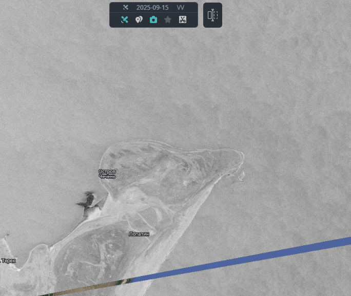
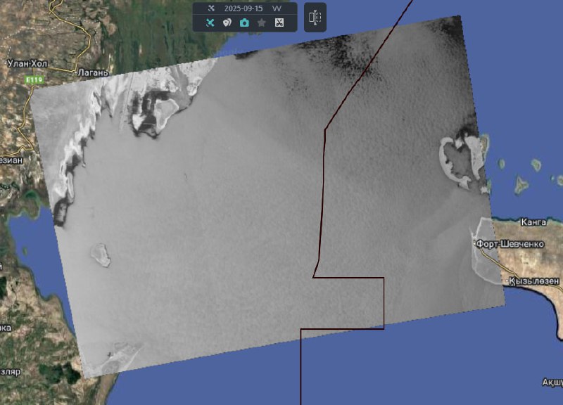
https://t.me/twworldkasp/583
Settings
Choose Layout
Vertical
Horizontal
Color Scheme
Light
Dark
Layout Mode
Fluid
Boxed
Detached
Topbar Color
Light
Dark
Brand
Menu Color
Light
Dark
Brand
Layout Position